Skip to search
Skip to main content
Skip to first result
Search
You Searched For
Date
1860 - 1879
Genre
Maps
Publication Place
[Washington] :
Date Created
1860 to 1879
New Search
Search Results
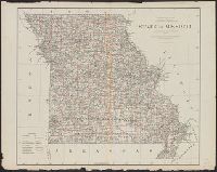
Creator:
Published / Created:
1878
Call Number:
816 1878
Container / Volume:
BRBL_00561
Image Count:
1
Resource Type:
Maps, Atlases & Globes
Publisher:
General Land Office,
Subject (Geographic):
Missouri--Maps
Subject (Name):
Bien, Julius, 1826-1909
Found in:
Beinecke Rare Book and Manuscript Library > State of Missouri : 1878.
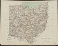
Creator:
Published / Created:
1878
Call Number:
804 1878
Container / Volume:
BRBL_00543
Image Count:
1
Resource Type:
Maps, Atlases & Globes
Description:
"J. A. Williamson, Commissioner." and Shows county boundaries, towns and railroads.
Publisher:
General Land Office.,
Subject (Geographic):
Ohio--Maps
Subject (Name):
Julius Bien & Co
Found in:
Beinecke Rare Book and Manuscript Library > State of Ohio / compiled from the official records of the Department of the Interior, General Land Office by C. Roeser, Principal Draughtsman.
Creator:
Published / Created:
1875
Call Number:
764 P37 1874
Container / Volume:
BRBL_00459
Image Count:
1
Resource Type:
Maps, Atlases & Globes
Description:
"C. S. Pierce, Assistant in charge of party, topographical survey by W.E. McClintock, Aid.", "Issued September 1875. C.P. Patterson, Superintendent. Verification by J.E. Hilgard, Assistant in charge of office.", "No. 3030.", and Relief shown by contours.
Publisher:
U.S. Coast Survey,
Subject (Geographic):
Hoosac Range (Mass.)--Maps and Hoosac Tunnel (Mass.)--Maps
Subject (Name):
U.S. Coast and Geodetic Survey
Found in:
Beinecke Rare Book and Manuscript Library > Two miles around the pendulum station on Hoosac Mountain near central shaft of tunnel, Massachusetts, 1874.
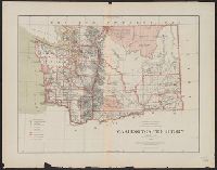
Creator:
Published / Created:
1879
Call Number:
847 1879
Container / Volume:
BRBL_00625
Image Count:
1
Resource Type:
Maps, Atlases & Globes
Description:
"J.A. Williamson, Commissioner" General Land Office., "Longitude west from Greenwich and Washington.", and Relief shown by hachures.
Publisher:
The Office,
Subject (Geographic):
Washington (State)--Maps
Subject (Name):
Bien, Julius, 1826-1909 and Roeser, C. (Charles)
Found in:
Beinecke Rare Book and Manuscript Library > Washington Territory / compiled from the official records of the General Land Office and other sources by C. Roeser, Principal Draughtsman, General Land Office.
Published / Created:
1866
Call Number:
75 1866H
Container / Volume:
BRBL_00403
Image Count:
1
Resource Type:
Maps, Atlases & Globes
Publisher:
U.S. Coast Survey Office,
Subject (Geographic):
United States--Maps
Found in:
Beinecke Rare Book and Manuscript Library > [United States] / drawn by A. Lindenkohl ; Chas. G. Krebs, Litho.
Branch:v1.61.6 ,Deployed:2024-06-12T09:55:37-04:00