Search
You Searched For
Search Results
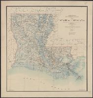
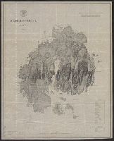
- Creator:
- O'Hare, Daniel
- Published / Created:
- 1896
- Call Number:
- 795 1896
- Container / Volume:
- BRBL_00521
- Image Count:
- 1
- Resource Type:
- Maps, Atlases & Globes
- Found in:
- Beinecke Rare Book and Manuscript Library > Map of the state of Louisiana / compiled from the official records of the General Land Office and other sources under the direction of Harry King ; revised and drawn by Daniel O'Hare.
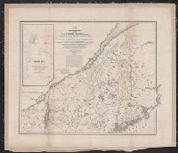
- Creator:
- United States. Bureau of the Census
- Published / Created:
- 1934
- Call Number:
- 831fb 1930
- Container / Volume:
- BRBL_00581
- Image Count:
- 1
- Resource Type:
- Maps, Atlases & Globes
- Found in:
- Beinecke Rare Book and Manuscript Library > Montana, minor civil divisions : 1930 / Bureau of the Census.
- Creator:
- United States. Bureau of the Census
- Published / Created:
- 1934
- Call Number:
- 844fb 1930
- Container / Volume:
- BRBL_00614
- Image Count:
- 1
- Resource Type:
- Maps, Atlases & Globes
- Found in:
- Beinecke Rare Book and Manuscript Library > California : minor civil divisions / Bureau of the Census, 1930.
- Creator:
- Geological Survey (U.S.)
- Published / Created:
- 1909
- Call Number:
- 844fcm Y83 1909
- Container / Volume:
- BRBL_00615
- Image Count:
- 1
- Resource Type:
- Maps, Atlases & Globes
- Found in:
- Beinecke Rare Book and Manuscript Library > Map of Yosemite Valley, Mariposa County, California / U.S. Geological Survey, George Otis Smith, Director ; E.M. Douglas, geographer ; State of California, George C. Pardee, Govenor.
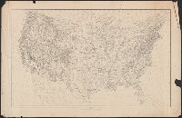
- Creator:
- Geological Survey (U.S.)
- Published / Created:
- 1910
- Call Number:
- 75cbf 1910
- Container / Volume:
- BRBL_00408
- Image Count:
- 1
- Resource Type:
- Maps, Atlases & Globes
- Found in:
- Beinecke Rare Book and Manuscript Library > United States relief map / compiled by Henry Gannett.
- Published / Created:
- 1920
- Call Number:
- 75ak 1920
- Container / Volume:
- BRBL_00407A
- Image Count:
- 1
- Resource Type:
- Maps, Atlases & Globes
- Found in:
- Beinecke Rare Book and Manuscript Library > [Outline Map of the United States] / engraved and printed by the U.S. Geological Survey.
- Published / Created:
- 1909
- Call Number:
- 75ak 1909
- Container / Volume:
- BRBL_00407A
- Image Count:
- 1
- Resource Type:
- Maps, Atlases & Globes
- Found in:
- Beinecke Rare Book and Manuscript Library > United States Base Map / engraved by U.S.G.S.
- Published / Created:
- 1891
- Call Number:
- 754 1891
- Container / Volume:
- BRBL_00417
- Image Count:
- 1
- Resource Type:
- Maps, Atlases & Globes
- Found in:
- Beinecke Rare Book and Manuscript Library > Progress of the surveys and resurveys between the St. Croix and Hudson Rivers.
- Creator:
- Nicholson, W. L
- Published / Created:
- 1863
- Call Number:
- 783 1863B
- Container / Volume:
- BRBL_00509
- Image Count:
- 1
- Resource Type:
- Maps, Atlases & Globes
- Found in:
- Beinecke Rare Book and Manuscript Library > Map of the state of Virginia / compiled from the best authorities and printed at the Coast Survey Office, A.D. Bache, supdt. ; compiled by W.L. Nicholson ; lith. by Chas. G. Krebs.
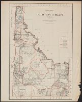
- Creator:
- United States. General Land Office
- Published / Created:
- 1883
- Call Number:
- 832 1883
- Container / Volume:
- BRBL_00582
- Image Count:
- 1
- Resource Type:
- Maps, Atlases & Globes
- Found in:
- Beinecke Rare Book and Manuscript Library > Territory of Idaho, 1883 / compiled from the official records of the General Land Office and other sources by G.P. Strum, Principal Draughtsman, Department of the Interior, General Land Office.
- Creator:
- Morton, Robert H
- Published / Created:
- 1899
- Call Number:
- 832 1899
- Container / Volume:
- BRBL_00582
- Image Count:
- 1
- Resource Type:
- Maps, Atlases & Globes
- Found in:
- Beinecke Rare Book and Manuscript Library > State of Idaho / compiled by R.H. Morton.
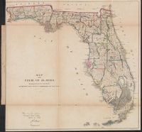
- Published / Created:
- 1860
- Call Number:
- 792 1860
- Container / Volume:
- BRBL_00518
- Image Count:
- 1
- Resource Type:
- Maps, Atlases & Globes
- Found in:
- Beinecke Rare Book and Manuscript Library > Map of the state of Florida showing the progress of the surveys accompanying annual report of the surveyor general for 1860.
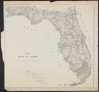
- Creator:
- United States. General Land Office
- Published / Created:
- 1866
- Call Number:
- 792 1866
- Container / Volume:
- BRBL_00518
- Image Count:
- 1
- Resource Type:
- Maps, Atlases & Globes
- Found in:
- Beinecke Rare Book and Manuscript Library > Map of the state of Florida : showing the progress of the surveys accompanying [the] annual report of [the] Commissioner.
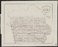
- Creator:
- United States. General Land Office
- Published / Created:
- 1866
- Call Number:
- 815fcm 1866
- Container / Volume:
- BRBL_00561
- Image Count:
- 1
- Resource Type:
- Maps, Atlases & Globes
- Found in:
- Beinecke Rare Book and Manuscript Library > Diagram of the public surveys in Iowa.
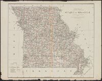
- Creator:
- United States. General Land Office
- Published / Created:
- 1878
- Call Number:
- 816 1878
- Container / Volume:
- BRBL_00561
- Image Count:
- 1
- Resource Type:
- Maps, Atlases & Globes
- Found in:
- Beinecke Rare Book and Manuscript Library > State of Missouri : 1878.
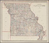
- Creator:
- United States. General Land Office
- Published / Created:
- 1891
- Call Number:
- 816 1891
- Container / Volume:
- BRBL_00561
- Image Count:
- 1
- Resource Type:
- Maps, Atlases & Globes
- Found in:
- Beinecke Rare Book and Manuscript Library > State of Missouri / compiled from the official records of the General Land Office, under the supervision of A.F. Dinsmore, Principal Draughtsman.
- Creator:
- Geological Survey (U.S.)
- Published / Created:
- 1909
- Call Number:
- 848 R14 1909
- Container / Volume:
- BRBL_00634
- Image Count:
- 1
- Resource Type:
- Maps, Atlases & Globes
- Found in:
- Beinecke Rare Book and Manuscript Library > Reconnaissance map of Rampart quadrangle, Yukon-Tanana region, Alaska / U.S. Geological Survey ; Alfred H. Brooks, geologist in charge.
- Creator:
- U.S. Coast and Geodetic Survey
- Published / Created:
- 1898
- Call Number:
- 848 Y91 1898
- Container / Volume:
- BRBL_00634
- Image Count:
- 1
- Resource Type:
- Maps, Atlases & Globes
- Found in:
- Beinecke Rare Book and Manuscript Library > Yukon River, Alaska.
- Creator:
- McClintock, W. E
- Published / Created:
- 1875
- Call Number:
- 764 P37 1874
- Container / Volume:
- BRBL_00459
- Image Count:
- 1
- Resource Type:
- Maps, Atlases & Globes
- Found in:
- Beinecke Rare Book and Manuscript Library > Two miles around the pendulum station on Hoosac Mountain near central shaft of tunnel, Massachusetts, 1874.
- Published / Created:
- 1882
- Call Number:
- 771 F53 1882
- Container / Volume:
- BRBL_00482A
- Image Count:
- 1
- Resource Type:
- Maps, Atlases & Globes
- Found in:
- Beinecke Rare Book and Manuscript Library > Fisher's Island, New York / Surveyed by E. Hergesheimer, JE Hilgard, Supt.
- Creator:
- United States. Bureau of the Census
- Published / Created:
- 1934
- Call Number:
- 824fb 1930
- Container / Volume:
- BRBL_00572
- Image Count:
- 1
- Resource Type:
- Maps, Atlases & Globes
- Found in:
- Beinecke Rare Book and Manuscript Library > Nebraska, minor civil divisions : 1930 / Bureau of the Census.
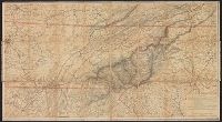
- Creator:
- Nicholson, W. L
- Published / Created:
- [1863]
- Call Number:
- 754 1863B
- Container / Volume:
- BRBL_00416
- Image Count:
- 1
- Resource Type:
- Maps, Atlases & Globes
- Found in:
- Beinecke Rare Book and Manuscript Library > Mountain region of North Carolina and Tennessee / compiled by W.L. Nicholson & A. Lindenkohl, 1863 ; drawn by A. Lindenkohl ; H. Lindenkohl & Chas. G. Krebs, lith.
- Published / Created:
- 1846
- Call Number:
- 764cea N422 1846
- Container / Volume:
- BRBL_00461
- Image Count:
- 1
- Resource Type:
- Maps, Atlases & Globes
- Found in:
- Beinecke Rare Book and Manuscript Library > The Harbor of New Bedford ...
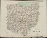
- Creator:
- United States. General Land Office
- Published / Created:
- 1878
- Call Number:
- 804 1878
- Container / Volume:
- BRBL_00543
- Image Count:
- 1
- Resource Type:
- Maps, Atlases & Globes
- Found in:
- Beinecke Rare Book and Manuscript Library > State of Ohio / compiled from the official records of the Department of the Interior, General Land Office by C. Roeser, Principal Draughtsman.
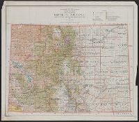
- Creator:
- United States. General Land Office
- Published / Created:
- 1934
- Call Number:
- 834 1934
- Container / Volume:
- BRBL_00588
- Image Count:
- 1
- Resource Type:
- Maps, Atlases & Globes
- Found in:
- Beinecke Rare Book and Manuscript Library > State of Colorado : compiled from the official records of the General Land Office and other sources / compiled and drawn by H. Ruh
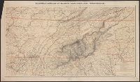
- Creator:
- Nicholson, W. L
- Published / Created:
- [1863]
- Call Number:
- 754 1863B
- Container / Volume:
- BRBL_00416
- Image Count:
- 1
- Resource Type:
- Maps, Atlases & Globes
- Found in:
- Beinecke Rare Book and Manuscript Library > Mountain region of North Carolina and Tennessee / compiled by W.L. Nicholson & A. Lindenkohl, 1863 ; drawn by A. Lindenkohl ; H. Lindenkohl & Chas. G. Krebs, lith.
- Creator:
- U.S. Coast and Geodetic Survey
- Published / Created:
- 1875
- Call Number:
- 761 M86 1875
- Container / Volume:
- BRBL_00448
- Image Count:
- 1
- Resource Type:
- Maps, Atlases & Globes
- Found in:
- Beinecke Rare Book and Manuscript Library > Mt. Desert Island Maine / C.P Patterson, Superintendent ; verified, J.E. Hilgard, Assistant in Charge of Office ; topography surveyed by J.W. Donn.
- Published / Created:
- 1849
- Call Number:
- 771cea B98 1849
- Container / Volume:
- BRBL_00493
- Image Count:
- 1
- Resource Type:
- Maps, Atlases & Globes
- Found in:
- Beinecke Rare Book and Manuscript Library > B No.2 Sketch of Buttermilk Channel New York Harbor by the Hydrographic party of the Coast Survey ...
- Creator:
- United States. Army. Corps of Topographical Engineers
- Published / Created:
- 1843
- Call Number:
- 73fab 1843
- Container / Volume:
- BRBL_00375B
- Image Count:
- 1
- Resource Type:
- Maps, Atlases & Globes
- Found in:
- Beinecke Rare Book and Manuscript Library > Map of the boundary lines between the United States and the adjacent British provinces : from the mouth of the River St. Croix to the intersection of the parallel of 45 degrees of north latitude with the River St. Lawrence near St. Regis.
- Published / Created:
- 1919
- Call Number:
- 30 1919A
- Container / Volume:
- BRBL_00032A
- Image Count:
- 4
- Resource Type:
- Maps, Atlases & Globes
- Found in:
- Beinecke Rare Book and Manuscript Library > Europe.
- Published / Created:
- 1919
- Call Number:
- 30 1919A
- Container / Volume:
- BRBL_00032A
- Image Count:
- 4
- Resource Type:
- Maps, Atlases & Globes
- Found in:
- Beinecke Rare Book and Manuscript Library > Europe.
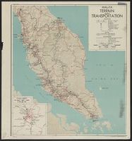
- Creator:
- United States. Office of Strategic Services. Research and Analysis Branch
- Published / Created:
- 1944
- Call Number:
- 583gm 1944A
- Container / Volume:
- BRBL_00314
- Image Count:
- 2
- Resource Type:
- Maps, Atlases & Globes
- Found in:
- Beinecke Rare Book and Manuscript Library > Malaya : terrain and transportation / compiled and drawn in the Branch of Research and Analysis, OSS.
- Published / Created:
- 1866
- Call Number:
- 75CKB 1870M
- Container / Volume:
- BRBL_00409
- Image Count:
- 1
- Resource Type:
- Maps, Atlases & Globes
- Found in:
- Beinecke Rare Book and Manuscript Library > Magnetic Declination : Isogonic lines for the year 1870 / Drawn by A. Lindenkohl ; Chas. G. Krebs, Lith.
- Published / Created:
- [1899?].
- Call Number:
- 75CBF 1899B
- Container / Volume:
- BRBL_00408
- Image Count:
- 1
- Resource Type:
- Maps, Atlases & Globes
- Found in:
- Beinecke Rare Book and Manuscript Library > United States contour map / U.S. Geological Survey, J.W. Powell, Director ; compiled by Henry Gannett.
- Published / Created:
- 1866
- Call Number:
- 75 1866H
- Container / Volume:
- BRBL_00403
- Image Count:
- 1
- Resource Type:
- Maps, Atlases & Globes
- Found in:
- Beinecke Rare Book and Manuscript Library > [United States] / drawn by A. Lindenkohl ; Chas. G. Krebs, Litho.
- Published / Created:
- 1882
- Call Number:
- 771 F53 1882
- Container / Volume:
- BRBL_00482A
- Image Count:
- 1
- Resource Type:
- Maps, Atlases & Globes
- Found in:
- Beinecke Rare Book and Manuscript Library > Fisher's Island, New York / Surveyed by E. Hergesheimer, JE Hilgard, Supt.
- Creator:
- Ives, J. C
- Published / Created:
- 1858
- Call Number:
- 80 C71 1858
- Container / Volume:
- BRBL_00537
- Image Count:
- 1
- Resource Type:
- Maps, Atlases & Globes
- Found in:
- Beinecke Rare Book and Manuscript Library > Rio Colorado of the West / explored by 1st. Lieut. Joseph C. Ives, Topl. Engrs. under the direction of the Office of Explorations and Surveys, A.A. Humphreys, Capt. Topl. Engrs. in charge, by order of the Hon. John B. Floyd, Secretary of War ; drawn by Fr
- Creator:
- Ives, J. C
- Published / Created:
- 1858
- Call Number:
- 80 C71 1858A
- Container / Volume:
- BRBL_00537
- Image Count:
- 1
- Resource Type:
- Maps, Atlases & Globes
- Found in:
- Beinecke Rare Book and Manuscript Library > Rio Colorado of the West / explored by 1st. Lieut. Joseph C. Ives, Topl. Engrs. under the direction of the Office of Explorations and Surveys, A.A. Humphreys, Capt. Topl. Engrs. in charge, by order of the Hon. John B. Floyd, Secretary of War ; drawn by Fr
- Creator:
- United States. General Land Office
- Published / Created:
- 1905
- Call Number:
- 847 1905
- Container / Volume:
- BRBL_00625
- Image Count:
- 1
- Resource Type:
- Maps, Atlases & Globes
- Found in:
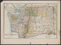
- Beinecke Rare Book and Manuscript Library > State of Washington / compiled from the official records of the General Land Office and other sources, under the direction of Frank Bond, chief of drafting division, G.L.O. ; compiled and drawn by Daniel O'Hare ; lettering by Wm. Bauman jr.
- Creator:
- United States. General Land Office
- Published / Created:
- 1909
- Call Number:
- 847 1909
- Container / Volume:
- BRBL_00625
- Image Count:
- 1
- Resource Type:
- Maps, Atlases & Globes
- Found in:
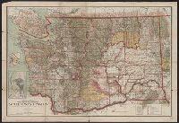
- Beinecke Rare Book and Manuscript Library > State of Washington / compiled from the official records of the General Land Office and other sources under the direction of I. P. Berthrong, chief of Drafting Division, G.L.O. ; compiled and drawn by Daniel O'Hare ; lettering by Wm Bauman, jr.
- Creator:
- United States. General Land Office
- Published / Created:
- 1879
- Call Number:
- 847 1879
- Container / Volume:
- BRBL_00625
- Image Count:
- 1
- Resource Type:
- Maps, Atlases & Globes
- Found in:
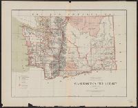
- Beinecke Rare Book and Manuscript Library > Washington Territory / compiled from the official records of the General Land Office and other sources by C. Roeser, Principal Draughtsman, General Land Office.
- Creator:
- U.S. Coast and Geodetic Survey
- Published / Created:
- 1881
- Call Number:
- 847cea W279 1880
- Container / Volume:
- BRBL_00628
- Image Count:
- 1
- Resource Type:
- Maps, Atlases & Globes
- Found in:
- Beinecke Rare Book and Manuscript Library > Washington Sound and approaches, Washington Territory : 1866.
- Creator:
- United States. Bureau of the Census
- Published / Created:
- 1934
- Call Number:
- 847fb 1930
- Container / Volume:
- BRBL_00628
- Image Count:
- 1
- Resource Type:
- Maps, Atlases & Globes
- Found in:
- Beinecke Rare Book and Manuscript Library > Washington, minor civil divisions / Bureau of the Census, 1930.
- Published / Created:
- [1915].
- Call Number:
- 38 C395 1915
- Container / Volume:
- BRBL_00156
- Image Count:
- 1
- Resource Type:
- Maps, Atlases & Globes
- Found in:
- Beinecke Rare Book and Manuscript Library > Ville de Chaumont.
- Creator:
- United States. General Land Office
- Published / Created:
- 1904
- Call Number:
- 811 1904L
- Container / Volume:
- BRBL_00552
- Image Count:
- 1
- Resource Type:
- Maps, Atlases & Globes
- Found in:
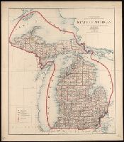
- Beinecke Rare Book and Manuscript Library > State of Michigan / compiled from the official records of the General Land Office and other sources Under the direction of Frank Bond, Chief of Drafting Division, G.L.O. ; revised and drawn by Charles J. Helm.
- Creator:
- United States. National Park Service
- Published / Created:
- [2001]
- Call Number:
- 834 B52 2001
- Container / Volume:
- BRBL_00589
- Image Count:
- 2
- Resource Type:
- Maps, Atlases & Globes
- Found in:
- Beinecke Rare Book and Manuscript Library > Black Canyon of the Gunnison National Park, Colorado / National Park Service, U.S. Department of the Interior.
- Creator:
- United States. National Park Service
- Published / Created:
- [1980]
- Call Number:
- 836 B51 1980
- Container / Volume:
- BRBL_00592
- Image Count:
- 2
- Resource Type:
- Maps, Atlases & Globes
- Found in:
- Beinecke Rare Book and Manuscript Library > Bryce Canyon National Park, Utah / National Park Service, U.S. Department of the Interior.
- Published / Created:
- 1944
- Call Number:
- 38 R75 1944
- Container / Volume:
- BRBL_00165
- Image Count:
- 2
- Resource Type:
- Maps, Atlases & Globes
- Found in:
- Beinecke Rare Book and Manuscript Library > Port of Rouen.
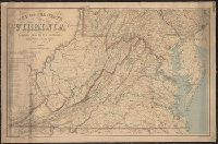
- Creator:
- United States. Post Office Dept
- Published / Created:
- 1874
- Call Number:
- 754GMD 1874
- Container / Volume:
- BRBL_00419
- Image Count:
- 2
- Resource Type:
- Maps, Atlases & Globes
- Found in:
- Beinecke Rare Book and Manuscript Library > Preliminary post route map of the states of Virginia and West Virginia together with Maryland and Delaware, with adjacent parts of Pennsylvania, Ohio, Kentucky, Tennessee and North Carolina / designed and constructed under the orders of Postmaster General
- Published / Created:
- 1863-1864.
- Call Number:
- 75cea 1864
- Container / Volume:
- BRBL_00409
- Image Count:
- 2
- Resource Type:
- Maps, Atlases & Globes
- Found in:
- Beinecke Rare Book and Manuscript Library > Atlantic Coast of the United States (in four sheets).