
Search


Limit your search
- Public✖[remove]92
- Maps, Atlases & Globes✖[remove]92
- United States. Office of Strategic Services. Research and Analysis Branch17
- United States. General Land Office11
- Geological Survey (U.S.)6
- U.S. Coast and Geodetic Survey5
- United States. Bureau of the Census4
- United States. Office of Strategic Services4
- Nicholson, W. L3
- Renshawe, John H3
- Ives, J. C2
- United States. Army. Corps of Topographical Engineers2
- Beaches--France--Normandy--Maps1
- Ethnic groups--Indochina--Maps1
- Ethnic groups--Southeast Asia--Maps1
- Ethnic groups--Thailand--Maps1
- Maps shelf1
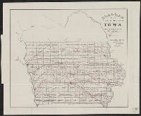
- Mines and mineral resources--Iowa--Maps1
- Nautical charts--Juan de Fuca, Strait of, Region (B.C. and Wash.)1
- Nautical charts--Maine1
- Population density--Caucasus--Maps1
- Population density--Southeast Asia--Maps1
- [Washington] :✖[remove]92
- New York, N.Y. :1
Current results range from 1843 to 2001