Search
You Searched For
Search Results
- Published / Created:
- 1909
- Call Number:
- 75ak 1909
- Container / Volume:
- BRBL_00407A
- Image Count:
- 1
- Resource Type:
- Maps, Atlases & Globes
- Subject (Geographic):
- United States--Maps
- Found in:
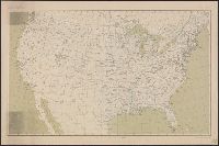
- Beinecke Rare Book and Manuscript Library > United States Base Map / engraved by U.S.G.S.
- Creator:
- Geological Survey (U.S.)
- Published / Created:
- 1910
- Call Number:
- 75cbf 1910
- Container / Volume:
- BRBL_00408
- Image Count:
- 1
- Resource Type:
- Maps, Atlases & Globes
- Subject (Geographic):
- United States--Maps
- Found in:
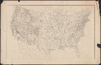
- Beinecke Rare Book and Manuscript Library > United States relief map / compiled by Henry Gannett.
- Published / Created:
- [1899?].
- Call Number:
- 75CBF 1899B
- Container / Volume:
- BRBL_00408
- Image Count:
- 1
- Resource Type:
- Maps, Atlases & Globes
- Subject (Geographic):
- United States--Maps
- Found in:
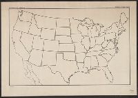
- Beinecke Rare Book and Manuscript Library > United States contour map / U.S. Geological Survey, J.W. Powell, Director ; compiled by Henry Gannett.
- Published / Created:
- 1863-1864.
- Call Number:
- 75cea 1864
- Container / Volume:
- BRBL_00409
- Image Count:
- 2
- Resource Type:
- Maps, Atlases & Globes
- Subject (Geographic):
- United States--Maps
- Found in:
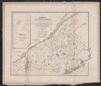
- Beinecke Rare Book and Manuscript Library > Atlantic Coast of the United States (in four sheets).
- Published / Created:
- 1866
- Call Number:
- 75CKB 1870M
- Container / Volume:
- BRBL_00409
- Image Count:
- 1
- Resource Type:
- Maps, Atlases & Globes
- Subject (Geographic):
- United States--Maps
- Found in:
- Beinecke Rare Book and Manuscript Library > Magnetic Declination : Isogonic lines for the year 1870 / Drawn by A. Lindenkohl ; Chas. G. Krebs, Lith.
- Published / Created:
- 1920
- Call Number:
- 75ak 1920
- Container / Volume:
- BRBL_00407A
- Image Count:
- 1
- Resource Type:
- Maps, Atlases & Globes
- Subject (Geographic):
- United States--Maps
- Found in:
- Beinecke Rare Book and Manuscript Library > [Outline Map of the United States] / engraved and printed by the U.S. Geological Survey.
- Published / Created:
- 1866
- Call Number:
- 75 1866H
- Container / Volume:
- BRBL_00403
- Image Count:
- 1
- Resource Type:
- Maps, Atlases & Globes
- Subject (Geographic):
- United States--Maps
- Found in:
- Beinecke Rare Book and Manuscript Library > [United States] / drawn by A. Lindenkohl ; Chas. G. Krebs, Litho.
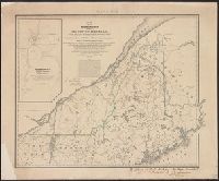
- Creator:
- United States. Army. Corps of Topographical Engineers
- Published / Created:
- 1843
- Call Number:
- 73fab 1843
- Container / Volume:
- BRBL_00375B
- Image Count:
- 1
- Resource Type:
- Maps, Atlases & Globes
- Subject (Geographic):
- Canada--Boundaries--United States--Maps
- Found in:
- Beinecke Rare Book and Manuscript Library > Map of the boundary lines between the United States and the adjacent British provinces : from the mouth of the River St. Croix to the intersection of the parallel of 45 degrees of north latitude with the River St. Lawrence near St. Regis.
- Creator:
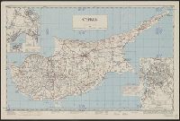
- Cyprus. Ktēmatologiko kai Chōrometriko Tmēma
- Published / Created:
- 1950
- Call Number:
- 509 1942
- Container / Volume:
- BRBL_00277
- Image Count:
- 1
- Resource Type:
- Maps, Atlases & Globes
- Alternative Title:
- AMS series (United States. Army Map
- Found in:
- Beinecke Rare Book and Manuscript Library > Cyprus [cartographic material] / compiled by land Registration and Surveys, Cyprus.