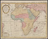
Africa accurate in imperia, regna, status & populos divisa, ad usum Ludovici XV Galliarum Regis and Africa accurate in imperia, regna, status et populos divisa, ad usum Ludovici XV Galliarum Regis
Description:
In French and Latin.
Publisher:
Chez I. Covens et C. Mortier,
Subject (Geographic):
Africa--Maps--Earlyworksto1800
Subject (Name):
Condet, Johannes, 1711-1781 and Cóvens et Mortier
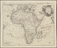
Africa accuraté in imperia, regna, status & populos divisa, ad usum serenissimi Bourgundiae Ducis.
Description:
"Avec privil[ège].", Appeared in various eds. of Cóvens et Mortier's Atlas noveau; cf. Koeman, C. Atlantes Neerlandici, Coverage includes the eastern coast of Brazil., II, C & M 3 and 4., Includes four bar scales., and Relief shown pictorially.
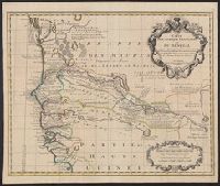
Covers portion of western Africa from Mauritania to Guinea., Includes text and ornamental cartouche., Prime meridian: Ferro., Relief shown pictorially., and Verso: stamped "Map Collection Yale Univ. Library" and numbered "46" in ink in upper right corner.
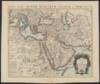
Appeared in de L'Isle's Atlas nouveau (after 1757)., Includes five bar scales., Prime meridian: Ferro., Relief shown pictorially., and With watermark. Sheet measures 54.8 x 65.7 cm.