[Atlas factice of 96 maps by Blaeu, Visscher, Jansson, Hondius and others]
Image Count:
1
Description:
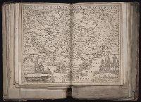
Imperfect: torn and repaired in lower right corner, with no loss of text. Sheet measures 39.5 x 50.2 cm. Reinforced along edges with paper. No. 53 of 92 maps bound together. and Numbered 57 on verso.
Publisher:
Everardus Cloppenburghius excudit
Subject (Geographic):
Bohemia (Czech Republic) --Maps --Early works to 1800
BEIN 1973 Folio 10: Sheet measures 61.2 x 52 cm. Bookplate of José M. Rodriguez. No. 22 of 63 maps bound together., Relief shown pictorially., Includes col. ill. and coats of arms., and Appears in various editions of Wit's Atlas.
[Atlas factice of 96 maps by Blaeu, Visscher, Jansson, Hondius and others]
Image Count:
1
Description:
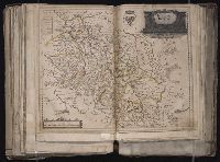
Imperfect: cartouche cut out and replaced in ms. with title Silesia Dvcatvs; edges reinforced with ms waste. Hand col. Sheet measures 38.8 x 51 cm. No. 69 of 92 maps bound together. and Numbered 74 [and 71, cancelled] on verso.
BEIN 1973 Folio 10: Sheet measures 51.8 x 61.2 cm. Bookplate of José M. Rodriguez. No. 54 of 63 maps bound together., Relief shown pictorially., Ferro meridian., and Bar scales given in milliaria Germanica communia and milliaria Gallica communia.
BEIN 1973 Folio 10: Imperfect: western sheet (with title cartouche) wanting. Part of eastern map (inset of Arras/Cambrai region) pasted over correction[?]. Sheet measures 65 x 96.2 cm. Bookplate of José M. Rodriguez. No. 47 of 63 maps bound together., Relief shown pictorially., Does not show troop positions or other military locations., Alternate title in upper margin: Première carte de la Meuse avec les pais, duchez et comtez voisins., Ferro meridian., Originally printed on 4 sheets., and Includes inset of Arras/Cambrai region and col. ill. of battles at upper left and lower right.
Publisher:
Apud Petrum Mortier et se vend à Londres chez David Mortier
Blaeu, Willem Janszoon, 1571-1638. Atlantis appendix Emmius, Ubbo, 1547-1625
Published / Created:
[1630]
Call Number:
1983 Folio 19
Collection Title:
[Atlas factice of 96 maps by Blaeu, Visscher, Jansson, Hondius and others]
Image Count:
1
Description:
Imperfect: mutilated along fold, with some loss of text. Reinforced along lower edges with manuscript waste. Sheet measures 39.2 x 51 cm. No. 58 of 92 maps bound together. and Numbered 62 on verso.
Publisher:
Guiljelm. Blaeuw excudit
Subject (Geographic):
Lower Saxony (Germany) --Maps --Early works to 1800