[Atlas factice of 96 maps by Blaeu, Visscher, Jansson, Hondius and others]
Image Count:
1
Description:
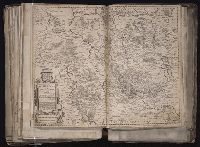
Imperfect: torn and mutilated along fold, with some loss of text; edges reinforced with ms. waste. Sheet measures 41.0 x 51.8 cm. No. 73 of 92 maps bound together. and Numbered 79 [and 74, cancelled] on verso.
Publisher:
Joan and Cornelis Blaeu
Subject (Geographic):
Lower Saxony (Germany) --Maps --Early works to 1800