Blaeu, Joan, 1596-1673 Blaeu, Willem Janszoon, 1571-1638
Published / Created:
[ca. 1634]
Call Number:
1983 Folio 19
Collection Title:
[Atlas factice of 96 maps by Blaeu, Visscher, Jansson, Hondius and others]
Image Count:
1
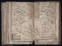
Description:
Imperfect: torn along fold, with some loss of text. Sheet measures 40.5 x 51.0 cm. Reinforced along edges with printed waste. No. 88 of 92 maps bound together. and Numbered 94 on verso.
[Atlas factice of 96 maps by Blaeu, Visscher, Jansson, Hondius and others]
Image Count:
2
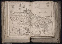
Description:
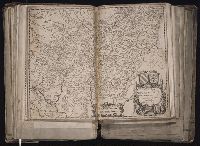
Imperfect: cartouche cut-out and replaced in ms. Sheet measures 38.1 x 49.3 cm. Reinforced along edges with printed waste. No. 84 of 92 maps bound together. and Numbered 90 on verso.
Publisher:
Apud Guiljelmum Blaeu
Subject (Geographic):
Salzburg (Austria : Land) --Maps --Early works to 1800
Blaeu, Willem Janszoon, 1571-1638 Mercator, Gerhard, 1512-1594
Published / Created:
[ca. 1634]
Call Number:
1983 Folio 19
Collection Title:
[Atlas factice of 96 maps by Blaeu, Visscher, Jansson, Hondius and others]
Image Count:
1
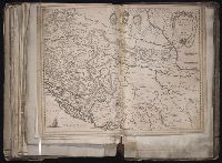
Description:
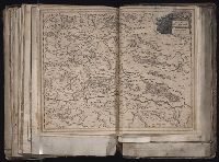
Imperfect: torn along fold, with some loss of text. Sheet measures 39 x 51.3 cm. Reinforced along edges with printed waste. No. 91 of 92 maps bound together. and Numbered 99 [98 and 100, cancelled] on verso.
Publisher:
Apud Guiljel. Blaeu
Subject (Geographic):
Bosnia and Hercegovina --Maps --Early works to 1800 and Croatia --Maps --Early works to 1800
[Atlas factice of 96 maps by Blaeu, Visscher, Jansson, Hondius and others]
Image Count:
1
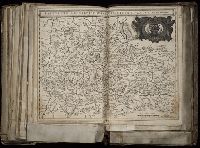
Description:
Imperfect: portion of cartouche cut-out, repaired, and replaced with ms. reproduction. Reinforced along edges with printed waste. Sheet measures 38.9 x 51.5 cm. No. 82 of 92 maps bound together. and Numbered 88 [86, cancelled] on verso.
Publisher:
Apud Guiljelmum Blaeuw
Subject (Geographic):
Styria (Austria) --Maps --Early works to 1800 and Styria, Lower (Slovenia) --Maps --Early works to 1800
[Atlas factice of 96 maps by Blaeu, Visscher, Jansson, Hondius and others]
Image Count:
1
Description:
Imperfect: mutilated along fold and in upper right, with some loss of text. Reinforced along edges with manuscript waste. Sheet measures 39 x 50.1 cm. No. 29 of 92 maps bound together.