Search
You Searched For
Search Results
- Creator:
- Rand McNally and Company
- Published / Created:
- [1882]
- Call Number:
- 75gme 1882B
- Container / Volume:
- BRBL_00413
- Image Count:
- 2
- Resource Type:
- Maps, Atlases & Globes
- Found in:
- Beinecke Rare Book and Manuscript Library > A correct map of the United States of America showing the Atchison, Topeka and Santa Fe R.R. and connections.
- Published / Created:
- 1890
- Call Number:
- 806gmb C43 1890
- Container / Volume:
- BRBL_00549
- Image Count:
- 1
- Resource Type:
- Maps, Atlases & Globes
- Found in:
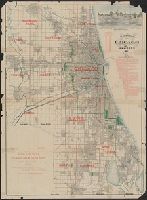
- Beinecke Rare Book and Manuscript Library > A.N. Marquis & Co's official map of Chicago / engraved by Matthews, Northrup & Co.
- Published / Created:
- [1874?].
- Call Number:
- 75gma 1874
- Container / Volume:
- BRBL_00411
- Image Count:
- 1
- Resource Type:
- Maps, Atlases & Globes
- Found in:
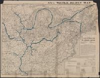
- Beinecke Rare Book and Manuscript Library > All water route map from the Mississippi to the Eastern Atlantic / [Printed for] The Illinois and Mississippi River and Canal Improvement Commission, Davenport, Iowa.
- Published / Created:
- 1874
- Call Number:
- 806am C43 1874
- Container / Volume:
- BRBL_00549
- Image Count:
- 1
- Resource Type:
- Maps, Atlases & Globes
- Found in:
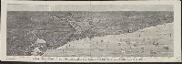
- Beinecke Rare Book and Manuscript Library > Bird's-eye view of Chicago and its environs : showing a distance of 45 miles on Lake Michigan, and 26 miles westward / drawn by R.W. Wallis.
- Published / Created:
- 1887
- Call Number:
- 806 C43 1887
- Container / Volume:
- BRBL_00548
- Image Count:
- 1
- Resource Type:
- Maps, Atlases & Globes
- Found in:
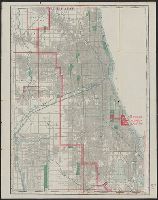
- Beinecke Rare Book and Manuscript Library > Blanchard's map of Chicago and environs.
- Creator:
- Rand McNally and Company
- Published / Created:
- 1883
- Call Number:
- 80gme 1883
- Container / Volume:
- BRBL_00539
- Image Count:
- 1
- Resource Type:
- Maps, Atlases & Globes
- Found in:
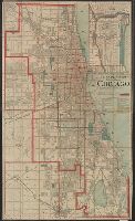
- Beinecke Rare Book and Manuscript Library > Chicago, Burlington & Quincy R.R., and intersecting lines.
- Published / Created:
- 1893
- Call Number:
- 806gmb C43 1893
- Container / Volume:
- BRBL_00549
- Image Count:
- 1
- Resource Type:
- Maps, Atlases & Globes
- Found in:
- Beinecke Rare Book and Manuscript Library > Chicago.
- Creator:
- Colton, G. Woolworth (George Woolworth), 1827-1901
- Published / Created:
- 1862
- Call Number:
- 754gme 1860A
- Container / Volume:
- BRBL_00420
- Image Count:
- 1
- Resource Type:
- Maps, Atlases & Globes
- Found in:
- Beinecke Rare Book and Manuscript Library > Colton's county and township rail road map of Wisconsin, Illinois, Missouri, & Iowa / Drawn, engraved & published by G. Woolworth Colton
- Published / Created:
- 1890
- Call Number:
- 802 1890
- Container / Volume:
- BRBL_00542
- Image Count:
- 1
- Resource Type:
- Maps, Atlases & Globes
- Found in:
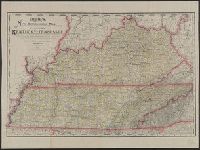
- Beinecke Rare Book and Manuscript Library > Cram's new commerical map of the states of Kentucky and Tennessee. : compiled from the most recent United States and state surveys, official maps and records, railroad surveys, and other authentic and reliable sources.
- Creator:
- Case, Francis M
- Published / Created:
- 1868
- Call Number:
- 834gme 1868
- Container / Volume:
- BRBL_00591
- Image Count:
- 1
- Resource Type:
- Maps, Atlases & Globes
- Found in:
- Beinecke Rare Book and Manuscript Library > Denver Pacific Railway map showing the final location with prospective connections : compiled from railroad and gov't. surveys / F.M. Case.