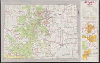
Index of cities and towns with elevation keyed to map., Relief shown by hachures and shading., Shows railroads, wagon roads, trails, county boundaries, ditches, land offices, forest, water, irrigation districts and land grants., and Shows township and range grid.
Includes 3 route maps., Map of "Colorado's topography as seen from 60 miles in the air," text, distance table, and photographs of recreational opportunities on verso., and Relief shown by spot heights.