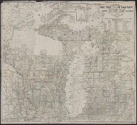
1. Farmer's township map of Michigan and Wisconsin : embracing part of Iowa Illinois and Minnesota Creator: Farmer, John, 1798-1859 Published / Created: 1857 Call Number: 754 1857 Container / Volume: BRBL_00416 Image Count: 1 Resource Type: Maps, Atlases & Globes Alternative Title: Township map of Michigan and Wisconsin. Subject (Geographic): Michigan--Maps Found in: Beinecke Rare Book and Manuscript Library > Farmer's township map of Michigan and Wisconsin : embracing part of Iowa Illinois and Minnesota, with a chart of the lakes / prepared engraved and published by the author at Detroit.
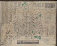
2. A new map of Detroit and suburbs : includes River Rouge, Oakwood, Highland Park, Hamtramck, St Creator: Silas Farmer & Co. Published / Created: 1911-12 [i.e. 1911?], and c1911. Call Number: 811 D48 1911 Container / Volume: BRBL_00553 Image Count: 1 Resource Type: Maps, Atlases & Globes Subject (Topic): Streets--Michigan--Detroit Metropolitan Found in: Beinecke Rare Book and Manuscript Library > A new map of Detroit and suburbs : includes River Rouge, Oakwood, Highland Park, Hamtramck, St. Clair Heights, and Grosse Pointe.
3. Ideal map of the city of Detroit Michigan. Published / Created: 1913 Call Number: 811 D48 1913A Container / Volume: BRBL_00553 Image Count: 2 Resource Type: Maps, Atlases & Globes Subject (Geographic): Detroit (Michigan)--Maps Found in: Beinecke Rare Book and Manuscript Library > Ideal map of the city of Detroit Michigan.
4. R.L. Polk & Co.'s map of the city of Detroit, Michigan. Published / Created: 1913 Call Number: 811 D48 1913 Container / Volume: BRBL_00553 Image Count: 1 Resource Type: Maps, Atlases & Globes Alternative Title: Map of the city of Detroit, Michigan Subject (Geographic): Detroit (Michigan)--Maps Found in: Beinecke Rare Book and Manuscript Library > R.L. Polk & Co.'s map of the city of Detroit, Michigan.