Skip to search
Skip to main content
Skip to first result
Search
You Searched For
Subject (Topic)
Nautical charts
Publication Place
France Paris
Search Results
Creator:
Published / Created:
1763.
Call Number:
2003 Folio 85
Image Count:
1
Description:
BEIN 2003 Folio 85: No. 45 of 45 maps bound together with binder's spine title: Atlas of America; ms. table of contents. Bookplate: Robinson. Bookplate of Paul Mellon.
Publisher:
Dépost des cartes et plans de la marine
Subject (Geographic):
French Guiana and Cayenne (French Guiana)
Subject (Topic):
Nautical charts
Found in:
Beinecke Rare Book and Manuscript Library > Carte de la Guyane françoise et l'isle de Cayenne
Creator:
Published / Created:
1752
Call Number:
2003 Folio 85
Image Count:
1
Resource Type:
cartographic image
Description:
BEIN 2003 Folio 85: No. 25 of 45 maps bound together with binder's spine title: Atlas of America; ms. table of contents. Bookplate: Robinson. Bookplate of Paul Mellon.
Publisher:
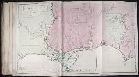
Jean Baptiste Bourguignon d'Anville
Subject (Geographic):
Louisiana, Southern States, and Gulf of Mexico
Subject (Topic):
Maps and Nautical charts
Found in:
Beinecke Rare Book and Manuscript Library > Carte de la Louisiane
Creator:
Published / Created:
ca. 1763]
Call Number:
2003 Folio 85
Image Count:
1
Description:
BEIN 2003 Folio 85: No. 11 of 45 maps bound together with binder's spine title: Atlas of America; ms. table of contents. Bookplate: Robinson. Bookplate of Paul Mellon.
Publisher:
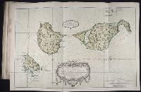
s.n
Subject (Geographic):
Saint Pierre and Miquelon
Subject (Topic):
Coasts and Nautical charts
Found in:
Beinecke Rare Book and Manuscript Library > Carte des isles de Saint Pierre et Miquelon : levée par ordre de M. Le Duc du Choiseul, Colonel Général des Suisses et Grisons Ministre de la Guerre et de la Marine, 1763 : reduite et assujetie au ciel par le service des vaisseaux du Roy
Creator:
Published / Created:
1791]
Call Number:
2003 Folio 85
Image Count:
1
Description:
BEIN 2003 Folio 85: No. 6 of 45 maps bound together with binder's spine title: Atlas of America; ms. table of contents. Bookplate of Paul Mellon.
Publisher:
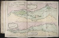
Dépôt de la Marine
Subject (Geographic):
Saint Lawrence River
Subject (Topic):
Nautical charts
Found in:
Beinecke Rare Book and Manuscript Library > Carte du cours du fleuve de Saint Laurent depuis Quebec jusqu'a la mer en deux feuilles 1re. feuille depuis Quebec jusqu'a Matane et Rivere des Outardes, 1761
Creator:
Published / Created:
1762?]
Call Number:
2003 Folio 85
Image Count:
1
Description:
BEIN 2003 Folio 85: No. 30 of 45 maps bound together with binder's spine title: Atlas of America; ms. table of contents. Bookplate: Robinson. Bookplate of Paul Mellon.
Publisher:
Dépost des cartes et plans de la marine
Subject (Geographic):
Cuba, Havana Bay (Cuba), Havana, and Havana (Cuba)
Subject (Topic):
Nautical charts, Fortification, and Buildings, structures, etc
Found in:
Beinecke Rare Book and Manuscript Library > Carte hydrographique de la baye de la Havane : avec le plan de la ville et de ses forts pour joindre a la Carte de l'isle de Cube
Creator:
Published / Created:
[1775?]
Call Number:
27 1775
Image Count:
1
Resource Type:
cartographic image
Description:
Depth shown by soundings.
Publisher:
Chez Demonville
Subject (Geographic):
Sunda Strait (Indonesia), Indonesia, and Sunda Strait.
Subject (Topic):
Maps and Nautical charts
Found in:
Beinecke Rare Book and Manuscript Library > Carte pour aller du détroit de la Sonde ou de Batavia au détroit de Banca
Creator:
Published / Created:
1760.
Call Number:
2003 Folio 85
Image Count:
1
Description:
BEIN 2003 Folio 85: No. 44 of 45 maps bound together with binder's spine title: Atlas of America; ms. table of contents. Bookplate: Robinson. Bookplate of Paul Mellon.
Publisher:
Dépost des cartes et plans de la marine
Subject (Geographic):
French Guiana and Cayenne (French Guiana)
Subject (Topic):
Nautical charts
Found in:
Beinecke Rare Book and Manuscript Library > Carte réduite des costes de la Guyane : depuis la riviere d'Orenoque jusqu'au Cap de Nord à l'entrée de la riviere des Amazones
Published / Created:
1754.
Call Number:
2003 Folio 85
Image Count:
1
Description:
BEIN 2003 Folio 85: No. 8 of 45 maps bound together with binder's spine title: Atlas of America; ms. table of contents. Bookplate of Paul Mellon.
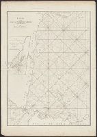
Publisher:
s.n.
Subject (Geographic):
Saint Lawrence, Gulf of
Subject (Topic):
Nautical charts
Found in:
Beinecke Rare Book and Manuscript Library > Carte réduite du golphe du St. Laurent : contenant l'isle de Terre-Neuve et partie de la coste des Esquimaux, l'isle Royale, l'isle St. Jean et celle d'Anticosti &ca.