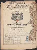
1. Wandkarte von Tirol und Vorarlberg für Volks-und Mittel-Schulen = Carta del Tirolo e Vorarlberg ad Published / Created: [ca. 1870] Call Number: 428 1870 Container / Volume: BRBL_00248 Image Count: 6 Resource Type: Maps, Atlases & Globes Found in: Beinecke Rare Book and Manuscript Library > Wandkarte von Tirol und Vorarlberg für Volks-und Mittel-Schulen = Carta del Tirolo e Vorarlberg ad uso di scuole popolari e medie / Gezeichnet von G.v. Kaler.
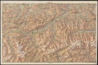
2. Nordosttirol / Geograph. artist. Anst. Kümmerly & Frey, Bern. Published / Created: 1914 Call Number: 428cbf 1914 Container / Volume: BRBL_00249 Image Count: 2 Resource Type: Maps, Atlases & Globes Found in: Beinecke Rare Book and Manuscript Library > Nordosttirol / Geograph. artist. Anst. Kümmerly & Frey, Bern.
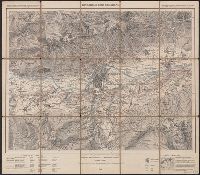
3. Innsbruck und Umgebung. Published / Created: 1909 Call Number: 428 In7 1909 Container / Volume: BRBL_00248 Image Count: 1 Resource Type: Maps, Atlases & Globes Found in: Beinecke Rare Book and Manuscript Library > Innsbruck und Umgebung.
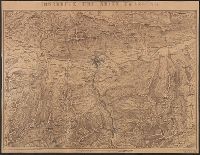
4. Innsbruck und seine Umgebung. Published / Created: [1860?] Call Number: 428 IN7 1860 Container / Volume: BRBL_00248 Image Count: 1 Resource Type: Maps, Atlases & Globes Found in: Beinecke Rare Book and Manuscript Library > Innsbruck und seine Umgebung.
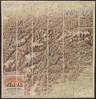
5. Plastische Karte des Alpenland Tirol nebst angrenzenden Gebieten als Beilage zum "Tiroler Verkehrs Published / Created: [1915?] Call Number: 428cbf 1915 Container / Volume: BRBL_00249 Image Count: 1 Resource Type: Maps, Atlases & Globes Found in: Beinecke Rare Book and Manuscript Library > Plastische Karte des Alpenland Tirol nebst angrenzenden Gebieten als Beilage zum "Tiroler Verkehrs- u. Hotelbuche" des Dr. v. Zimmeter in Innsbruck.