Search
You Searched For
Search Results
- Published / Created:
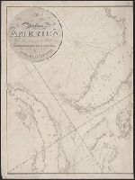
- 1818
- Call Number:
- 755cea 1818
- Container / Volume:
- BRBL_00442
- Image Count:
- 4
- Resource Type:
- Maps, Atlases & Globes
- Found in:
- Beinecke Rare Book and Manuscript Library > A New Chart of America, by Robt. Blachford. To His Excellency James Monroe ...
- Published / Created:
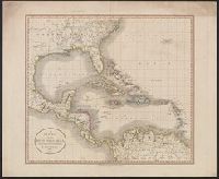
- 1803
- Call Number:
- 85 1803C
- Container / Volume:
- BRBL_00637
- Image Count:
- 1
- Resource Type:
- Maps, Atlases & Globes
- Found in:
- Beinecke Rare Book and Manuscript Library > A New MAp of the West India Isles, from the latest authorities.
- Published / Created:
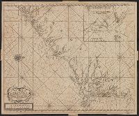
- [1749?]
- Call Number:
- 7855 1749
- Container / Volume:
- BRBL_00515
- Image Count:
- 1
- Resource Type:
- Maps, Atlases & Globes
- Found in:
- Beinecke Rare Book and Manuscript Library > A New Mapp of Carolina By John Thornton at ye Platt in ye Minories And Will: Fisher at ye Postorn Gate on Towerhill, London.
- Published / Created:
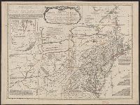
- 1790
- Call Number:
- 755 1790A
- Container / Volume:
- BRBL_00435
- Image Count:
- 1
- Resource Type:
- Maps, Atlases & Globes
- Found in:
- Beinecke Rare Book and Manuscript Library > A Particular Map of the American Lakes, Rivers, &c. Par le Sr. D'Anville. Drawn & Engraved for John Harrison.
- Creator:
- Kitchin, Thomas, d. 1784.
- Published / Created:
- 1773
- Call Number:
- 1979 Folio 59
- Image Count:
- 2
- Resource Type:
- Maps, Atlases & Globes
- Found in:
- Beinecke Rare Book and Manuscript Library > A general atlas, describing the whole universe. Being a compleat and new collection of the most approved maps extant; corrected with the utmost care, and augmented from the latest discoveries: the whole being an improvement of the maps of d'Anville and Robert ... By Thomas Kitchen, senior, and others ...
- Creator:
- Evans, Lewis, 1700?-1756
- Published / Created:
- 1771
- Call Number:
- 755 1771B
- Container / Volume:
- BRBL_00429
- Image Count:
- 1
- Resource Type:
- Maps, Atlases & Globes
- Found in:
- Beinecke Rare Book and Manuscript Library > A general map of the middle British colonies in America, viz. Virginia, Maryland, Delaware, Pensilvania, New-Jersey, New York, Connecticut & Rhode Island: Of Aquanishuonigy the country of the confederate Indians comprehending Aquanishuonigy proper, their
- Creator:
- Faden, William, 1749-1836
- Published / Created:
- 1777
- Call Number:
- 73 1777
- Container / Volume:
- BRBL_00373
- Image Count:
- 1
- Resource Type:
- Maps, Atlases & Globes
- Found in:
- Beinecke Rare Book and Manuscript Library > A map of the inhabited part of Canada from the French surveys, with the frontiers of New York and New England; from the large survey by Claude Joseph Sauthier. Engraved by Wm. Faden, 1777.
- Call Number:
- 783 1775
- Container / Volume:
- BRBL_00507
- Image Count:
- 3
- Resource Type:
- Maps, Atlases & Globes
- Found in:
- Beinecke Rare Book and Manuscript Library > A map of the most inhabited part of Virginia part of Pensilvania, new Yersey & North Carolina.
- Creator:
- Rocque, John, -1762
- Published / Created:
- 1746. and 1913-1919.
- Call Number:
- 32 L84 1746/1919
- Container / Volume:
- BRBL_00738
- Image Count:
- 49
- Resource Type:
- Maps, Atlases & Globes
- Found in:
- Beinecke Rare Book and Manuscript Library > A plan of the cities of London and Westminster, and borough of Southwark, with the contiguous buildings; from an actual survey, taken by John Rocque and engraved by John Pine.
- Creator:
- Faden, William, 1749-1836
- Published / Created:
- 1779
- Call Number:
- 774 P53 1779A
- Container / Volume:
- BRBL_00499
- Image Count:
- 1
- Resource Type:
- Maps, Atlases & Globes
- Found in:
- Beinecke Rare Book and Manuscript Library > A plan of the city and environs of Philadelphia, with the works and encampments of His Majesty's forces under the command of Lieutenant General Sir William Howe, K.B. Engraved and published by Wm. Faden.