Skip to search
Skip to main content
Skip to first result
Search
You Searched For
"Library of Congress"
Publication Place
London,
New Search
Search Results
Creator:
Published / Created:
1779
Call Number:
774 P53 1779A
Container / Volume:
BRBL_00499
Image Count:
1
Resource Type:
Maps, Atlases & Globes
Alternative Title:
Library of Congress . American maps ; v
Description:
Indexed for public buildings. and Shows names of rural landholders.
Subject (Geographic):
Philadelphia (Pa.)--History--Revolution, 1775-1783--Maps--Early works to 1800
Subject (Topic):
Fortification--Pennsylvania--Philadelphia--Maps--Early works to 1800
Found in:
Beinecke Rare Book and Manuscript Library > A plan of the city and environs of Philadelphia, with the works and encampments of His Majesty's forces under the command of Lieutenant General Sir William Howe, K.B. Engraved and published by Wm. Faden.
Creator:
Published / Created:
1916
Call Number:
468fab 1919
Container / Volume:
BRBL_00261
Image Count:
1
Resource Type:
Maps, Atlases & Globes
Description:
the Wilson papers in the Library of
Subject (Geographic):
Adriatic Coast (Balkan Peninsula)--Maps and Adriatic Coast (Italy)--Maps
Found in:
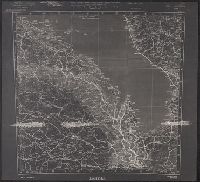
Beinecke Rare Book and Manuscript Library > Triest / compiled at the Royal Geographical Society under the direction of the Geographical Section ; drawn and printed by the Ordnance Survey.
Creator:
Published / Created:
1777
Call Number:
73 1777
Container / Volume:
BRBL_00373
Image Count:
1
Resource Type:
Maps, Atlases & Globes
Alternative Title:
Library of Congress . American maps ; v
Description:
Relief shown pictorially and by hachures. and Shows the Canadian-United States border from Lake Ontario along the St. Lawrence River to 45₋p0₋s N. latitude, east to the Connecticut River, and northeast along the "Height of the land." Coverage of areas away fr
Subject (Geographic):
Canada--Boundaries--United States--Maps--Early works to 1800, New York (State)--Maps--Early works to 1800, Québec (Province)--Maps--Early works to 1800, and United States--History--Revolution, 1775-1783--British forces
Subject (Name):
Sauthier, Claude Joseph
Found in:
Beinecke Rare Book and Manuscript Library > A map of the inhabited part of Canada from the French surveys, with the frontiers of New York and New England; from the large survey by Claude Joseph Sauthier. Engraved by Wm. Faden, 1777.
Branch:v1.61.6 ,Deployed:2024-06-12T09:55:31-04:00