Search
You Searched For
Search Results
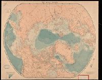
- Creator:
- Edward Stanford Ltd.
- Published / Created:
- [between 1890 and 1900]
- Call Number:
- BrSides Double Folio 2019 10
- Image Count:
- 1
- Resource Type:
- Maps, Atlases & Globes
- Found in:
- Beinecke Rare Book and Manuscript Library > The arctic regions.
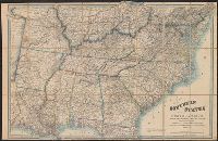
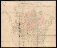
- Creator:
- Wyld, James, 1812-1887
- Published / Created:
- [1862?]
- Call Number:
- 754 1861B
- Container / Volume:
- BRBL_00416
- Image Count:
- 1
- Resource Type:
- Maps, Atlases & Globes
- Found in:
- Beinecke Rare Book and Manuscript Library > Map of the southern states of North America with the forts, harbours & military positions James Wyld, Geographer to the Queen.
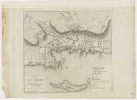
- Creator:
- Blaskowitz, Charles
- Published / Created:
- 1777.
- Call Number:
- 777.09.01.05++
- Image Count:
- 1
- Found in:
- Lewis Walpole Library > A plan of the town of Newport in Rhode Island
- Published / Created:
- 1784]
- Call Number:
- 784.00.00.78+
- Image Count:
- 1
- Found in:
- Lewis Walpole Library > A Representation, of the sea fight, on the 5th of Sepr. 1781, between Rear Admiral Graves and the Count de Grasse
- Creator:
- Blaskowitz, Charles
- Published / Created:
- 1777.
- Call Number:
- Drawer 777.07.22.01+
- Image Count:
- 1
- Found in:
- Lewis Walpole Library > A topographical chart of the bay of Narraganset in the province of New England : with all the isles contained therein, among which Rhode Island and Connonicut have been particularly surveyed, shewing the true position & bearings of the banks, shoals, rocks &c. as likewise the soundings: To which have been added the several works & batteries raised by the Americans. Taken by order of the principal farmers on Rhode Island
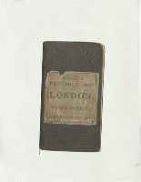
- Creator:
- G.W. Bacon & Co.
- Published / Created:
- [187-?]
- Call Number:
- Purdy 155
- Image Count:
- 9
- Found in:
- Beinecke Rare Book and Manuscript Library > Bacon's central London : divided into half mile squares & circles
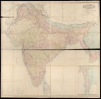
- Creator:
- Walker, John, 1786-1873, cartographer
- Published / Created:
- 1882.
- Call Number:
- Covers 59 +1882
- Image Count:
- 2
- Resource Type:
- cartographic image
- Found in:
- Beinecke Rare Book and Manuscript Library > Map of India : shewing the British territories, subdivided into collectorates and including British Burmah, with the position and boundary of each native state
- Creator:
- Arrowsmith, Aaron, 1750-1823, cartographer
- Published / Created:
- [1820]
- Call Number:
- 71 1820B
- Image Count:
- 1
- Resource Type:
- cartographic image
- Found in:
- Beinecke Rare Book and Manuscript Library > A map exhibiting all the new discoveries in the interior parts of North America : inscribed by permission to the honorable governor and company of adventurers of England trading into Hudsons Bay, in testimony of their liberal communications to their most obedient and very humble servant, A. Arrowsmith, Hydrographer to His Majesty
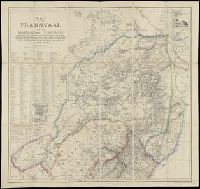
- Creator:
- Jeppe, Frederick, cartographer
- Published / Created:
- [1878?]
- Call Number:
- Covers 643 1878
- Image Count:
- 2
- Found in:
- Beinecke Rare Book and Manuscript Library > Map of the Transvaal and the surrounding territories
- Published / Created:
- 1801
- Call Number:
- Zc90 801mab
- Collection Title:
- Voyages from Montreal, on the river St. Laurence, through the continent of North America, to the
- Image Count:
- 1
- Found in:
- Beinecke Rare Book and Manuscript Library > A map of America, between latitudes 40 and 70 north and longitudes 45 and 180 west, exhibiting Mackenzie's track from Montreal to Fort Chipewyan & from thence to the North Sea In 1789 & to the West Pacific Ocean in 1793