Search
You Searched For
Search Results
- Creator:
- Great Britain. Hydrographic Dept
Stokes, J. Lort (John Lort), 1811-1885
- Published / Created:
- Aug. 16th. 1852 [i.e. 1865]
- Call Number:
- 26cea 1851A
- Container / Volume:
- BRBL_00023
- Image Count:
- 1
- Resource Type:
- Maps, Atlases & Globes
- Found in:
- Beinecke Rare Book and Manuscript Library > Australia east coast. Sheet I, Cape Howe to Barriga Point / from a running survey by Captn. J. Lort Stokes ... 1851.
- Creator:
- Great Britain. Hydrographic Dept
Stokes, J. Lort (John Lort), 1811-1885
- Published / Created:
- Aug. 16th. 1852 [i.e. 1865]
- Call Number:
- 26cea 1851B
- Container / Volume:
- BRBL_00023
- Image Count:
- 1
- Resource Type:
- Maps, Atlases & Globes
- Found in:
- Beinecke Rare Book and Manuscript Library > Australia east coast. Sheet II, Barriga Point to Jervis Bay / from a running survey by Captn. J. Lort Stokes ... 1851 ; engraved by J. & C. Walker.
- Creator:
- Great Britain. Hydrographic Dept
Potter, J. D
- Published / Created:
- Aug. 16th 1852 [i.e. 1865]
- Call Number:
- 26cea 1851C
- Container / Volume:
- BRBL_00023
- Image Count:
- 1
- Resource Type:
- Maps, Atlases & Globes
- Found in:
- Beinecke Rare Book and Manuscript Library > Australia east coast. Sheet III, Jervis Bay to Broken Bay / from a running survey by Captn. J. Lort Stokes ... 1851.
- Creator:
- Great Britain. Hydrographic Dept
Potter, J. D
- Published / Created:
- Aug. 16th. 1852 [i.e. 1862]
- Call Number:
- 26cea 1851D
- Container / Volume:
- BRBL_00023
- Image Count:
- 1
- Resource Type:
- Maps, Atlases & Globes
- Found in:
- Beinecke Rare Book and Manuscript Library > Australia east coast. Sheet IV, Broken Bay to Sugarloaf Point / from a running survey by Captn. J. Lort Stokes ... 1851 ; engraved by J. & C. Walker.
- Creator:
- Evans, F. J. (Frederick J.)
Great Britain. Hydrographic Dept
J. & C. Walker (Firm)
Potter, J. D. (John D.)
Washington Capt
- Published / Created:
- Decr. 12th 1860.
- Call Number:
- 26cea 1860
- Container / Volume:
- BRBL_00023
- Image Count:
- 1
- Resource Type:
- Maps, Atlases & Globes
- Found in:
- Beinecke Rare Book and Manuscript Library > Australia, Coral Sea and Great Barrier Reefs shewing the inner and outer routes to Torres Strait. Sheet 2 : from the surveys of Captains Blackwood, Owen Stanley, and Yule, R.N., 1842-50 : the outer detached reef's from Captains Flinders and Denham, Royal
- Creator:
- Great Britain. Hydrographic Dept
- Published / Created:
- 1863
- Call Number:
- 5735 1861
- Container / Volume:
- BRBL_00734
- Image Count:
- 1
- Resource Type:
- Maps, Atlases & Globes
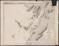
- Found in:
- Beinecke Rare Book and Manuscript Library > Japan Kiusiu Island, West Coast. Nagasaki Harbour, 1861 / engraved by Davies & Powell.
- Creator:
- Davidson, George, 1825-1911. asn CU-BANC
Great Britain. Hydrographic Dept
J. & C. Walker (Firm)
- Published / Created:
- [1856?-186-?]
- Call Number:
- 23cea 1856
- Collection Title:
- Pacific Ocean / Hydrographic Office ; Engraved by J. & C. Walker.
- Container / Volume:
- BRBL_00021
- Image Count:
- 1
- Resource Type:
- Maps, Atlases & Globes
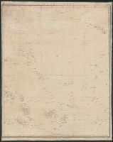
- Found in:
- Beinecke Rare Book and Manuscript Library > Sandwich Islands to New Caledonia.
- Creator:
- Great Britain. Hydrographic Dept
J. & C. Walker (Firm)
- Published / Created:
- [1866?]
- Call Number:
- 23cea J328 1861
- Image Count:
- 1
- Resource Type:
- Maps, Atlases & Globes
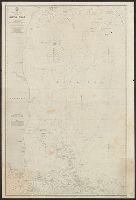
- Found in:
- Beinecke Rare Book and Manuscript Library > Western part of the Java Sea : from Lucipara I. to Sunda Strait and Batavia, corrected to 1861 / engraved by J. & C. Walker.