Skip to search
Skip to main content
Skip to first result
Search
You Searched For
Extent of Digitization
Completely digitized
Access
Public
Repository
Beinecke Rare Book and Manuscript Library
Resource Type
Maps, Atlases & Globes
Publication Place
London :
New Search
Search Results
Published / Created:
1776
Call Number:
786cea P838 1776
Container / Volume:
BRBL_00516
Image Count:
1
Resource Type:
Maps, Atlases & Globes
Description:
From the North America Pilot 1783.
Publisher:
R. Sayer & J. Bennett,
Subject (Geographic):
Port Royal (S.C.)--Maps--Early works to 1800
Found in:
Beinecke Rare Book and Manuscript Library > A Plan of Port Royal in South Carolina ...
Published / Created:
1755
Call Number:
97 L62 1755
Container / Volume:
BRBL_00678
Image Count:
1
Resource Type:
Maps, Atlases & Globes
Publisher:
John Rocque,
Subject (Geographic):
Lima (Peru)--Maps--Early works to 1800
Found in:
Beinecke Rare Book and Manuscript Library > A Scenographic Plan of the City of the Kings, otherwise called Lima, the capital of the Kingdonm of Peru ... as it was before the late earthquakes.
Creator:
Published / Created:
1983
Call Number:
32 L84 1694/1983
Container / Volume:
BRBL_00739
Image Count:
2
Resource Type:
Maps, Atlases & Globes
Alternative Title:
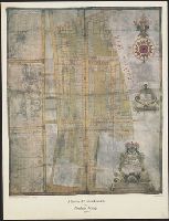
Publication (London Topographical Society) ; no. 128., Publication ; no. 128, and Suruey of Hatton-Garden belonging to ye Right Hon'b. Christopher, Lord Viscount Hatton of Gretton, Barron Hatton of Kirby.
Description:
Accompanied by text: The survey of Hatton Garden in 1694 by Abraham Arlidge / PS Hunting ([1] leaf ; 27 x 21 cm.)., Facsim. of ms. cadastral map showing buildings, lot numbers, and householders' names., and Includes indexes of householders' names and coat of arms.
Publisher:
London Topographical Society,
Subject (Geographic):
Hatton Garden (London, England)--Maps--Early works to 1800
Subject (Topic):
Early maps--Facsimiles and Real property--England--Hatton Garden (London)--Maps--Early works to 1800
Found in:
Beinecke Rare Book and Manuscript Library > A Survey of Hatton Garden : a suruey of Hatton-Garden belonging to ... Barron Hatton of Kirby / by Abraham Arlidge.
Published / Created:
1776
Call Number:
771 C358 1776C
Container / Volume:
BRBL_00482
Image Count:
1
Resource Type:
Maps, Atlases & Globes
Description:
Inset: A particular plan of Lake George. Surveyed in 1756 by Capt. Jackson. Scale [ca. 1:150 000].
Publisher:
Robt. Sayer & Jno. Bennett,
Subject (Geographic):
Champlain, Lake--Maps--Early works to 1800 and New York (State)--Maps--Early works to 1800
Subject (Name):
Robert Sayer and John Bennett (Firm)
Found in:
Beinecke Rare Book and Manuscript Library > A Survey of Lake Champlain including Lake George, Crown Point, and St. John ... by William Brassier, Draughtsman. 1762.
Published / Created:
1776
Call Number:
771 C358 1776
Container / Volume:
BRBL_00482
Image Count:
1
Resource Type:
Maps, Atlases & Globes
Description:
Inset: Lake George. Scale ca. 1:150 000
Publisher:
Map & Sea Chartsellers,
Subject (Geographic):
Champlain, Lake--Maps--Early works to 1800 and New York (State)--Maps--Early works to 1800
Found in:
Beinecke Rare Book and Manuscript Library > A Survey of Lake Champlain including Lake George, Crown Point, and St. John : surveyed by order of his Excellency major General Sr. Jeffery Amherst ... / by William Brassier, Draughtsman, 1762.
Published / Created:
1776
Call Number:
771 H864 1776A
Container / Volume:
BRBL_00483
Image Count:
1
Resource Type:
Maps, Atlases & Globes
Description:
Engraved by William Faden.
Publisher:
Wm. Faden,
Subject (Geographic):
Hudson River (N.Y. and N.J.)--Maps--Early works to 1800
Found in:
Beinecke Rare Book and Manuscript Library > A Topographical map of Hudsons River ... Communication with Canada by Lake George and lake Champlain ... by Claude Joseph Sauthier ...
Published / Created:
1776
Call Number:
771 H864 1776
Container / Volume:
BRBL_00483
Image Count:
1
Resource Type:
Maps, Atlases & Globes
Description:
Engraved by William Faden Succesor to the late Mr. Jefferys geographer to the King Charing Cross.
Publisher:
Wm. Faden,
Subject (Geographic):
Hudson River (N.Y. and N.J.)--Maps--Early works to 1800
Found in:
Beinecke Rare Book and Manuscript Library > A Topographical map of Hudsons River ... Communication with Canada by Lake George and lake Champlain ... by Claude Joseph Sauthier ...
Published / Created:
1777
Call Number:
765cea N16 1777
Container / Volume:
BRBL_00464
Image Count:
1
Resource Type:
Maps, Atlases & Globes
Publisher:
Wm. Faden,
Subject (Geographic):
Narragansett Bay (R.I.)--Maps--Early works to 1800
Found in:
Beinecke Rare Book and Manuscript Library > A Topological Chart of the Bay of Narragansett in the Province of New englannd ... by Charles Blaskowitz.
Published / Created:
1776
Call Number:
775cea 1776
Container / Volume:
BRBL_00502
Image Count:
1
Resource Type:
Maps, Atlases & Globes
Description:
From North American Pilot 1782.
Publisher:
Robt. Sayer & Jno. Bennett,
Subject (Geographic):
Delaware Bay (Del and N.J.)--Maps--Early works to 1800
Found in:
Beinecke Rare Book and Manuscript Library > A chart of Delaware Bay and River ... by joshua Fisher.
Published / Created:
1776
Call Number:
775cea 1776B
Container / Volume:
BRBL_00502
Image Count:
1
Resource Type:
Maps, Atlases & Globes
Description:
Published at Philadelphia by Joshua Fisher.
Publisher:
Andrew Durg,
Subject (Geographic):
Delaware Bay (Del. and N.J.)--Maps--Early works to 1800
Found in:
Beinecke Rare Book and Manuscript Library > A chart of Delaware Bay and River. Contains a full and exact description of the shores, creeks, harbours, soundings, shoals, sands and bearings of the most considerable landmarks from the Capes to Philadelphia taken from the original chart.
Branch:v1.61.8 ,Deployed:2024-06-20T11:15:04-04:00