Search
You Searched For
Search Results
- Published / Created:
- 1828
- Call Number:
- 38GMD 1828
- Container / Volume:
- BRBL_00171
- Image Count:
- 1
- Resource Type:
- Maps, Atlases & Globes
- Found in:
- Beinecke Rare Book and Manuscript Library > A Physical and Topographical map of France ... the post Roads & Relays ... inland Navigation &c. Pickett Sculp. J. Smith Delin.
- Published / Created:
- 1806
- Call Number:
- 38 1806
- Container / Volume:
- BRBL_00154
- Image Count:
- 1
- Resource Type:
- Maps, Atlases & Globes
- Found in:
- Beinecke Rare Book and Manuscript Library > A new map of France ... division into Provinces as previous to the Revolution ... by John Cary, Engraver.
- Published / Created:
- 1811
- Call Number:
- 38 1811
- Container / Volume:
- BRBL_00154
- Image Count:
- 1
- Resource Type:
- Maps, Atlases & Globes
- Found in:
- Beinecke Rare Book and Manuscript Library > A new map of France ... divison into provinces as previous to the revolution ... John Cary, Engraver.
- Published / Created:
- 1799
- Call Number:
- 38 1799A
- Container / Volume:
- BRBL_00154
- Image Count:
- 1
- Resource Type:
- Maps, Atlases & Globes
- Found in:
- Beinecke Rare Book and Manuscript Library > A new map of France divided into departments as decreed by the National Assembly, 1790 ... John Cary, Engraver.
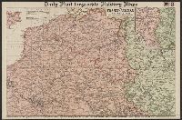
- Creator:
- Philip, George, 1870-1937
- Published / Created:
- [1914.]
- Call Number:
- 11hc 1915B
- Image Count:
- 2
- Resource Type:
- Maps, Atlases & Globes
- Found in:
- Beinecke Rare Book and Manuscript Library > Daily Mail large-scale Military maps No. 3. : The Franco-Belgian Theatre of War / edited by George Philip, F.R.G.S., in conjunction with Military experts.
- Published / Created:
- [1849?]
- Call Number:
- 38 1849
- Container / Volume:
- BRBL_00154
- Image Count:
- 1
- Resource Type:
- Maps, Atlases & Globes
- Found in:
- Beinecke Rare Book and Manuscript Library > France ... Edw. Weller.
- Creator:
- Wyld, James, 1790-1836
- Published / Created:
- [1874]
- Call Number:
- 38 1874
- Container / Volume:
- BRBL_00155
- Image Count:
- 1
- Resource Type:
- Maps, Atlases & Globes
- Found in:
- Beinecke Rare Book and Manuscript Library > Map of France : describing the new limits according to the treaty of peace, 1874.
- Creator:
- Edward Stanford Ltd
- Published / Created:
- 1917
- Call Number:
- 11hc 1917P
- Container / Volume:
- BRBL_00010E
- Image Count:
- 1
- Resource Type:
- Maps, Atlases & Globes
- Found in:
- Beinecke Rare Book and Manuscript Library > Stanford's half-inch map of the British front in France & Flanders.
- Creator:
- Geographia Ltd
Gross, Alexander, 1879-1958
- Published / Created:
- [1916?]
- Call Number:
- 11hcf 1919C-6
- Container / Volume:
- BRBL_00010V
- Image Count:
- 1
- Resource Type:
- Maps, Atlases & Globes
- Found in:
- Beinecke Rare Book and Manuscript Library > The Daily telegraph war map no. 15 [cartographic material] : of the western front, Verdun to Belfort / By Alexander Gross ; Geographia Ltd.