Skip to search
Skip to main content
Skip to first result
Search
You Searched For
Extent of Digitization
Completely digitized
Publication Place
London :
New Search
Search Results
Published / Created:
1866
Call Number:
304 1866
Container / Volume:
BRBL_00033
Image Count:
1
Resource Type:
Maps, Atlases & Globes
Description:
Supplement to the Illustrated London News July 7, 1866.
Publisher:
Illustrated London News,
Subject (Geographic):
Europe, Central--Maps
Found in:
Beinecke Rare Book and Manuscript Library > A Map of the Germanic Confederation as it existed in June, 1866 and of Central Europe.
Published / Created:
1757
Call Number:
36hc P88 1756
Container / Volume:
BRBL_00134
Image Count:
1
Resource Type:
Maps, Atlases & Globes
Alternative Title:
Plan of the city of Prague ...
Description:
Includes "Extract from several Authentic Letters from Berlin, giving an Account of the Battle fought between the Prussians and Austrians near Prague, May 6, 1757."
Publisher:
T. Jefferys,
Subject (Geographic):
Germany--Maps--Early works to 1800
Found in:
Beinecke Rare Book and Manuscript Library > A Map of the country round Prague ... : A Plan of the city of Prague ...
Published / Created:
1798
Call Number:
27cea 1798
Container / Volume:
BRBL_00700
Image Count:
1
Resource Type:
Maps, Atlases & Globes
Description:
Original manuscript map.
Publisher:
Laurie & Whittle,
Subject (Geographic):
Indonesia--Maps, Manuscript--Early works to 1800
Found in:
Beinecke Rare Book and Manuscript Library > A New Chart of the Eastern Straits or the Straits of the East of Java, with a part of the Banda Sea; corrected and improved chiefly from the observation of Captn. - Williams.
Published / Created:
1794
Call Number:
11 1794A
Container / Volume:
BRBL_00006
Image Count:
1
Resource Type:
Maps, Atlases & Globes
Publisher:
Laurie & Whittle,
Subject (Geographic):
World--Maps--Early works to 1800
Found in:
Beinecke Rare Book and Manuscript Library > A New Chart of the World ... with the tracks of the British Circumnavigators Bryon, Wallis, Carteret and Cook, &c.
Published / Created:
1792
Call Number:
326 1792
Container / Volume:
BRBL_00069
Image Count:
1
Resource Type:
Maps, Atlases & Globes
Description:
Directions and Rules for Playing.
Publisher:
J. Wallis & E. Newbery,
Subject (Geographic):
Scotland--Maps--Early works to 1800
Found in:
Beinecke Rare Book and Manuscript Library > A New Geographical Game exhibiting a complete Tour through Scotland and the Western Isles. Neele Sc.
Published / Created:
1750
Call Number:
3218 1750A
Container / Volume:
BRBL_00057
Image Count:
1
Resource Type:
Maps, Atlases & Globes
Description:
Preliminary record.
Publisher:
J. Hinton,
Subject (Geographic):
Oxfordshire (England)--Maps--Early works to 1800
Found in:
Beinecke Rare Book and Manuscript Library > A New Improved Map of Oxfordshire ... Thos. Kitchin ... 1750.
Published / Created:
1811
Call Number:
3247 1811
Container / Volume:
BRBL_00066
Image Count:
1
Resource Type:
Maps, Atlases & Globes
Description:
Preliminary record.
Publisher:
John Cary,
Subject (Geographic):
England--Maps
Found in:
Beinecke Rare Book and Manuscript Library > A New Map of Northamptonshire, Divided Into Hundreds ... by John Cary.
Published / Created:
1811
Call Number:
3251 1811
Container / Volume:
BRBL_00067
Image Count:
1
Resource Type:
Maps, Atlases & Globes
Description:
Preliminary record.
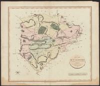
Publisher:
John Cary,
Subject (Geographic):
Rutland (England)--Maps
Found in:
Beinecke Rare Book and Manuscript Library > A New Map of Rutlandshire, Divided into Hundreds ... By John Cary.
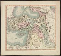
Published / Created:
1801
Call Number:
501 1801
Container / Volume:
BRBL_00276
Image Count:
1
Resource Type:
Maps, Atlases & Globes
Publisher:
J. Cary,
Subject (Geographic):
Turkey--Maps
Found in:
Beinecke Rare Book and Manuscript Library > A New Map of Turkey in Asia divided into its provinces, from the best authorities. By John Cary, Engraver.
Published / Created:
1811
Call Number:
27 1811
Container / Volume:
BRBL_00023A
Image Count:
1
Resource Type:
Maps, Atlases & Globes
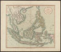
Description:
Preliminary record.
Publisher:
J. Cary,
Subject (Geographic):
Indonesia--Maps
Found in:
Beinecke Rare Book and Manuscript Library > A New Map of the East India Isles ... John Cary, Engraver.
Branch:v1.61.8 ,Deployed:2024-06-20T11:15:04-04:00