Skip to search
Skip to main content
Skip to first result
Search
You Searched For
Extent of Digitization
Unspecified
Repository
Beinecke Rare Book and Manuscript Library
Format
cartographic
Publication Place
London :
New Search
Search Results
Creator:
Published / Created:
Jany. 1st, 1795.
Call Number:
1977 Folio 177
Image Count:
2
Resource Type:
Maps, Atlases & Globes
Found in:
Beinecke Rare Book and Manuscript Library > A map of China : with the surrounding states, correctly copied from Monsr. d'Anville : engraved for Monsr. de Paun's Philosophical dissertations on the Egyptians & Chinese.
Creator:
Published / Created:
[1759]
Call Number:
1977 Folio 177
Image Count:
2
Resource Type:
Maps, Atlases & Globes
Found in:
Beinecke Rare Book and Manuscript Library > A map of the King of Great Britain's Dominions in Germany, or, The Electorate of Brunswick-Lunenburg with its dependencies [cartographic material] : containing the Dutchies of Lunenburg, Calenberg, Grunbenhagen, Lauenburg, Bremen & Verden, and the countie
Creator:
Published / Created:
1787
Call Number:
1977 Folio 177
Image Count:
2
Resource Type:
Maps, Atlases & Globes
Found in:
Beinecke Rare Book and Manuscript Library > A map of the country between Albemarle Sound, and Lake Erie [cartographic material] : comprehending the whole of Virginia, Maryland, Delaware and Pensylvania, with parts of several other of the United States of America / engraved by S.J. Neele.
Creator:
Published / Created:
Jany. 1st , 1793.
Call Number:
1977 Folio 177
Image Count:
2
Resource Type:
Maps, Atlases & Globes
Found in:
Beinecke Rare Book and Manuscript Library > A new map of France divided into eighty three departments according to the decree of the National Assembly in 1790.
Creator:
Published / Created:
[1783?]
Call Number:
1977 Folio 177
Image Count:
4
Resource Type:
Maps, Atlases & Globes
Found in:
Beinecke Rare Book and Manuscript Library > England and Ireland : containing all the cities, boroughs, markettowns & principal villages : with the coast of France from Calais to Brest delineated and engraved from actual surveys / by Richard William Seale.
Creator:
Published / Created:
[1768]
Call Number:
1977 Folio 177
Image Count:
2
Resource Type:
Maps, Atlases & Globes
Found in:
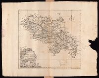
Beinecke Rare Book and Manuscript Library > Martinico, one of the Caribbee Islands in the West Indies subject to the French / [cartographic material] / according to the observations of Mr. Houel engineer ; by Thos. Jefferys, geographer to His Royal Highness the Prince.
Branch:v1.60.98 ,Deployed:2024-06-05T10:04:39-04:00