Search
You Searched For
Search Results
- Published / Created:
- 1775
- Call Number:
- 966 1775
- Container / Volume:
- BRBL_00676
- Image Count:
- 1
- Resource Type:
- Maps, Atlases & Globes
- Found in:
- Beinecke Rare Book and Manuscript Library > A chart of the Straits of Magellan. Inlarged from a chart published at Madrid in 1769, by Don Juan de la Cruz Cano y Olmedilla ... and improved from the observations and surveys of Captns. Byron, Wallis and Carteret ...
- Creator:
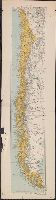
- Edward Stanford Ltd
- Published / Created:
- [1912?]
- Call Number:
- 96 1912
- Container / Volume:
- BRBL_00676
- Image Count:
- 1
- Resource Type:
- Maps, Atlases & Globes
- Found in:
- Beinecke Rare Book and Manuscript Library > Chile.
- Published / Created:
- [1920?].
- Call Number:
- 911 1920
- Container / Volume:
- BRBL_00669
- Image Count:
- 1
- Resource Type:
- Maps, Atlases & Globes
- Found in:
- Beinecke Rare Book and Manuscript Library > Official map of Brazil / by Joao Chrockatt de Sa, John Pereira de Castro and Eduardo A.G. Thompson.
- Published / Created:
- 1900
- Call Number:
- 935 1900
- Container / Volume:
- BRBL_00674
- Image Count:
- 1
- Resource Type:
- Maps, Atlases & Globes
- Found in:
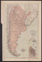
- Beinecke Rare Book and Manuscript Library > Map of Argentina and adjoining states : to illustrate "Argentina" by W.A. Hirst.
- Published / Created:
- 1755
- Call Number:
- 97 L62 1755
- Container / Volume:
- BRBL_00678
- Image Count:
- 1
- Resource Type:
- Maps, Atlases & Globes
- Found in:
- Beinecke Rare Book and Manuscript Library > A Scenographic Plan of the City of the Kings, otherwise called Lima, the capital of the Kingdonm of Peru ... as it was before the late earthquakes.
- Published / Created:
- 1849
- Call Number:
- 844cea 1849
- Container / Volume:
- BRBL_00613
- Image Count:
- 1
- Resource Type:
- Maps, Atlases & Globes
- Found in:
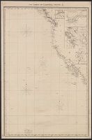
- Beinecke Rare Book and Manuscript Library > The coasts of California, Oregon, &c.
- Published / Created:
- 1873
- Call Number:
- 9713 1873
- Container / Volume:
- BRBL_00678
- Image Count:
- 1
- Resource Type:
- Maps, Atlases & Globes
- Found in:
- Beinecke Rare Book and Manuscript Library > Mapa del Peru, Departamento de Anchachs : con la nueva provincia Dos de Mayo del Departo. de Huanuco / por A. Raimondi.
- Published / Created:
- 1798
- Call Number:
- 27cea 1798
- Container / Volume:
- BRBL_00700
- Image Count:
- 1
- Resource Type:
- Maps, Atlases & Globes
- Found in:
- Beinecke Rare Book and Manuscript Library > A New Chart of the Eastern Straits or the Straits of the East of Java, with a part of the Banda Sea; corrected and improved chiefly from the observation of Captn. - Williams.
- Published / Created:
- 1738
- Call Number:
- 583 1738
- Container / Volume:
- BRBL_00707
- Image Count:
- 1
- Resource Type:
- Maps, Atlases & Globes
- Found in:
- Beinecke Rare Book and Manuscript Library > Part of Malaya. Part of Tanasary.
- Published / Created:
- 1787
- Call Number:
- 21 1787
- Container / Volume:
- BRBL_00724
- Image Count:
- 1
- Resource Type:
- Maps, Atlases & Globes
- Found in:
- Beinecke Rare Book and Manuscript Library > The Atlantic Ocean / by Governor Pownall F.R.S.
- Published / Created:
- 1797
- Call Number:
- 70 1797
- Container / Volume:
- BRBL_00725
- Image Count:
- 1
- Resource Type:
- Maps, Atlases & Globes
- Found in:
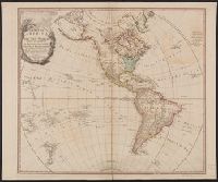
- Beinecke Rare Book and Manuscript Library > A map of America, or the new world, wherein are introduced all the known parts of the western hemisphere, from the map of d'Anville ...
- Published / Created:
- 1774
- Call Number:
- 71 1774
- Container / Volume:
- BRBL_00726
- Image Count:
- 1
- Resource Type:
- Maps, Atlases & Globes
- Found in:
- Beinecke Rare Book and Manuscript Library > A map of the British empire in North America / by Samuel Dunn, mathematician.
- Published / Created:
- 1776
- Call Number:
- 71 1776M
- Container / Volume:
- BRBL_00726
- Image Count:
- 1
- Resource Type:
- Maps, Atlases & Globes
- Found in:
- Beinecke Rare Book and Manuscript Library > A map of the British empire in North America / by Samuel Dunn, mathematician ; improved from the surveys of Capt. Carver.
- Creator:
- Pownall, Thomas, 1722-1805
- Published / Created:
- March 25th, 1776.
- Call Number:
- 71 1776N
- Container / Volume:
- BRBL_00726
- Image Count:
- 1
- Resource Type:
- Maps, Atlases & Globes
- Found in:
- Beinecke Rare Book and Manuscript Library > A map of the middle British colonies in North America [cartographic material] : First published by Lewis Evans, of Philadelphia, in 1755 ; and since corrected and improved, as also extended, with the addition of New England, and bordering parts of Canada
- Creator:
- Stokes, John Lort, 1811-1885, cartographer.
- Published / Created:
- Apr. 5, 1845.
- Call Number:
- BrSides Double Folio 2019 107
- Image Count:
- 1
- Resource Type:
- Maps, Atlases & Globes
- Found in:
- Beinecke Rare Book and Manuscript Library > The Victoria River : 1839 / surveyed by Commr. J.L. Stokes, R.N. ; J. & C. Walker, sculpt.
- Creator:
- Stokes, John Lort, 1811-1885, cartographer.
- Published / Created:
- April 10, 1845.
- Call Number:
- BrSides Double Folio 2019 108
- Image Count:
- 1
- Resource Type:
- Maps, Atlases & Globes
- Found in:
- Beinecke Rare Book and Manuscript Library > The Albert River : 1841 / surveyed by J.L. Stokes, R.N. ; J. & C. Walker, sculpt.
- Creator:
- Wyld, James, 1812-1887
- Published / Created:
- 1861
- Call Number:
- 754hc 1861E
- Container / Volume:
- BRBL_00420
- Image Count:
- 1
- Resource Type:
- Maps, Atlases & Globes
- Found in:
- Beinecke Rare Book and Manuscript Library > Wyld's military map of the United States, the northern states, and the southern confederate states: with the forts, harbours, arsenals, and military positions.
- Published / Created:
- 1783
- Call Number:
- 755 1783E
- Container / Volume:
- BRBL_00434
- Image Count:
- 1
- Resource Type:
- Maps, Atlases & Globes
- Found in:
- Beinecke Rare Book and Manuscript Library > Bowles's New Pocket map of the United States of America with the British possessions ... French and Spanish ... Louisiana and Florida according to Versailles ... 1783.
- Published / Created:
- 1783
- Call Number:
- 755 1783C
- Container / Volume:
- BRBL_00434
- Image Count:
- 1
- Resource Type:
- Maps, Atlases & Globes
- Found in:
- Beinecke Rare Book and Manuscript Library > A new map of the United States of North America with the British Dominions on the Continent &c. By Samuel Dunn, Mathematician; improved from the Surveys of Capt. Carver.
- Published / Created:
- 1794
- Call Number:
- 755 1794D
- Container / Volume:
- BRBL_00436
- Image Count:
- 1
- Resource Type:
- Maps, Atlases & Globes
- Found in:
- Beinecke Rare Book and Manuscript Library > A new and general map of the Southern dominions belonging to the United States of America, ... Indian countries, and the Spanish Possessions of Louisiana and Florida.