Search
You Searched For
Search Results
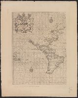
- Published / Created:
- March 1880.
- Call Number:
- 11 1584
- Container / Volume:
- BRBL_00722
- Image Count:
- 2
- Resource Type:
- Maps, Atlases & Globes
- Found in:
- Beinecke Rare Book and Manuscript Library > [World map].
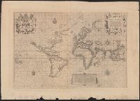
- Published / Created:
- March 1880.
- Call Number:
- 11 1600
- Container / Volume:
- BRBL_00002
- Image Count:
- 1
- Resource Type:
- Maps, Atlases & Globes
- Found in:
- Beinecke Rare Book and Manuscript Library > [World map].
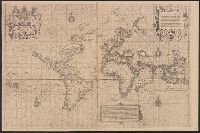
- Published / Created:
- March 1880.
- Call Number:
- 11 1600
- Image Count:
- 1
- Resource Type:
- Maps, Atlases & Globes
- Found in:
- Beinecke Rare Book and Manuscript Library > [World map].
- Published / Created:
- 1825
- Call Number:
- 23cea 1825A
- Container / Volume:
- BRBL_00021
- Image Count:
- 2
- Resource Type:
- Maps, Atlases & Globes
- Found in:
- Beinecke Rare Book and Manuscript Library > [Two charts of the Pacific Ocean, showing the Northwestern America and Sandwich Islands and ports].
- Published / Created:
- 1915
- Call Number:
- 11ba 1915A
- Container / Volume:
- BRBL_00010A
- Image Count:
- 1
- Resource Type:
- Maps, Atlases & Globes
- Found in:
- Beinecke Rare Book and Manuscript Library > [Philips' 4 inch graphic globe.]
- Call Number:
- 11ba 1915
- Container / Volume:
- BRBL_00010A
- Image Count:
- 1
- Resource Type:
- Maps, Atlases & Globes
- Found in:
- Beinecke Rare Book and Manuscript Library > [Philips' 12 inch terrestrial globe.]
- Published / Created:
- [19--?]
- Call Number:
- 32 L84 1900
- Container / Volume:
- BRBL_00051
- Image Count:
- 5
- Resource Type:
- Maps, Atlases & Globes
- Found in:
- Beinecke Rare Book and Manuscript Library > [Map of London and Environs].
- Published / Created:
- [1845?]
- Call Number:
- 530 No. 12
- Container / Volume:
- BRBL_00287
- Image Count:
- 1
- Resource Type:
- Maps, Atlases & Globes
- Found in:
- Beinecke Rare Book and Manuscript Library > [Ancient Near East] Asia Minor Antiqua by William Henry Francis Plate L.L.D. ... J. & C. Walker, Sculp.
- Published / Created:
- 1858
- Call Number:
- 32 L84 1858A
- Container / Volume:
- BRBL_00050
- Image Count:
- 1
- Resource Type:
- Maps, Atlases & Globes
- Found in:
- Beinecke Rare Book and Manuscript Library > Wyld's new plan of London for 1858.
- Creator:
- Wyld, James, 1812-1887
- Published / Created:
- [1862]
- Call Number:
- 32 L84 1862
- Container / Volume:
- BRBL_00050
- Image Count:
- 1
- Resource Type:
- Maps, Atlases & Globes
- Found in:
- Beinecke Rare Book and Manuscript Library > Wyld's new plan of London = Nouveau plan des Londres = Neuer Plan von London.
- Creator:
- Wyld, James, 1812-1887
- Published / Created:
- 1861
- Call Number:
- 754hc 1861E
- Container / Volume:
- BRBL_00420
- Image Count:
- 1
- Resource Type:
- Maps, Atlases & Globes
- Found in:
- Beinecke Rare Book and Manuscript Library > Wyld's military map of the United States, the northern states, and the southern confederate states: with the forts, harbours, arsenals, and military positions.
- Creator:
- Wyld, James, 1812-1887
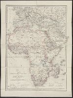
- Published / Created:
- [1875?]
- Call Number:
- 60 1875
- Container / Volume:
- BRBL_00327
- Image Count:
- 1
- Resource Type:
- Maps, Atlases & Globes
- Found in:
- Beinecke Rare Book and Manuscript Library > Wyld's map shewing the various explorations in Africa / James Wyld.
- Creator:
- Wyld, James, 1812-1887
- Published / Created:
- 1873
- Call Number:
- 6555 1873
- Container / Volume:
- BRBL_00346
- Image Count:
- 1
- Resource Type:
- Maps, Atlases & Globes
- Found in:
- Beinecke Rare Book and Manuscript Library > Wyld's Map of Ashanti : and neighbouring states with the British Possessions on the Gold Coast / published by James Wyld, Geographer to the Queen, 457 Strand, 11 & 12 Charing Cross & 2 Royal Exchange, London, November 20, 1873.
- Published / Created:
- [1855?]
- Call Number:
- 3191gm 1855
- Container / Volume:
- BRBL_00041
- Image Count:
- 1
- Resource Type:
- Maps, Atlases & Globes
- Found in:
- Beinecke Rare Book and Manuscript Library > Wyld's A map of England, Wales, & Scotland describing all the direct and principal cross roads of Great Britain, with the distances measured between the market towns and from London: Likewise the Great Rivers and Navigable Canals and Railroads.
- Published / Created:
- c1914.
- Call Number:
- 32am L84 1914
- Container / Volume:
- BRBL_00075
- Image Count:
- 1
- Resource Type:
- Maps, Atlases & Globes
- Found in:
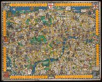
- Beinecke Rare Book and Manuscript Library > Wonderground map of the London Town drawn by MacDonald Gill.
- Published / Created:
- c1914.
- Call Number:
- 32am L84 1914
- Container / Volume:
- BRBL_00075
- Image Count:
- 1
- Resource Type:
- Maps, Atlases & Globes
- Found in:
- Beinecke Rare Book and Manuscript Library > Wonderground map of the London Town drawn by MacDonald Gill.
- Published / Created:
- 1755
- Call Number:
- 3223 1755
- Container / Volume:
- BRBL_00060
- Image Count:
- 1
- Resource Type:
- Maps, Atlases & Globes
- Found in:
- Beinecke Rare Book and Manuscript Library > Wiltshire ... Eman: Bowen ...
- Published / Created:
- 1816
- Call Number:
- 32 L84 1816A
- Container / Volume:
- BRBL_00049
- Image Count:
- 1
- Resource Type:
- Maps, Atlases & Globes
- Found in:
- Beinecke Rare Book and Manuscript Library > William Belch's New Map of London.
- Published / Created:
- [1916?]
- Call Number:
- BrSides Elephant Folio 2019 3
- Image Count:
- 1
- Resource Type:
- Maps, Atlases & Globes
- Found in:
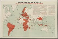
- Beinecke Rare Book and Manuscript Library > What Germany wants : her claims as set forth by leaders of German thought.
- Published / Created:
- [1916?]
- Call Number:
- 11hc 1914R
- Container / Volume:
- BRBL_00010B
- Image Count:
- 1
- Resource Type:
- Maps, Atlases & Globes
- Found in:
- Beinecke Rare Book and Manuscript Library > What Germany wants : her claims as set forth by leaders of German thought.
- Creator:
- Great Britain. Hydrographic Dept
J. & C. Walker (Firm)
- Published / Created:
- [1866?]
- Call Number:
- 23cea J328 1861
- Image Count:
- 1
- Resource Type:
- Maps, Atlases & Globes
- Found in:
- Beinecke Rare Book and Manuscript Library > Western part of the Java Sea : from Lucipara I. to Sunda Strait and Batavia, corrected to 1861 / engraved by J. & C. Walker.
- Creator:
- George Philip & Son
London Geographical Institute
- Published / Created:
- 1940
- Call Number:
- 36 1940A
- Container / Volume:
- BRBL_00121
- Image Count:
- 1
- Resource Type:
- Maps, Atlases & Globes
- Found in:
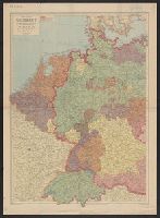
- Beinecke Rare Book and Manuscript Library > Western Germany, with Holland, Belgium and Switzerland.
- Published / Created:
- 1832
- Call Number:
- 36 1832
- Container / Volume:
- BRBL_00119
- Image Count:
- 1
- Resource Type:
- Maps, Atlases & Globes
- Found in:
- Beinecke Rare Book and Manuscript Library > Western Germany By J. Arrowsmith.
- Creator:
- Arrowsmith, John, 1790-1873
- Published / Created:
- 1858
- Call Number:
- 36 1858A
- Container / Volume:
- BRBL_00120
- Image Count:
- 1
- Resource Type:
- Maps, Atlases & Globes
- Found in:
- Beinecke Rare Book and Manuscript Library > Western Germany / by J. Arrowsmith.
- Published / Created:
- [1840?]
- Call Number:
- 654 1840
- Container / Volume:
- BRBL_00344
- Image Count:
- 2
- Resource Type:
- Maps, Atlases & Globes
- Found in:
- Beinecke Rare Book and Manuscript Library > West Africa. Engraved by J. & C. Walker.
- Creator:
- Wallis, J. (John), -1818
- Published / Created:
- Augt. 2nd, 1798.
- Call Number:
- 32 1798
- Container / Volume:
- BRBL_00044
- Image Count:
- 1
- Resource Type:
- Maps, Atlases & Globes
- Found in:
- Beinecke Rare Book and Manuscript Library > Wallis's new and correct map of the post roads of England and Wales.
- Creator:
- George Philip & Son
- Published / Created:
- [1920?]
- Call Number:
- 263 1920
- Container / Volume:
- BRBL_00023
- Image Count:
- 2
- Resource Type:
- Maps, Atlases & Globes
- Found in:
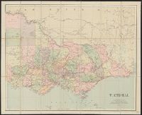
- Beinecke Rare Book and Manuscript Library > Victoria.
- Creator:
- Great Britain. Hydrographic Office
- Published / Created:
- [1871]
- Call Number:
- 7391 1871
- Container / Volume:
- BRBL_00394
- Image Count:
- 1
- Resource Type:
- Maps, Atlases & Globes
- Found in:
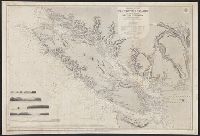
- Beinecke Rare Book and Manuscript Library > Vancouver Island and adjacent shores of British Columbia / surveyed by G.H. Richards, assisted by R.C. Mayne ... [et al.], 1859-65 ; compiled and drawn for engraving by E.J. Powell ; engraved by Davies & Powell.
- Creator:
- Arrowsmith, John, 1790-1873, cartographer
- Published / Created:
- 1834 February 15
- Call Number:
- 73 1834A
- Container / Volume:
- BRBL_00374
- Image Count:
- 1
- Resource Type:
- Maps, Atlases & Globes
- Found in:
- Beinecke Rare Book and Manuscript Library > Upper Canada &c [cartographic material] / by J. Arrowsmith.
- Published / Created:
- 1886
- Call Number:
- 32 Ox1 1886
- Container / Volume:
- BRBL_00053
- Image Count:
- 1
- Resource Type:
- Maps, Atlases & Globes
- Found in:
- Beinecke Rare Book and Manuscript Library > University of London. The Park and Marston Estate, 1886.
- Published / Created:
- 1823
- Call Number:
- 755 1823A
- Container / Volume:
- BRBL_00439
- Image Count:
- 1
- Resource Type:
- Maps, Atlases & Globes
- Found in:
- Beinecke Rare Book and Manuscript Library > United States of America. Neele & Son Sculpt.
- Published / Created:
- [1845?]
- Call Number:
- 75 1845B
- Container / Volume:
- BRBL_00399
- Image Count:
- 1
- Resource Type:
- Maps, Atlases & Globes
- Found in:
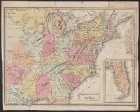
- Beinecke Rare Book and Manuscript Library > United States of America.
- Published / Created:
- Octr. 5th. 1809.
- Call Number:
- 75 1809
- Container / Volume:
- BRBL_00727
- Image Count:
- 1
- Resource Type:
- Maps, Atlases & Globes
- Found in:
- Beinecke Rare Book and Manuscript Library > United States of America, southern part.
- Creator:
- Arrowsmith, John, 1790-1873
- Published / Created:
- 1876
- Call Number:
- 491 1876
- Container / Volume:
- BRBL_00269
- Image Count:
- 1
- Resource Type:
- Maps, Atlases & Globes
- Found in:
- Beinecke Rare Book and Manuscript Library > Turkey in Europe [cartographic material] / by J. Arrowsmith.
- Published / Created:
- 1813
- Call Number:
- 501 1813
- Container / Volume:
- BRBL_00276
- Image Count:
- 1
- Resource Type:
- Maps, Atlases & Globes
- Found in:
- Beinecke Rare Book and Manuscript Library > Turkey in Asia. Neele Sculpt. Strand.
- Creator:
- Ordnance Survey of Great Britain and Ireland
Royal Geographical Society (Great Britain). Geographical Section
- Published / Created:
- 1915
- Call Number:
- 11hcf 1919E-11
- Image Count:
- 1
- Resource Type:
- Maps, Atlases & Globes
- Found in:
- Beinecke Rare Book and Manuscript Library > Triest : North L 33. / compiled at the Royal Geographical Society under the direction of the Geographical Section; drawn and printed by Ordnance Survey.
- Creator:
- Ordnance Survey of Great Britain and Ireland
Royal Geographical Society (Great Britain). Geographical Section
- Published / Created:
- 1915
- Call Number:
- 11hcf 1919E-10
- Container / Volume:
- BRBL_00010Z
- Image Count:
- 1
- Resource Type:
- Maps, Atlases & Globes
- Found in:
- Beinecke Rare Book and Manuscript Library > Triest : North L 33. / compiled at the Royal Geographical Society under the direction of the Geographical Section; drawn and printed by Ordnance Survey.
- Creator:
- Ordnance Survey of Great Britain and Ireland
Royal Geographical Society (Great Britain). Geographical Section
- Published / Created:
- 1915
- Call Number:
- 11hcf 1919E-10
- Image Count:
- 1
- Resource Type:
- Maps, Atlases & Globes
- Found in:
- Beinecke Rare Book and Manuscript Library > Triest : North L 33. / compiled at the Royal Geographical Society under the direction of the Geographical Section; drawn and printed by Ordnance Survey.
- Published / Created:
- [1900?]
- Call Number:
- 321 1900A
- Container / Volume:
- BRBL_00054A
- Image Count:
- 1
- Resource Type:
- Maps, Atlases & Globes
- Found in:
- Beinecke Rare Book and Manuscript Library > Tombleson's Panoramic Map of the Thames and Medway.
- Creator:
- Wyld, James, 1812-1887
- Published / Created:
- [186-?]
- Call Number:
- 267 1865
- Container / Volume:
- BRBL_00023
- Image Count:
- 1
- Resource Type:
- Maps, Atlases & Globes
- Found in:
- Beinecke Rare Book and Manuscript Library > To the Right Honourable the Secretary of State for the Colonies &c. This chart of New Zealand from original surveys / engraved by Jas. Wyld, Charing Cross East.
- Published / Created:
- 1816
- Call Number:
- 59 1816
- Container / Volume:
- BRBL_00317
- Image Count:
- 6
- Resource Type:
- Maps, Atlases & Globes
- Found in:
- Beinecke Rare Book and Manuscript Library > To the Honble. the court of directors of the East India Company this improved map of India ... / A. Arrowsmith.
- Published / Created:
- [1738]
- Call Number:
- 785cea 1738
- Container / Volume:
- BRBL_00514
- Image Count:
- 1
- Resource Type:
- Maps, Atlases & Globes
- Found in:
- Beinecke Rare Book and Manuscript Library > To his grace Thomas Hollis Pelham, Duke of Newcastle... : this chart of his majesties province of North Carolina... / James Wimble... 1738.
- Published / Created:
- 1760
- Call Number:
- 36hc M66 1756
- Container / Volume:
- BRBL_00134
- Image Count:
- 3
- Resource Type:
- Maps, Atlases & Globes
- Found in:
- Beinecke Rare Book and Manuscript Library > To Prince Ferdinand of Brunswich, this plan of the battle of Thonhausen ... by William Roy, captain of engineers, & assistant quatermaster general of the British forces. Surveyed & drawn by Capt. William Roy. Engraved by Thos: Major.
- Published / Created:
- 1796
- Call Number:
- 755cea 1796
- Container / Volume:
- BRBL_00441
- Image Count:
- 3
- Resource Type:
- Maps, Atlases & Globes
- Found in:
- Beinecke Rare Book and Manuscript Library > To His Excellency General George Washington, President of the United States of North America, This Chart Including the Navigation from the Gulf of Florida to Philadelphia, Is respectfully dedicated ... by ... John Hamilton Moore.
- Published / Created:
- 1740
- Call Number:
- 902 C24 1740
- Container / Volume:
- BRBL_00666
- Image Count:
- 1
- Resource Type:
- Maps, Atlases & Globes
- Found in:
- Beinecke Rare Book and Manuscript Library > This plan of the harbour, town, and forts of Cartagena ... taken from a curious and exact survey made in the year 1739.
- Published / Created:
- 1817
- Call Number:
- 215 1815
- Container / Volume:
- BRBL_00015
- Image Count:
- 1
- Resource Type:
- Maps, Atlases & Globes
- Found in:
- Beinecke Rare Book and Manuscript Library > This Geographical Plan of The Island & Ports of Saint Helena is Dedicated by Permifsion to Field Marshal His Rl. Highnefs The Duke of Kent and Strathearn By Lieu. R.P. Read. Engd. by R. Kirkwood.
- Creator:
- Jefferys, Thomas, d. 1771
- Published / Created:
- 1794
- Call Number:
- 795cea 1794
- Container / Volume:
- BRBL_00523
- Image Count:
- 1
- Resource Type:
- Maps, Atlases & Globes
- Found in:
- Beinecke Rare Book and Manuscript Library > The western coast of Louisiana and the coast of New Leon / by Thos. Jefferys, geographer to His Majesty.
- Creator:
- Jefferys, Thomas, d. 1771
- Published / Created:
- 1st January 1789.
- Call Number:
- 655 1789
- Container / Volume:
- BRBL_00345
- Image Count:
- 1
- Resource Type:
- Maps, Atlases & Globes
- Found in:
- Beinecke Rare Book and Manuscript Library > The western coast of Africa, from Cape Blanco to Cape Virga, exhibiting Senegambia proper / by T. Jefferys.
- Creator:
- Jefferys, Thomas, d. 1771
- Published / Created:
- August 12th, 1768.
- Call Number:
- 655 1768
- Container / Volume:
- BRBL_00345
- Image Count:
- 1
- Resource Type:
- Maps, Atlases & Globes
- Found in:
- Beinecke Rare Book and Manuscript Library > The western coast of Africa, from Cape Blanco to Cape Virga, exhibiting Senegambia proper / by T. Jefferys.