Search
You Searched For
Search Results
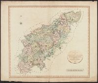
- Published / Created:
- 1811
- Call Number:
- 3247 1811
- Container / Volume:
- BRBL_00066
- Image Count:
- 1
- Resource Type:
- Maps, Atlases & Globes
- Found in:
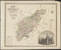
- Beinecke Rare Book and Manuscript Library > A New Map of Northamptonshire, Divided Into Hundreds ... by John Cary.
- Published / Created:
- 1804
- Call Number:
- 32 1804
- Container / Volume:
- BRBL_00044
- Image Count:
- 1
- Resource Type:
- Maps, Atlases & Globes
- Found in:
- Beinecke Rare Book and Manuscript Library > A complete representation of the Coast of England ... intended for the invasion of England, By John Luffman Geog.
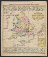
- Published / Created:
- [1820].
- Call Number:
- 32 1820
- Container / Volume:
- BRBL_00045
- Image Count:
- 2
- Resource Type:
- Maps, Atlases & Globes
- Found in:
- Beinecke Rare Book and Manuscript Library > A new map of England & Wales, drawn from the latest surveys, 1820.
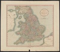
- Published / Created:
- 1807
- Call Number:
- 32 1807
- Container / Volume:
- BRBL_00044
- Image Count:
- 1
- Resource Type:
- Maps, Atlases & Globes
- Found in:
- Beinecke Rare Book and Manuscript Library > A new map of England ... By John Cary, Engraver.
- Published / Created:
- 1811
- Call Number:
- 32 1811
- Container / Volume:
- BRBL_00044
- Image Count:
- 1
- Resource Type:
- Maps, Atlases & Globes
- Found in:
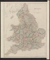
- Beinecke Rare Book and Manuscript Library > A new map of England ... By John Cary.
- Published / Created:
- 1811
- Call Number:
- 32 1811A
- Container / Volume:
- BRBL_00044
- Image Count:
- 1
- Resource Type:
- Maps, Atlases & Globes
- Found in:
- Beinecke Rare Book and Manuscript Library > A new map of England ... by John Cary, Engraver.
- Published / Created:
- 1846
- Call Number:
- 32 1846
- Container / Volume:
- BRBL_00045
- Image Count:
- 1
- Resource Type:
- Maps, Atlases & Globes
- Found in:
- Beinecke Rare Book and Manuscript Library > Betts's New Railway and Commercial map of England and Wales ...
- Published / Created:
- 1845
- Call Number:
- 32 1845
- Container / Volume:
- BRBL_00045
- Image Count:
- 1
- Resource Type:
- Maps, Atlases & Globes
- Found in:
- Beinecke Rare Book and Manuscript Library > Betts's new map of England & Wales ...
- Published / Created:
- 1828
- Call Number:
- 32 1828
- Container / Volume:
- BRBL_00045
- Image Count:
- 1
- Resource Type:
- Maps, Atlases & Globes
- Found in:
- Beinecke Rare Book and Manuscript Library > Cary's ... map of England and Wales with part of Scotland ... John Cary.
- Published / Created:
- [1849?]
- Call Number:
- 32 1849
- Container / Volume:
- BRBL_00045
- Image Count:
- 1
- Resource Type:
- Maps, Atlases & Globes
- Found in:
- Beinecke Rare Book and Manuscript Library > Cruchley's Travelling Railway map of England & Wales.
- Published / Created:
- 1830
- Call Number:
- 32 1830
- Container / Volume:
- BRBL_00045
- Image Count:
- 1
- Resource Type:
- Maps, Atlases & Globes
- Found in:
- Beinecke Rare Book and Manuscript Library > Cruchley's improved Geographical Companion throughout England & Wales including part of Scotland ...
- Published / Created:
- 1831
- Call Number:
- 32 1831
- Container / Volume:
- BRBL_00045
- Image Count:
- 1
- Resource Type:
- Maps, Atlases & Globes
- Found in:
- Beinecke Rare Book and Manuscript Library > Cruchley's new travelling map and itinerary comprising the whole of England ...
- Creator:
- Arrowsmith, John, 1790-1873
- Published / Created:
- 1858
- Call Number:
- 32 1858
- Container / Volume:
- BRBL_00045
- Image Count:
- 1
- Resource Type:
- Maps, Atlases & Globes
- Found in:
- Beinecke Rare Book and Manuscript Library > England / by J. Arrowsmith.
- Creator:
- George Philip & Son
- Published / Created:
- [1915?]
- Call Number:
- 32 1915
- Container / Volume:
- BRBL_00045
- Image Count:
- 1
- Resource Type:
- Maps, Atlases & Globes
- Found in:
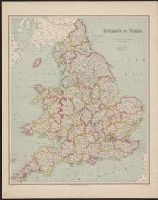
- Beinecke Rare Book and Manuscript Library > England and Wales.
- Published / Created:
- 1850
- Call Number:
- 32gme 1850
- Container / Volume:
- BRBL_00076
- Image Count:
- 1
- Resource Type:
- Maps, Atlases & Globes
- Found in:
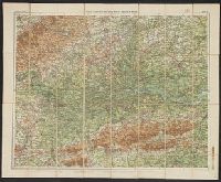
- Beinecke Rare Book and Manuscript Library > Great Britain with the railways completed and in progress and for which acts of Parliment have been obtained.
- Published / Created:
- [1890]
- Call Number:
- 32gme 1890
- Container / Volume:
- BRBL_00076
- Image Count:
- 2
- Resource Type:
- Maps, Atlases & Globes
- Found in:
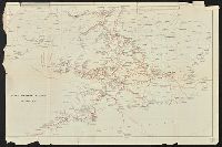
- Beinecke Rare Book and Manuscript Library > Great Western Railway General Map.
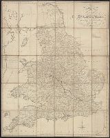
- Published / Created:
- 1830
- Call Number:
- 3247 1830
- Container / Volume:
- BRBL_00066
- Image Count:
- 1
- Resource Type:
- Maps, Atlases & Globes
- Found in:
- Beinecke Rare Book and Manuscript Library > Map of the County of Northhampton ... by C. & J. Greenwood. Engraved by J. & C. Walker.
- Published / Created:
- 1845
- Call Number:
- 32gme 1845
- Container / Volume:
- BRBL_00076
- Image Count:
- 2
- Resource Type:
- Maps, Atlases & Globes
- Found in:
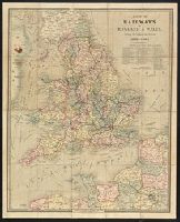
- Beinecke Rare Book and Manuscript Library > Map of the Railways of England & Wales ...
- Published / Created:
- 1823
- Call Number:
- 32 1823
- Container / Volume:
- BRBL_00045
- Image Count:
- 1
- Resource Type:
- Maps, Atlases & Globes
- Found in:
- Beinecke Rare Book and Manuscript Library > New and Improved map of England and Wales including the principal part of Scotland ... by W.R. Gardner, Engraved by W.R. Gardner.
- Published / Created:
- 1900
- Call Number:
- 32 1900
- Container / Volume:
- BRBL_00045
- Image Count:
- 2
- Resource Type:
- Maps, Atlases & Globes
- Found in:
- Beinecke Rare Book and Manuscript Library > Philips' Clear-Print half-inch map of England & Wales/ London Sheet.