Search
You Searched For
Search Results
- Creator:
- Arrowsmith, Aaron, 1750-1823
- Published / Created:
- [betw. 1804 and 1811?]
- Call Number:
- 70 1808
- Container / Volume:
- BRBL_00358
- Image Count:
- 4
- Resource Type:
- Maps, Atlases & Globes
- Found in:
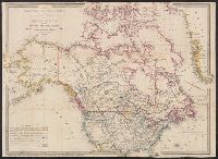
- Beinecke Rare Book and Manuscript Library > Map of America / by A. Arrowsmith ; engraved by W. West, the hills by H. Wilson.
- Creator:
- Arrowsmith, Aaron, 1750-1823
- Published / Created:
- [1818]
- Call Number:
- 71 1818A
- Container / Volume:
- BRBL_00368
- Image Count:
- 4
- Resource Type:
- Maps, Atlases & Globes
- Subject (Geographic):
- North America--Maps
- Found in:
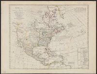
- Beinecke Rare Book and Manuscript Library > A map exhibiting all the new discoveries in the interior parts of North America : inscribed by permission to the honourable governor and company of adventurers of England trading into Hudsons Bay in testimony of their liberal communications to their most
- Creator:
- Wyld, James, 1812-1887
- Published / Created:
- [1854?]
- Call Number:
- 71 1854A
- Container / Volume:
- BRBL_00371
- Image Count:
- 1
- Resource Type:
- Maps, Atlases & Globes
- Subject (Geographic):
- North America--Maps
- Found in:
- Beinecke Rare Book and Manuscript Library > Map of North America : exhibiting the recent discoveries, geographical & nautical / by James Wyld, Geographer to Her Majesty ; J.W. del. ; Stockley fc.
- Creator:
- Wyld, James, 1812-1887
- Published / Created:
- [1828]
- Call Number:
- 71 1828
- Container / Volume:
- BRBL_00369
- Image Count:
- 7
- Resource Type:
- Maps, Atlases & Globes
- Subject (Geographic):
- North America--Maps
- Found in:
- Beinecke Rare Book and Manuscript Library > Map of North America : exhibiting the recent discoveries, geographical and nautical; drawn chiefly from the authorities of M. de Humbolt, Lieutt. Pike, Messrs. Lewis and Clarke, Sir Alexr. Mackenzie, Mr. Hearne, Coll. Bouchette, Captns. Vancouver, Ross, P
- Creator:
- Wyld, James, 1812-1887
- Published / Created:
- [187-?]
- Call Number:
- 71 1870A
- Container / Volume:
- BRBL_00371
- Image Count:
- 1
- Resource Type:
- Maps, Atlases & Globes
- Subject (Geographic):
- North America--Maps
- Found in:
- Beinecke Rare Book and Manuscript Library > Map of North America : exhibiting the recent discoveries, geographical and nautical; drawn chiefly from the authorities of M. de Humbolt, Lieutt. Pike, Messrs. Lewis and Clarke, Sir Alexr. Mackenzie, Mr. Hearne, Coll. Bouchette, Captns. Vancouver, Ross, P
- Creator:
- Wilkinson, Robert, -approximately 1825
- Published / Created:
- 1823 August 12
- Call Number:
- 71 1823
- Container / Volume:
- BRBL_00369
- Image Count:
- 1
- Resource Type:
- Maps, Atlases & Globes
- Subject (Geographic):
- North America--Maps
- Found in:
- Beinecke Rare Book and Manuscript Library > North America / E. Bourne sculp.
- Creator:
- Betts, John, fl. 1844-1863
- Published / Created:
- [18--?]
- Call Number:
- 71 18XX
- Container / Volume:
- BRBL_00371
- Image Count:
- 2
- Resource Type:
- Maps, Atlases & Globes
- Subject (Geographic):
- North America--Maps
- Found in:
- Beinecke Rare Book and Manuscript Library > North America.
- Creator:
- Wyld, James, 1812-1887
- Published / Created:
- March 2nd 1857.
- Call Number:
- 71 1857
- Container / Volume:
- BRBL_00371
- Image Count:
- 2
- Resource Type:
- Maps, Atlases & Globes
- Subject (Geographic):
- North America--Maps
- Found in:
- Beinecke Rare Book and Manuscript Library > The British possessions in North America and the United States with the Hudson's Bay territories / by James Wyld, geographer to the Queen & H.R.H. Prince Albert.
- Published / Created:
- 1849
- Call Number:
- 844cea 1849
- Container / Volume:
- BRBL_00613
- Image Count:
- 1
- Resource Type:
- Maps, Atlases & Globes
- Subject (Geographic):
- Pacific Coast (North America)--Maps
- Found in:
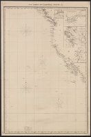
- Beinecke Rare Book and Manuscript Library > The coasts of California, Oregon, &c.
- Creator:
- Delarochette, L. (Louis), 1731-1802
- Published / Created:
- 1765
- Call Number:
- 71 1765
- Container / Volume:
- BRBL_00364
- Image Count:
- 1
- Resource Type:
- Maps, Atlases & Globes
- Subject (Geographic):
- North America--Maps--Early works to
- Found in:
- Beinecke Rare Book and Manuscript Library > A map of North America / by J. Palairet, with considerable alterations & improvements from d'Anville, Mitchell & Bellin, by L. Delarochette.
- Creator:
- Dunn, Samuel, d. 1794
- Call Number:
- 71 1776
- Container / Volume:
- BRBL_00687
- Image Count:
- 1
- Resource Type:
- Maps, Atlases & Globes
- Subject (Geographic):
- North America--Maps--Early works to
- Found in:
- Beinecke Rare Book and Manuscript Library > A map of the British Empire, in North America / by Samuel Dunn, mathematician, improved from the surveys of Capt. Carver.
- Creator:
- Mitchell, John, 1711-1768
- Published / Created:
- [1773]
- Call Number:
- 71 1773
- Container / Volume:
- BRBL_00365
- Image Count:
- 4
- Resource Type:
- Maps, Atlases & Globes
- Subject (Geographic):
- North America--Maps--Early works to
- Found in:
- Beinecke Rare Book and Manuscript Library > A map of the British and French dominions in North America : with the roads, distances, limits, and extent of the settlements, humbly inscribed to the Right Honourable the Earl of Halifax, and the other Right Honourable the Lords Commissioners for Trade &
- Creator:
- Mitchell, John, 1711-1768
- Published / Created:
- [1775?]
- Call Number:
- 71 1755A
- Container / Volume:
- BRBL_00363
- Image Count:
- 8
- Resource Type:
- Maps, Atlases & Globes
- Subject (Geographic):
- North America--Maps--Early works to
- Found in:
- Beinecke Rare Book and Manuscript Library > A map of the British colonies in North America : with the roads, distances, limits, and extent of the settlements, humbly inscribed to the Right Honourable the Earl of Halifax, and the other Right Honourable the Lords Commissioners for Trade & Plantations
- Published / Created:
- 1776
- Call Number:
- 71 1776M
- Container / Volume:
- BRBL_00726
- Image Count:
- 1
- Resource Type:
- Maps, Atlases & Globes
- Subject (Geographic):
- North America--Maps--Early works to
- Found in:
- Beinecke Rare Book and Manuscript Library > A map of the British empire in North America / by Samuel Dunn, mathematician ; improved from the surveys of Capt. Carver.
- Published / Created:
- 1774
- Call Number:
- 71 1774
- Container / Volume:
- BRBL_00726
- Image Count:
- 1
- Resource Type:
- Maps, Atlases & Globes
- Subject (Geographic):
- North America--Maps--Early works to
- Found in:
- Beinecke Rare Book and Manuscript Library > A map of the British empire in North America / by Samuel Dunn, mathematician.
- Creator:
- Pownall, Thomas, 1722-1805
- Published / Created:
- 1777
- Call Number:
- 71 1777B
- Container / Volume:
- BRBL_00365
- Image Count:
- 1
- Resource Type:
- Maps, Atlases & Globes
- Subject (Geographic):
- North America--Maps--Early works to
- Found in:
- Beinecke Rare Book and Manuscript Library > A new and correct map of North America, with the West India Islands : divided according to the last treaty of peace, concluded at Paris. 10th. Feby. 1763, wherein are particularly distinguished, the several provinces and colonies, which compose the Britis
- Creator:
- Pownall, Thomas, 1722-1805
- Published / Created:
- [1783?]
- Call Number:
- 71 1783B
- Container / Volume:
- BRBL_00366
- Image Count:
- 2
- Resource Type:
- Maps, Atlases & Globes
- Subject (Geographic):
- North America--Maps--Early works to
- Found in:
- Beinecke Rare Book and Manuscript Library > A new and correct map of North America, with the West India Islands : divided according to the preliminary articles of peace, concluded at Versailles, 20 Jan. 1783, wherein are particularly distinguished, the United States & the several provinces and colo
- Creator:
- Sayer, Robert, 1725-1794
- Published / Created:
- [between 1750 and 1769?]
- Call Number:
- 71 1760C
- Container / Volume:
- BRBL_00364
- Image Count:
- 1
- Resource Type:
- Maps, Atlases & Globes
- Subject (Geographic):
- North America--Maps--Early works to
- Found in:
- Beinecke Rare Book and Manuscript Library > A new map of North America : with the British, French, Spanish, Dutch & Danish dominions on that great continent; and the West India Islands / done from the latest geographers, with great improvements from the Sieurs d'Anville & Robert.
- Creator:
- Pownall, Thomas, 1722-1805
- Published / Created:
- 1794 May 12
- Call Number:
- 71 1794
- Container / Volume:
- BRBL_00367
- Image Count:
- 2
- Resource Type:
- Maps, Atlases & Globes
- Subject (Geographic):
- North America--Maps--Early works to
- Found in:
- Beinecke Rare Book and Manuscript Library > A new map of North America with the West India Islands : divided according to the preliminary articles of peace, signed at Versailles, 20 Jan. 1783, wherein are particularly distinguished the United States, and the several provinces, governments &ca which
- Creator:
- Pownall, Thomas, 1722-1805
- Published / Created:
- 1794 May 12
- Call Number:
- 71 1794
- Container / Volume:
- BRBL_00367
- Image Count:
- 1
- Resource Type:
- Maps, Atlases & Globes
- Subject (Geographic):
- North America--Maps--Early works to
- Found in:
- Beinecke Rare Book and Manuscript Library > A new map of North America with the West India Islands : divided according to the preliminary articles of peace, signed at Versailles, 20 Jan. 1783, wherein are particularly distinguished the United States, and the several provinces, governments &ca which
- Published / Created:
- 1783
- Call Number:
- 71 1783P
- Container / Volume:
- BRBL_00726
- Image Count:
- 2
- Resource Type:
- Maps, Atlases & Globes
- Subject (Geographic):
- North America--Maps--Early works to
- Found in:
- Beinecke Rare Book and Manuscript Library > A new map of North America, with the West India islands ... laid down according to the latest surveys, and corrected from the original materials, of Goverr. Pownall.
- Creator:
- Blome, Richard, d. 1705
- Published / Created:
- [1669]
- Call Number:
- 71 1669
- Container / Volume:
- BRBL_00360
- Image Count:
- 1
- Resource Type:
- Maps, Atlases & Globes
- Subject (Geographic):
- North America--Maps--Early works to
- Found in:
- Beinecke Rare Book and Manuscript Library > A new mapp of America Septentrionale / designed by Mousieur Sanson, geographer to the French King and rendred into English, and illustrated by Richard Blome by His Majesties especiall command ; Francis Lamb sculp.
- Creator:
- Bowen, Emanuel, -1767
- Published / Created:
- 2d. July 1772.
- Call Number:
- 71 1763
- Container / Volume:
- BRBL_00364
- Image Count:
- 4
- Resource Type:
- Maps, Atlases & Globes
- Subject (Geographic):
- North America--Maps--Early works to
- Found in:
- Beinecke Rare Book and Manuscript Library > An accurate map of North America [cartographic material] : Describing and distinguishing the British and Spanish dominions on this great continent; according to the definitive treaty concluded at Paris 10th Feby. 1763. Also all the West India Islands belo
- Creator:
- Delarochette, L. (Louis), 1731-1802
- Published / Created:
- [ca. 1771]
- Call Number:
- 71 1771
- Container / Volume:
- BRBL_00365
- Image Count:
- 1
- Resource Type:
- Maps, Atlases & Globes
- Subject (Geographic):
- North America--Maps--Early works to
- Found in:
- Beinecke Rare Book and Manuscript Library > Bowles's new pocket map of North America : divided into its provinces, colonies, &c. / by J. Palairet, geographer ; lately revised and improved with many additions, from d'Anville, Mitchel, & Bellin, by L. Delarochette.
- Creator:
- W. Mount and T. Page
- Published / Created:
- [between 1732 and 1749]
- Call Number:
- 71cea 1723
- Container / Volume:
- BRBL_00688
- Image Count:
- 1
- Resource Type:
- Maps, Atlases & Globes
- Subject (Geographic):
- Atlantic Coast (North America)--Maps
- Found in:
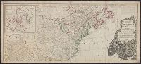
- Beinecke Rare Book and Manuscript Library > A chart of the sea coast of New Found Land, New Scotland, New England, New York, New Jersey, with Virginia and Maryland.
- Creator:
- Wyld, James, 1812-1887
- Published / Created:
- July 16th, 1858.
- Call Number:
- 739 1858
- Container / Volume:
- BRBL_00388
- Image Count:
- 2
- Resource Type:
- Maps, Atlases & Globes
- Subject (Topic):
- Indians--North America, Western--Maps
- Found in:
- Beinecke Rare Book and Manuscript Library > Map of the colony of New Caledonia and the British & American territory west of the Rocky mountains including Vancouvers Island and the gold fields [cartographic material] / by James Wyld, geographer to the Queen & the Prince Consort, Charing Cross East,
- Creator:
- Pownall, Thomas, 1722-1805
- Published / Created:
- March 25th, 1776.
- Call Number:
- 71 1776N
- Container / Volume:
- BRBL_00726
- Image Count:
- 4
- Resource Type:
- Maps, Atlases & Globes
- Subject (Geographic):
- North America--Maps--Early works to
- Found in:
- Beinecke Rare Book and Manuscript Library > A map of the middle British colonies in North America [cartographic material] : First published by Lewis Evans, of Philadelphia, in 1755 ; and since corrected and improved, as also extended, with the addition of New England, and bordering parts of Canada
- Creator:
- Pownall, Thomas, 1722-1805
- Published / Created:
- March 25th, 1776.
- Call Number:
- 71 1776N
- Container / Volume:
- BRBL_00726
- Image Count:
- 1
- Resource Type:
- Maps, Atlases & Globes
- Subject (Geographic):
- North America--Maps--Early works to
- Found in:
- Beinecke Rare Book and Manuscript Library > A map of the middle British colonies in North America [cartographic material] : First published by Lewis Evans, of Philadelphia, in 1755 ; and since corrected and improved, as also extended, with the addition of New England, and bordering parts of Canada
- Creator:
- Vancouver, George, 1757-1798
- Published / Created:
- 1798
- Call Number:
- 845 1798B
- Container / Volume:
- BRBL_00619
- Image Count:
- 1
- Resource Type:
- Maps, Atlases & Globes
- Subject (Geographic):
- Northwest Coast of North America--Maps
- Found in:
- Beinecke Rare Book and Manuscript Library > A chart shewing part of the coast of N.W. America, with the tracks of His Majesty's sloop Discovery and armed tender Chatham / commanded by George Vancouver, esqr. and prepared from the foregoing surveys under his immediate inspection by Lieut. Edwd. Robe
- Creator:
- Popple, Henry, -1743
- Published / Created:
- 1733
- Call Number:
- 89 1720
- Container / Volume:
- BRBL_00697
- Image Count:
- 1
- Resource Type:
- Maps, Atlases & Globes
- Subject (Geographic):
- North America--Maps--Early works to
- Found in:
- Beinecke Rare Book and Manuscript Library > A map of the British Empire in America, with the French and Spanish settlements adjacent thereto / by Henry Popple.
- Creator:
- Dunn, Samuel, d. 1794
- Published / Created:
- Augst. 17th. 1776.
- Call Number:
- 755 1776F
- Container / Volume:
- BRBL_00430
- Image Count:
- 1
- Resource Type:
- Maps, Atlases & Globes
- Subject (Geographic):
- North America--Maps--Early works to
- Found in:
- Beinecke Rare Book and Manuscript Library > A map of the British empire in North America / by Samuel Dunn, mathematician, improved from the surveys of Capt. Carver.
- Creator:
- Overton, Henry, 1675 or 6-1751
- Published / Created:
- [1755?]
- Call Number:
- 755 1756F
- Container / Volume:
- BRBL_00428
- Image Count:
- 1
- Resource Type:
- Maps, Atlases & Globes
- Subject (Geographic):
- North America--Maps--Early works to
- Found in:
- Beinecke Rare Book and Manuscript Library > An accurate map of the British colonies in North America bordering on the river Ohio.