Colton, G. Woolworth (George Woolworth), 1827-1901
Published / Created:
1862
Call Number:
754gme 1860A
Container / Volume:
BRBL_00420
Image Count:
1
Resource Type:
Maps, Atlases & Globes
Alternative Title:
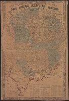
map of Wisconsin, Illinois, Missouri
Description:
"Entered according to Act of Congress by Thayer & Colton in the Clerk's office of the District Court of the United States for the Southern District of New York in t and Does not include northern half of Wisconsin; Appleton is the northernmost town on the map.
Publisher:
Drawn, engraved & published by G. Woolworth Colton; and Rufus Blanchard,