Skip to search
Skip to main content
Skip to first result
Search
You Searched For
Extent of Digitization
Completely digitized
Publication Place
New York :
New Search
Search Results
Published / Created:
[1880?].
Call Number:
75gme 1880R
Container / Volume:
BRBL_00413
Image Count:
1
Resource Type:
Maps, Atlases & Globes
Publisher:
Lith. of F. Michelin & Geo. E. Leefe,
Subject (Geographic):
United States--Maps
Found in:
Beinecke Rare Book and Manuscript Library > Map of Michigan, Southern & Northern Indiana Railroad : with their connections from Council Bluffs to New York.
Creator:
Published / Created:
1912
Call Number:
766 M59 1912
Container / Volume:
BRBL_00469
Image Count:
1
Resource Type:
Maps, Atlases & Globes
Alternative Title:
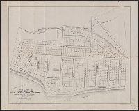
Pond Point, Milford, Conn.
Description:
"Robert A. Welke, photo lith."--Lower margin. and Oriented with north to right.
Publisher:
Yale Land Co.,
Subject (Geographic):
Milford (Conn.)--Maps
Subject (Topic):
Land companies--Maps and Real property--Connecticut--Milford--Maps
Found in:
Beinecke Rare Book and Manuscript Library > Map of Morningside property, Pond Point, Milford, Conn. / Yale Land Co.
Published / Created:
1867
Call Number:
824 1867
Container / Volume:
BRBL_00570
Image Count:
1
Resource Type:
Maps, Atlases & Globes
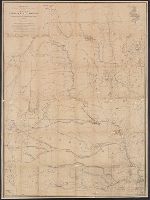
Description:
As of Aug. 12, 1867 under signature of [Merril?], I. Warren, Governeur Kemble, 1830-1882., and Manuscript additions showing Indian reservations.
Publisher:
J. Bien Lith.,
Subject (Geographic):
Nebraska--Maps
Found in:
Beinecke Rare Book and Manuscript Library > Map of Nebraska and Dakota and portions of the states and territories bordering thereon ... by Bv't. Maj. Gen. G.K. Warren, Maj. Eng'rs. March 1967.
Creator:
Published / Created:
1847
Call Number:
76 1847
Container / Volume:
BRBL_00445
Image Count:
1
Resource Type:
Maps, Atlases & Globes
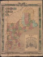
Description:
"Entered according to act of Congress in the year 1847, by Ensigns & Thayer in the Clerk's office, for the Southern District of New York." and Includes portrait of John Hancock in decorative cartouche, ill. in border, and seals of New England states in upper
Publisher:
Ensigns & Thayer,
Subject (Geographic):
New England--Maps
Subject (Name):
Ensigns & Thayer
Found in:
Beinecke Rare Book and Manuscript Library > Map of New England / Lossing-Barritt, sc.
Creator:
Published / Created:
[1855?]
Call Number:
771 N49 1855A
Container / Volume:
BRBL_00486
Image Count:
1
Resource Type:
Maps, Atlases & Globes
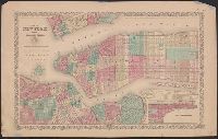
Alternative Title:
New York and the adjacent cities
Description:
"Entered according to act of Congress in the year 1855 ...", In top margin: No. 17 ... No. 18., and Inset map: Continuation of the city & county of New York, on a reduced scale.
Publisher:
J.H. Colton,
Subject (Geographic):
New York (N.Y.)--Maps
Found in:
Beinecke Rare Book and Manuscript Library > Map of New York and the adjacent cities / published by J.H. Colton & Co.
Published / Created:
[1868]
Call Number:
771 N49 1868B
Container / Volume:
BRBL_00487
Image Count:
1
Resource Type:
Maps, Atlases & Globes
Description:
Shows townships, roads, railroads, and radial distances from Manhattan.
Publisher:
Beers, Ellis & Soule,
Subject (Geographic):
New York Region--Maps
Subject (Name):
Beers, Ellis & Soule and Beers, F. W. (Frederick W.). Atlas of New York and vicinity. 1868
Found in:
Beinecke Rare Book and Manuscript Library > Map of New York and vicinity accompanying "Atlas of New York and vicinity." [cartographic material].
Published / Created:
[1868]
Call Number:
771 N49 1868
Container / Volume:
BRBL_00487
Image Count:
1
Resource Type:
Maps, Atlases & Globes
Description:
Shows townships, roads, railroads, and radial distances from Manhattan.
Publisher:
Beers, Ellis & Soule,
Subject (Geographic):
New York Region--Maps
Subject (Name):
Beers, Ellis & Soule and Beers, F. W. (Frederick W.). Atlas of New York and vicinity. 1868
Found in:
Beinecke Rare Book and Manuscript Library > Map of New York and vicinity accompanying "Atlas of New York and vicinity." [cartographic material].
Published / Created:
[1867]
Call Number:
771 N49 1867
Container / Volume:
BRBL_00487
Image Count:
1
Resource Type:
Maps, Atlases & Globes
Description:
Accompanies Atlas of New York and vicinity Shows state and township boundaries, streets, RR and highways; parks and distances from the city hall.
Publisher:
Beers Ellis & Soule,
Subject (Geographic):
New York (N.Y.)--Maps
Found in:
Beinecke Rare Book and Manuscript Library > Map of New York and vicinity, [ect.]
Creator:
Published / Created:
1866
Call Number:
771 N49 1866
Container / Volume:
BRBL_00487
Image Count:
1
Resource Type:
Maps, Atlases & Globes
Description:
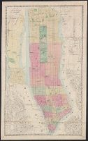
Covers all of Manhattan, also the westernmost parts of Queens and Brooklyn in New York (N.Y.); also part of Jersey City and Hoboken in Hudson County (N.J.) New York (N.Y.) Map shows railroads, shows and names piers. and Hand col.
Publisher:
M. Dripps,
Subject (Geographic):
Hudson County (N.J.), Manhattan (New York, N.Y.)--Maps, and New York (N.Y.)--Maps
Subject (Topic):
Piers--New York (State)--New York--Maps and Railroads--New York (State)--New York--Maps
Found in:
Beinecke Rare Book and Manuscript Library > Map of New York and vicinity.
Creator:
Published / Created:
[ca. 1871].
Call Number:
771 N49 1871D
Container / Volume:
BRBL_00487
Image Count:
1
Resource Type:
Maps, Atlases & Globes
Description:
Imperfect: mutilated, with some loss of and text.
Publisher:
G.W. & C.B. Colton & Co.,
Subject (Geographic):
New York (N.Y.)--Maps
Found in:
Beinecke Rare Book and Manuscript Library > Map of New York, Brooklyn, Jersey City, etc. etc.
Branch:v1.61.8 ,Deployed:2024-06-20T11:15:02-04:00