Search
You Searched For
Search Results
- Call Number:
- 771 W528 1867
- Container / Volume:
- BRBL_00492
- Image Count:
- 1
- Resource Type:
- Maps, Atlases & Globes
- Found in:
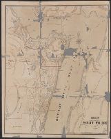
- Beinecke Rare Book and Manuscript Library > Map of West Point.
- Creator:
- Perry, E. W.
- Published / Created:
- 1865
- Call Number:
- Small 837gfc P65 1865
- Image Count:
- 2
- Resource Type:
- Maps, Atlases & Globes
- Found in:
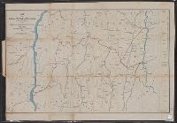
- Beinecke Rare Book and Manuscript Library > Map of mining claims of Pine Wood District, state of Nevada / by E.W. Perry, New York 1865.
- Creator:
- Barnes, Oliver W
- Published / Created:
- 1868
- Call Number:
- 771 1868A
- Container / Volume:
- BRBL_00479
- Image Count:
- 1
- Resource Type:
- Maps, Atlases & Globes
- Found in:
- Beinecke Rare Book and Manuscript Library > Map of portions of New York and New England showing the routes of the Dutchess and Columbia & Connecticut Western Rail Roads / Oliver W. Barnes.
- Published / Created:
- [1834]
- Call Number:
- 771 J222 1834
- Container / Volume:
- BRBL_00483
- Image Count:
- 1
- Resource Type:
- Maps, Atlases & Globes
- Found in:
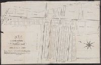
- Beinecke Rare Book and Manuscript Library > Map of property at Jamaica belonging to Abrm. H. Van Wyck.
- Published / Created:
- 1873
- Call Number:
- 771 N49 1873B
- Container / Volume:
- BRBL_00487
- Image Count:
- 2
- Resource Type:
- Maps, Atlases & Globes
- Found in:
- Beinecke Rare Book and Manuscript Library > Map of property containing an area of 473 lots of 2500 square feet each divided into 31 plots situated on the Harlem River Heights ... in the proposed 24th Ward of the City of N.Y. ... / Photo-lith. by J. Bien, N.Y.
- Creator:
- Asher & Adams
- Published / Created:
- [1875]
- Call Number:
- 71 1776E
- Container / Volume:
- BRBL_00687
- Image Count:
- 1
- Resource Type:
- Maps, Atlases & Globes
- Found in:
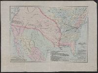
- Beinecke Rare Book and Manuscript Library > Map of the American colonies and adjacent country as known in 1776 / compiled by permission of the American Geographical Society, New York from works in their possession and presented to its patrons by the Baltimore and Ohio Railroad Co. ; drawn, engraved
- Creator:
- Asher & Adams
- Published / Created:
- [1875?]
- Call Number:
- 71 1776F
- Container / Volume:
- BRBL_00365
- Image Count:
- 1
- Resource Type:
- Maps, Atlases & Globes
- Found in:
- Beinecke Rare Book and Manuscript Library > Map of the American colonies and adjacent country as known in 1776 / compiled by permission of the American Geographical Society, New York from works in their possession and presented to its patrons by the Baltimore and Ohio Railroad Co. ; drawn, engraved
- Creator:
- Asher & Adams
- Published / Created:
- [1875]
- Call Number:
- 71 1776E
- Container / Volume:
- BRBL_00365
- Image Count:
- 1
- Resource Type:
- Maps, Atlases & Globes
- Found in:
- Beinecke Rare Book and Manuscript Library > Map of the American colonies and adjacent country as known in 1776 / compiled by permission of the American Geographical Society, New York from works in their possession and presented to its patrons by the Baltimore and Ohio Railroad Co. ; drawn, engraved
- Creator:
- Bellefontaine and Indiana Railroad Company
- Published / Created:
- 1870
- Call Number:
- 754gme 1870
- Container / Volume:
- BRBL_00420
- Image Count:
- 1
- Resource Type:
- Maps, Atlases & Globes
- Found in:
- Beinecke Rare Book and Manuscript Library > Map of the Bellefontaine and Indiana rail road : with connections.
- Published / Created:
- 1884
- Call Number:
- 771 C29 1884
- Container / Volume:
- BRBL_00481
- Image Count:
- 1
- Resource Type:
- Maps, Atlases & Globes
- Found in:
- Beinecke Rare Book and Manuscript Library > Map of the Catskill mountains prepared expressly for the New York, West Shore & Buffalo RR Co 1884.