Skip to search
Skip to main content
Skip to first result
Search
You Searched For
Extent of Digitization
Completely digitized
Publication Place
New York :
New Search
Search Results
Published / Created:
1896
Call Number:
771 C29 1896
Container / Volume:
BRBL_00482
Image Count:
2
Resource Type:
Maps, Atlases & Globes
Description:
Hudson River Division of the West Shore railroad., Index attached., and Text on verso.
Publisher:
New York Central & Hudson River R.R. Co.,
Subject (Geographic):
Catskill Mountains (N.Y.)--Maps
Found in:
Beinecke Rare Book and Manuscript Library > Map of the Catskill mountains prepared expressly for the West Shore Railroad 1896.
Creator:
Published / Created:
1929
Call Number:
923 1929
Container / Volume:
BRBL_00673
Image Count:
1
Resource Type:
Maps, Atlases & Globes
Description:
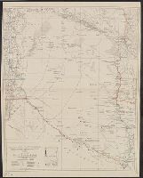
"Contours and altitudes in meters.", Relief shown by contours and spot heights. River depths shown by soundings., and Shows rivers - surveyed and unsurveyed, astronomical points, roads, trails, fortines/[bunkers] (Bolivian, Paraguayan or Argentine), settlements, indian settlements and mission stations.
Publisher:
American Geographical Society of New York,
Subject (Geographic):
Chaco Boreal (Paraguay and Bolivia)--Maps
Subject (Topic):
Chaco War, 1932-1935--Maps
Found in:
Beinecke Rare Book and Manuscript Library > Map of the Chaco Boreal [cartographic material] / compiled by the American Geographical Society of New York.
Published / Created:
1898
Call Number:
806gme C43 1898
Container / Volume:
BRBL_00549
Image Count:
1
Resource Type:
Maps, Atlases & Globes
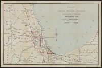
Description:
Company rail lines noted in red.
Publisher:
Bradley & Poates, engrs.,
Subject (Geographic):
Illinois--Maps
Found in:
Beinecke Rare Book and Manuscript Library > Map of the Chicago terminal transfer railroad company : and connecting lines / F.E. Paradis, chief engineer.
Published / Created:
1829
Call Number:
771 C31 1829
Container / Volume:
BRBL_00482
Image Count:
1
Resource Type:
Maps, Atlases & Globes
Description:
From Burr's "Atlas of the State of New York" 1829.
Publisher:
David H. Burr,
Subject (Geographic):
Cayuga County (N.Y)--Maps
Found in:
Beinecke Rare Book and Manuscript Library > Map of the County of Cayuga [N.Y.]
Published / Created:
1829
Call Number:
771 C42 1829
Container / Volume:
BRBL_00482
Image Count:
1
Resource Type:
Maps, Atlases & Globes
Description:
From Burr's "Atlas of the State of New York" 1829.
Publisher:
David H. Burr,
Subject (Geographic):
Chenango County (N.Y.)--Maps
Found in:
Beinecke Rare Book and Manuscript Library > Map of the County of Chenango [N.Y.]
Published / Created:
1829
Call Number:
771 L58 1829
Container / Volume:
BRBL_00483
Image Count:
1
Resource Type:
Maps, Atlases & Globes
Description:
From Burr's "Atlas of the state of New York"
Publisher:
David H. Burr,
Subject (Geographic):
Lewis County (N.Y.)--Maps
Found in:
Beinecke Rare Book and Manuscript Library > Map of the County of Lewis [N.Y.]
Published / Created:
1829
Call Number:
771 M26 1829
Container / Volume:
BRBL_00483
Image Count:
1
Resource Type:
Maps, Atlases & Globes
Description:
From Burr's "Atlas of the state of New York"
Publisher:
David H. Burr,
Subject (Geographic):
Madison County (N.Y.)--Maps
Found in:
Beinecke Rare Book and Manuscript Library > Map of the County of Madison, N.Y.
Published / Created:
1829
Call Number:
771 M766 1829
Container / Volume:
BRBL_00483
Image Count:
1
Resource Type:
Maps, Atlases & Globes
Description:
From Burr's "Atlas of the state of New York"
Publisher:
David H. Burr,
Subject (Geographic):
Montgomery County (N.Y.)--Maps
Found in:
Beinecke Rare Book and Manuscript Library > Map of the County of Montgomery [N.Y.]
Published / Created:
1829
Call Number:
771 On2 1829
Image Count:
1
Resource Type:
Maps, Atlases & Globes
Description:
From Burr's "Atlas of the State of New York" 1829.
Publisher:
David H. Burr,
Subject (Geographic):
Oneida County (N.Y.)--Maps
Found in:
Beinecke Rare Book and Manuscript Library > Map of the County of Oneida [N.Y.].
Published / Created:
1829
Call Number:
771 ON6 1829
Container / Volume:
BRBL_00490
Image Count:
1
Resource Type:
Maps, Atlases & Globes
Description:
From Burr's "Atlas of the State of New York" 1829.
Publisher:
David H. Burr,
Subject (Geographic):
Onondaga County (N.Y.)--Maps--Early works to 1800
Found in:
Beinecke Rare Book and Manuscript Library > Map of the County of Onondaga [N.Y.]
Branch:v1.61.8 ,Deployed:2024-06-20T11:14:46-04:00