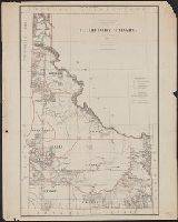
Prime meridians: Washington & Greenwich., Relief shown by hachures., and Shows drainage, county boundaries, railroads, railroad grants, military & Indian reservations, township lines, etc.
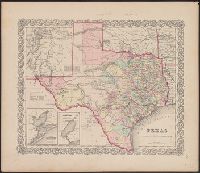
Inset: Plan of the Port of Galveston / made by order of the Mexican government by Alexander Thompson of t and Unlike the later 1835 issue, shows Beals Grant south of Stephen E. Austin's Grant and does not show the towns of Columbia, Electa, Mina, and Augusta.
Publisher:
J.H. Colton & Co.,
Subject (Geographic):
Galveston Bay (Tex.)--Maps and Texas--Maps
Subject (Name):
J.H. Colton & Co, S. Stiles & Co, and Thompson, Alexander
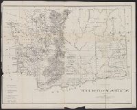
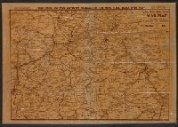
"Entered according to act of Congress in the year 1855 by J.H. Colton & Co. in the clerks office of the district court of the United States for the southern district of New York.", "No. 35.", Prime meridians: Greenwich and Washington., Relief, and Shows counties.
Publisher:
J.H. Colton & Co.,
Subject (Geographic):
Texas--Administrative and political divisions--Maps and Texas--Maps
Subject (Name):
Streeter, Thomas W.--(Thomas Winthrop),--1883-1965--Ownership
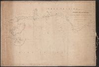
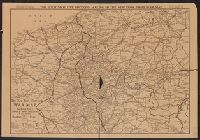
Continuation inset: Central America [12 x 17 cm., scale ca. 1:11,000,000] and Includes time and distance table, list of Presidents, 1860 population statistics, and explanation of British American possessions.
Publisher:
Haasis & Lubrecht,
Subject (Geographic):
North America--Maps and United States--Maps
Subject (Name):
B.B. Russell & Co., publisher, Ch. Lubrecht & Co., publisher, Haasis & Lubrecht, publisher, J. & D. Beatson Co., publisher, and Lubrecht & Co., publisher