Skip to search
Skip to main content
Skip to first result
Search
You Searched For
Date
-
"Missouri"
Genre
Maps
Language
English
Publication Place
New York :
New Search
Search Results
Creator:
Published / Created:
1857
Call Number:
825 1857B
Container / Volume:
BRBL_00573
Image Count:
1
Resource Type:
Maps, Atlases & Globes
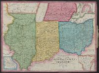
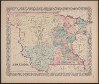
Alternative Title:
Kansas and Nebraska
Description:
Minnesota, Wisconsin, Iowa, Illinois, Missouri
Publisher:
J.G. Wells, 11 Beekman St.,
Subject (Geographic):
Kansas--Maps and West (U.S.)--Maps
Found in:
Beinecke Rare Book and Manuscript Library > Kansas & Nebraska.
Creator:
Published / Created:
1867
Call Number:
816 1867
Container / Volume:
BRBL_00561
Image Count:
1
Resource Type:
Maps, Atlases & Globes
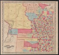
Alternative Title:
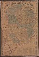
Sectional map of the state of Missouri
Description:
"Entered according to act of Congress in the year 1860 by J.H. Colton in the clerks office of the district court for the southern district of New York." and Relief shown by hachures.
Publisher:
G.W. & C.B. Colton & Co.,
Subject (Geographic):
Missouri --Maps
Subject (Name):
Colton, J. H. (Joseph Hutchins), 1800-1893
Found in:
Beinecke Rare Book and Manuscript Library > Colton's sectional map of the state of Missouri : compiled from the United States surveys & other authentic sources, exhibiting the sections, fractional sections, counties, cities, towns, villages, post offices, rail roads & other internal improvements.
Creator:
Published / Created:
1862
Call Number:
754gme 1860A
Container / Volume:
BRBL_00420
Image Count:
1
Resource Type:
Maps, Atlases & Globes
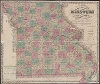
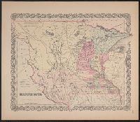
Alternative Title:
map of Wisconsin, Illinois, Missouri
Description:
"Entered according to Act of Congress by Thayer & Colton in the Clerk's office of the District Court of the United States for the Southern District of New York in t and Does not include northern half of Wisconsin; Appleton is the northernmost town on the map.
Publisher:
Drawn, engraved & published by G. Woolworth Colton; and Rufus Blanchard,
Subject (Geographic):
Missouri --Maps
Subject (Name):
Blanchard, Rufus, 1821-1904
Subject (Topic):
Railroads--Missouri --Maps
Found in:
Beinecke Rare Book and Manuscript Library > Colton's county and township rail road map of Wisconsin, Illinois, Missouri, & Iowa / Drawn, engraved & published by G. Woolworth Colton
Creator:
Published / Created:
[1855 or 1856?]
Call Number:
814 1855H
Container / Volume:
BRBL_00557
Image Count:
1
Resource Type:
Maps, Atlases & Globes
Description:
to White Earth and Missouri rivers to the
Publisher:
J. H. Colton & Co.,
Subject (Geographic):
Minnesota--Maps, North Dakota--Maps, and South Dakota--Maps
Found in:
Beinecke Rare Book and Manuscript Library > Minnesota.
Creator:
Published / Created:
[1855 or 1856?]
Call Number:
814 1855F
Container / Volume:
BRBL_00557
Image Count:
1
Resource Type:
Maps, Atlases & Globes
Description:
Chippewa areas, with Missouri River and White
Publisher:
J.H. Colton & Co.,
Subject (Geographic):
Minnesota--Maps, North Dakota--Maps, and South Dakota--Maps
Found in:
Beinecke Rare Book and Manuscript Library > Minnesota.
Branch:v1.61.6 ,Deployed:2024-06-12T09:55:33-04:00