Search
You Searched For
Search Results
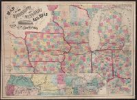
- Creator:
- J.H. Colton & Co.
- Published / Created:
- 1858
- Call Number:
- 754gme 1858
- Container / Volume:
- BRBL_00420
- Image Count:
- 1
- Resource Type:
- Maps, Atlases & Globes
- Found in:
- Beinecke Rare Book and Manuscript Library > Map of the Mississippi and Missouri Railroad : and its connections.
- Published / Created:
- [1857?]
- Call Number:
- 754gme 1857
- Container / Volume:
- BRBL_00419
- Image Count:
- 1
- Resource Type:
- Maps, Atlases & Globes
- Found in:
- Beinecke Rare Book and Manuscript Library > Map showing position of the Lake Erie and Pacific rail road : and its connections / [by] Chas. E. Hore, mechanical and topographical draftsman, 308 Broadway, N.Y.
- Creator:
- Colton, G. Woolworth (George Woolworth), 1827-1901
- Published / Created:
- 1862
- Call Number:
- 754gme 1860A
- Container / Volume:
- BRBL_00420
- Image Count:
- 1
- Resource Type:
- Maps, Atlases & Globes
- Found in:
- Beinecke Rare Book and Manuscript Library > Colton's county and township rail road map of Wisconsin, Illinois, Missouri, & Iowa / Drawn, engraved & published by G. Woolworth Colton
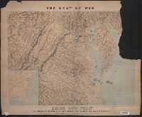
- Creator:
- Schedler, Joseph
- Published / Created:
- c1861.
- Call Number:
- 754hc 1862B
- Container / Volume:
- BRBL_00421
- Image Count:
- 1
- Resource Type:
- Maps, Atlases & Globes
- Found in:
- Beinecke Rare Book and Manuscript Library > The seat of war : birds eye view of Virginia, Maryland, Delaware and the District of Columbia / drawn and engr. by J. Schedler.
- Creator:
- H. H. Lloyd & Co. (New York, N.Y)
- Published / Created:
- 188-.
- Call Number:
- 754gme 1881
- Container / Volume:
- BRBL_00420
- Image Count:
- 1
- Resource Type:
- Maps, Atlases & Globes
- Found in:
- Beinecke Rare Book and Manuscript Library > Map showing the connections of the Illinois Central Railroad : with the railway lines to the Gulf ports.
- Creator:
- E. & G.W. Blunt (Firm)
- Published / Created:
- 1861
- Call Number:
- 754cea 1854
- Container / Volume:
- BRBL_00418
- Image Count:
- 1
- Resource Type:
- Maps, Atlases & Globes
- Found in:
- Beinecke Rare Book and Manuscript Library > The coast of the United States sheet no. 1. : From Point Judith to Cape Lookout, from the U.S. Coast Surveys.
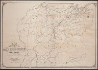
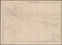
- Creator:
- Steinwehr, A. von (Adolph), 1822-1877
- Published / Created:
- [1855]
- Call Number:
- 754EG 1855
- Container / Volume:
- BRBL_00418
- Image Count:
- 1
- Resource Type:
- Maps, Atlases & Globes
- Found in:
- Beinecke Rare Book and Manuscript Library > Map showing the distribution of slaves in the Southern States / projected & compiled by A. von Steinwehr.
- Published / Created:
- 186-.
- Call Number:
- 754gme 1865
- Container / Volume:
- BRBL_00420
- Image Count:
- 1
- Resource Type:
- Maps, Atlases & Globes
- Found in:
- Beinecke Rare Book and Manuscript Library > Map of the Williamsport and Elmira rail road : with its connections.
- Published / Created:
- 1848
- Call Number:
- 76 1848
- Container / Volume:
- BRBL_00445
- Image Count:
- 1
- Resource Type:
- Maps, Atlases & Globes
- Found in:
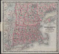
- Beinecke Rare Book and Manuscript Library > Map of Massachusetts, Rhode Island and Connecticut.
- Creator:
- Lossing & Barritt
- Published / Created:
- 1847
- Call Number:
- 76 1847
- Container / Volume:
- BRBL_00445
- Image Count:
- 1
- Resource Type:
- Maps, Atlases & Globes
- Found in:
- Beinecke Rare Book and Manuscript Library > Map of New England / Lossing-Barritt, sc.
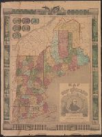
- Creator:
- G.W. & C.B. Colton & Co
- Published / Created:
- 1886
- Call Number:
- 76 1886
- Container / Volume:
- BRBL_00445
- Image Count:
- 1
- Resource Type:
- Maps, Atlases & Globes
- Found in:
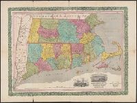
- Beinecke Rare Book and Manuscript Library > Colton's railroad & township map of Massachusetts, Rhode Island and Connecticut : with parts of Maine, New Hampshire, Vermont & New York.
- Creator:
- Ensign, Bridgman & Fanning
- Published / Created:
- 1855
- Call Number:
- 76 1855
- Container / Volume:
- BRBL_00445
- Image Count:
- 1
- Resource Type:
- Maps, Atlases & Globes
- Found in:
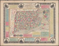
- Beinecke Rare Book and Manuscript Library > Township map of Massachusetts, Connecticut and Rhode Island.
- Creator:
- Ensign, Bridgman & Fanning
- Published / Created:
- 1855
- Call Number:
- 76 1855
- Container / Volume:
- BRBL_00445
- Image Count:
- 1
- Resource Type:
- Maps, Atlases & Globes
- Found in:
- Beinecke Rare Book and Manuscript Library > Township map of Massachusetts, Connecticut and Rhode Island.
- Creator:
- Horace Thayer & Co
- Published / Created:
- 1853
- Call Number:
- 76 1853
- Container / Volume:
- BRBL_00445
- Image Count:
- 1
- Resource Type:
- Maps, Atlases & Globes
- Found in:
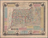
- Beinecke Rare Book and Manuscript Library > Rail-road & township map of Massachusetts, Connecticut and Rhode Island.
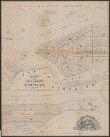
- Published / Created:
- 1858
- Call Number:
- 771 N49 1858A
- Container / Volume:
- BRBL_00486
- Image Count:
- 1
- Resource Type:
- Maps, Atlases & Globes
- Found in:
- Beinecke Rare Book and Manuscript Library > Map of the city & county of New-York.
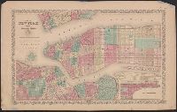
- Published / Created:
- [1868]
- Call Number:
- 771 N49 1868B
- Container / Volume:
- BRBL_00487
- Image Count:
- 1
- Resource Type:
- Maps, Atlases & Globes
- Found in:
- Beinecke Rare Book and Manuscript Library > Map of New York and vicinity accompanying "Atlas of New York and vicinity." [cartographic material].
- Published / Created:
- [1868]
- Call Number:
- 771 N49 1868
- Container / Volume:
- BRBL_00487
- Image Count:
- 1
- Resource Type:
- Maps, Atlases & Globes
- Found in:
- Beinecke Rare Book and Manuscript Library > Map of New York and vicinity accompanying "Atlas of New York and vicinity." [cartographic material].
- Published / Created:
- [1867]
- Call Number:
- 771 N49 1867
- Container / Volume:
- BRBL_00487
- Image Count:
- 1
- Resource Type:
- Maps, Atlases & Globes
- Found in:
- Beinecke Rare Book and Manuscript Library > Map of New York and vicinity, [ect.]
- Creator:
- Miller, James
- Published / Created:
- [1857?]
- Call Number:
- 771 N49 1857A
- Container / Volume:
- BRBL_00486
- Image Count:
- 1
- Resource Type:
- Maps, Atlases & Globes
- Found in:
- Beinecke Rare Book and Manuscript Library > New York city map.
- Creator:
- J.H. Colton & Co
- Published / Created:
- [1855?]
- Call Number:
- 771 N49 1855A
- Container / Volume:
- BRBL_00486
- Image Count:
- 1
- Resource Type:
- Maps, Atlases & Globes
- Found in:
- Beinecke Rare Book and Manuscript Library > Map of New York and the adjacent cities / published by J.H. Colton & Co.
- Published / Created:
- 1833
- Call Number:
- 771 N49 1833
- Container / Volume:
- BRBL_00485
- Image Count:
- 1
- Resource Type:
- Maps, Atlases & Globes
- Found in:
- Beinecke Rare Book and Manuscript Library > City of New York, by David H. Burr.
- Creator:
- G.W. & C.B. Colton & Co
- Published / Created:
- [ca. 1871].
- Call Number:
- 771 N49 1871D
- Container / Volume:
- BRBL_00487
- Image Count:
- 1
- Resource Type:
- Maps, Atlases & Globes
- Found in:
- Beinecke Rare Book and Manuscript Library > Map of New York, Brooklyn, Jersey City, etc. etc.
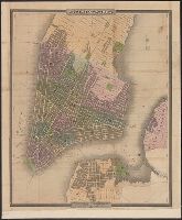
- Creator:
- Dripps, M. (Matthew)
- Published / Created:
- 1866
- Call Number:
- 771 N49 1866
- Container / Volume:
- BRBL_00487
- Image Count:
- 1
- Resource Type:
- Maps, Atlases & Globes
- Found in:
- Beinecke Rare Book and Manuscript Library > Map of New York and vicinity.
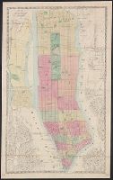
- Creator:
- Dripps, M. (Matthew)
- Published / Created:
- 1858
- Call Number:
- 771 N49 1858
- Container / Volume:
- BRBL_00486
- Image Count:
- 1
- Resource Type:
- Maps, Atlases & Globes
- Found in:
- Beinecke Rare Book and Manuscript Library > Topographical map of the cities of New York, Brooklyn, Jersey City & Hoboken.
- Published / Created:
- 1829
- Call Number:
- 771 L58 1829
- Container / Volume:
- BRBL_00483
- Image Count:
- 1
- Resource Type:
- Maps, Atlases & Globes
- Found in:
- Beinecke Rare Book and Manuscript Library > Map of the County of Lewis [N.Y.]
- Published / Created:
- 1863
- Call Number:
- 774hc G33 1863D
- Container / Volume:
- BRBL_00502
- Image Count:
- 1
- Resource Type:
- Maps, Atlases & Globes
- Found in:
- Beinecke Rare Book and Manuscript Library > Field of Gettysburg, July 1st, 2nd & 3rd, 1863 / Prepared by T. Ditterline.
- Creator:
- H.H. Lloyd & Co
- Published / Created:
- 1861
- Call Number:
- 777hc 1861
- Container / Volume:
- BRBL_00504A
- Image Count:
- 1
- Resource Type:
- Maps, Atlases & Globes
- Found in:
- Beinecke Rare Book and Manuscript Library > Lloyd's military maps : showing the principal places of interest / compiled from official data by Egbert L. Viele and Charles Haskins.
- Published / Created:
- 1795
- Call Number:
- 777 1795A
- Container / Volume:
- BRBL_00503
- Image Count:
- 1
- Resource Type:
- Maps, Atlases & Globes
- Found in:
- Beinecke Rare Book and Manuscript Library > The States of Maryland and Delaware from the latest Surveys.
- Creator:
- Colton, J. H. (Joseph Hutchins), 1800-1893
- Published / Created:
- 1857
- Call Number:
- 783 1857
- Container / Volume:
- BRBL_00508
- Image Count:
- 1
- Resource Type:
- Maps, Atlases & Globes
- Found in:
- Beinecke Rare Book and Manuscript Library > Virginia.
- Published / Created:
- 1796
- Call Number:
- 783 1796A
- Container / Volume:
- BRBL_00507
- Image Count:
- 1
- Resource Type:
- Maps, Atlases & Globes
- Found in:
- Beinecke Rare Book and Manuscript Library > The State of Virginia from the best Authorities.
- Creator:
- Lloyd, James T
- Published / Created:
- 1861
- Call Number:
- 783 1861L
- Container / Volume:
- BRBL_00508
- Image Count:
- 1
- Resource Type:
- Maps, Atlases & Globes
- Found in:
- Beinecke Rare Book and Manuscript Library > Lloyd's official map of the state of Virginia : from actual surveys by order of the Executive, 1828 & 1859 / corrected and revised by J.T. Lloyd to 1861.
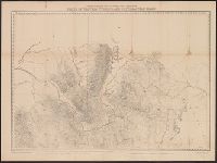
- Creator:
- Geological and Geographical Survey of the Territories (U.S.)
- Published / Created:
- [1878?]
- Call Number:
- 833 1878A
- Container / Volume:
- BRBL_00584
- Image Count:
- 1
- Resource Type:
- Maps, Atlases & Globes
- Found in:
- Beinecke Rare Book and Manuscript Library > Part of central Wyoming / U.S. Geological and Geographical Survey of the Territories ; F.V. Hayden, U.S. geologist in charge ; George B. Chittenden topographical assistant.
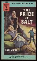
- Creator:
- Morgan, Claire, 1921-1995
- Published / Created:
- 1953, c1952.
- Call Number:
- Zab H5375 952Pb
- Image Count:
- 1
- Found in:
- Beinecke Rare Book and Manuscript Library > The price of salt / by Claire Morgan.
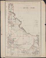
- Creator:
- United States. General Land Office
- Published / Created:
- 1879
- Call Number:
- 832 1879
- Container / Volume:
- BRBL_00582
- Image Count:
- 1
- Resource Type:
- Maps, Atlases & Globes
- Found in:
- Beinecke Rare Book and Manuscript Library > Territory of Idaho : 1879 / compiled from the official records of the General Land Office and other sources by C. Roeser.
- Creator:
- Geological and Geographical Survey of the Territories (U.S.)
- Published / Created:
- [1878]
- Call Number:
- 833 1878
- Container / Volume:
- BRBL_00584
- Image Count:
- 1
- Resource Type:
- Maps, Atlases & Globes
- Found in:
- Beinecke Rare Book and Manuscript Library > Parts of western Wyoming and southeastern Idaho / U.S. Geological and Geographical Survey of the Territories ; F.V. Hayden, U.S. geologist in charge ; G.R. Bechler and Fred A. Clark, topographical assistants.
- Creator:
- Kibbe, A. F
- Published / Created:
- 1881
- Call Number:
- 834 1881A
- Container / Volume:
- BRBL_00587
- Image Count:
- 1
- Resource Type:
- Maps, Atlases & Globes
- Found in:
- Beinecke Rare Book and Manuscript Library > Kibbe's geographical and geological map of the San Juan Mining Region, Colorado / A.F. Kibbe.
- Creator:
- Hollister, Ovando James, 1834-1892
- Published / Created:
- 1866
- Call Number:
- 834 1866
- Container / Volume:
- BRBL_00587
- Image Count:
- 1
- Resource Type:
- Maps, Atlases & Globes
- Found in:
- Beinecke Rare Book and Manuscript Library > Map of Colorado Territory to accompany Hollisters "Mines of Colorado" corrected from the Public Surveys of 1866.
- Creator:
- United States. General Land Office
- Published / Created:
- 1885
- Call Number:
- 834 1885
- Container / Volume:
- BRBL_00587
- Image Count:
- 1
- Resource Type:
- Maps, Atlases & Globes
- Found in:
- Beinecke Rare Book and Manuscript Library > State of Colorado : compiled from the official records of the General Land Office and other sources / under the supervision of G.P. Strum, principal draughtsman G.L.O.
- Creator:
- Roeser, C. (Charles)
- Published / Created:
- 1879
- Call Number:
- 834 1879A
- Container / Volume:
- BRBL_00587
- Image Count:
- 1
- Resource Type:
- Maps, Atlases & Globes
- Found in:
- Beinecke Rare Book and Manuscript Library > State of Colorado : compiled from the official records of the General Land Office and other sources / by C. Roeser, principal draughtsman G.L.O.
- Published / Created:
- 1823
- Call Number:
- 85 1492
- Container / Volume:
- BRBL_00636
- Image Count:
- 1
- Resource Type:
- Maps, Atlases & Globes
- Found in:
- Beinecke Rare Book and Manuscript Library > Map of The Route of Colombus on arriving among the Bahama Islands. Plan by D.G. Johnson
- Published / Created:
- 1823
- Call Number:
- 85 1492
- Container / Volume:
- BRBL_00636
- Image Count:
- 1
- Resource Type:
- Maps, Atlases & Globes
- Found in:
- Beinecke Rare Book and Manuscript Library > Map of The Route of Colombus on arriving among the Bahama Islands. Plan by D.G. Johnson
- Creator:
- Watson, Walter, civil engineer
- Published / Created:
- [1896].
- Call Number:
- 764 B45 1896
- Container / Volume:
- BRBL_00454
- Image Count:
- 1
- Resource Type:
- Maps, Atlases & Globes
- Found in:
- Beinecke Rare Book and Manuscript Library > Railway and highway map of the famous Berkshire Hills region, showing also villages and points of interest : from official records and other information / by Walter Watson, C.E. for the Berkshire Life Insurance Co. of Pittsfield, Mass., 1883 (Corrected 18
- Creator:
- C.S. Hammond & Company
- Published / Created:
- c1916.
- Call Number:
- 766gmb 1916H
- Container / Volume:
- BRBL_00475
- Image Count:
- 1
- Resource Type:
- Maps, Atlases & Globes
- Found in:
- Beinecke Rare Book and Manuscript Library > Hammond's new road map of Connecticut (Eastern part) / based on the surveys of the United States Geological Survey, United States Coast and Geodetic Survey and the various local surveys, revised and corrected ... C.S. Hammond & Company.
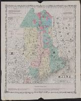
- Published / Created:
- 1860
- Call Number:
- 761gme 1860
- Container / Volume:
- BRBL_00449
- Image Count:
- 1
- Resource Type:
- Maps, Atlases & Globes
- Found in:
- Beinecke Rare Book and Manuscript Library > Map of the Eastern part of Maine : showing the settling land in Piscataquis and Aroostook counties with the proposed lines of rail roads to promote the sale and settlement of public lands & land owned by individuals, also rail road communication with the
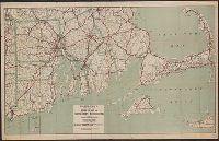
- Creator:
- C.S. Hammond & Company
- Published / Created:
- [1917].
- Call Number:
- 76gmb 1917
- Container / Volume:
- BRBL_00446
- Image Count:
- 1
- Resource Type:
- Maps, Atlases & Globes
- Found in:
- Beinecke Rare Book and Manuscript Library > Hammond's new road map of Rhode Island and southeastern Massachusetts.
- Published / Created:
- 1908
- Call Number:
- 763gmb 1908
- Container / Volume:
- BRBL_00452
- Image Count:
- 1
- Resource Type:
- Maps, Atlases & Globes
- Found in:
- Beinecke Rare Book and Manuscript Library > Automobile map of Vermont, South.
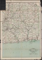
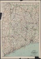
- Creator:
- C.S. Hammond & Company
- Published / Created:
- 1916
- Call Number:
- 766gmb 1916H
- Container / Volume:
- BRBL_00475
- Image Count:
- 1
- Resource Type:
- Maps, Atlases & Globes
- Found in:
- Beinecke Rare Book and Manuscript Library > Hammond's new road map of Connecticut (Western part) / based on the surveys of the United States Geological Survey, United States Coast and Geodetic Survey and the various local surveys, revised and corrected ... C.S. Hammond & Company.
- Published / Created:
- 1908
- Call Number:
- 754gme 1908
- Container / Volume:
- BRBL_00420
- Image Count:
- 1
- Resource Type:
- Maps, Atlases & Globes
- Found in:
- Beinecke Rare Book and Manuscript Library > Erie Railroad with branches and connections / Office of Chief Engineer.
- Published / Created:
- 1847
- Call Number:
- 88 M57 1847A
- Container / Volume:
- BRBL_00647
- Image Count:
- 1
- Resource Type:
- Maps, Atlases & Globes
- Found in:
- Beinecke Rare Book and Manuscript Library > Map of the Valley of Mexico and the surrounding mountains.
- Published / Created:
- [1894?]
- Call Number:
- BrSides Double Folio 2018 93
- Image Count:
- 1
- Resource Type:
- Maps, Atlases & Globes
- Found in:
- Beinecke Rare Book and Manuscript Library > Chart of the world showing distances saved by the interoceanic canal of Nicaragua and Costa Rica [cartographic material].