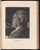
"This edition consists of 160 copies of which this is number 160.", Bookplate of the Meriden Gravure Company. Number "Out of Edition". Manuscript note of E. H. Hugo on limitation leaf. From the collection of the Meriden-Stinehour Press., and Printed on one side of leaf on opposite pages.
Publisher:
Huntington Press,
Subject (Name):
Hugo, Harold--Autograph, Hugo, Harold--Ms. notes, Martin, John K.--Bookplate, Meriden Gravure Company Bookplate, Meriden-Stinehour Press Ownership, and Stikeman & Co, binder
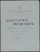
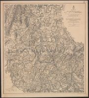
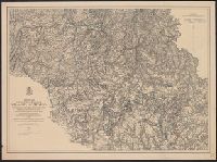
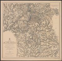
Preliminary agricultural map of Colville region, Washington Terr., Preliminary agricultural map of Yakima Region., and Soils of the Yakima and Colville regions.
Description:
Accompanied by text: Soils of the Yakima and Colville regions (1 leaf ; 61 cm.), Cover title., Preliminary agricultural map of Yakima Region -- Preliminary agricultural map of Colville region, Washington Terr., Raphael Pumpelly, director., and Relief shown by contours, spot heights, and hachures.
Publisher:
Julius Bien & Co.,
Subject (Name):
Hilgard, Eugene W. (Eugene Woldemar), 1833-1916, Julius Bien & Co, and Pumpelly, Raphael, 1837-1923
Map II. This map includes the region from Resaca on the north to Ackworth [sic] on the south and exhibits the works of the United States and Confederate forces (1864).
Map III. This map includes the region extending from Rome, Kingston, and Cassville on the north to include Dallas and Marietta on the south and exhibits the works of the United States and Confederate forces (1864)
Map IV. Embracing the region from Pine, Lost, and Kennesaw Mountains south to include Atlanta and its environs, exhibiting the lines of operations at Pine, Lost, and Kennesaw Mts., at Smyrna Camp Ground a and Ms. notations in blue and red pencil.
Map V. This map includes the region from the Chattahoochee River south to Jonesboro and Lovejoy's Station and exhibits the works of the United States and Confederate forces (1877). and MS. notations in blue and red pencil.