Search
You Searched For
Search Results
- Published / Created:
- [1831?]
- Call Number:
- 811 1831
- Container / Volume:
- BRBL_00552
- Image Count:
- 1
- Resource Type:
- Maps, Atlases & Globes
- Subject (Geographic):
- Michigan--Maps
- Found in:
- Beinecke Rare Book and Manuscript Library > Michigan.
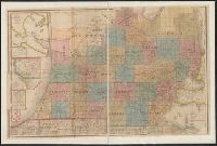
- Published / Created:
- 1844
- Call Number:
- 755 1844
- Container / Volume:
- BRBL_00441
- Image Count:
- 1
- Resource Type:
- Maps, Atlases & Globes
- Description:
- the printed maps of Michigan, 1804-1880
- Found in:
- Beinecke Rare Book and Manuscript Library > Guide through Ohio, Michigan, Indiana, Illinois, Missouri, Wisconsin & Iowa by J. Calvin Smith ...
- Published / Created:
- 1843
- Call Number:
- 811 1843
- Container / Volume:
- BRBL_00552
- Image Count:
- 1
- Resource Type:
- Maps, Atlases & Globes
- Subject (Geographic):
- Michigan--Maps
- Found in:
- Beinecke Rare Book and Manuscript Library > Traveller's map of Michigan, Indiana & Ohio.
- Published / Created:
- 1837
- Call Number:
- 811 1837
- Container / Volume:
- BRBL_00552
- Image Count:
- 1
- Resource Type:
- Maps, Atlases & Globes
- Subject (Geographic):
- Michigan--Maps
- Found in:
- Beinecke Rare Book and Manuscript Library > The Surveyed Part of Michigan by John Farmer.
- Published / Created:
- 1836
- Call Number:
- 811 1836
- Container / Volume:
- BRBL_00552
- Image Count:
- 1
- Resource Type:
- Maps, Atlases & Globes
- Subject (Geographic):
- Michigan--Maps
- Found in:
- Beinecke Rare Book and Manuscript Library > An improved edition of a map of the survryed part of the Territory of Michigan. by John Farmer
- Published / Created:
- 1858
- Call Number:
- 811cea Sa245 1858A
- Container / Volume:
- BRBL_00554
- Image Count:
- 1
- Resource Type:
- Maps, Atlases & Globes
- Subject (Geographic):
- Michigan--Maps
- Found in:
- Beinecke Rare Book and Manuscript Library > Chart of East Neebish rapids, River St. Mary : showing the improved west channel, dredged and surveyed in 1858 under the direction of Capt. A.W. Whipple, T.E. / J.H. Foster U.S. Sub. Agt., James T. Foster, draughtsman.
- Published / Created:
- 1832
- Call Number:
- 75 1832P
- Container / Volume:
- BRBL_00398
- Image Count:
- 1
- Resource Type:
- Maps, Atlases & Globes
- Description:
- boundary before settlement of 1842; Michigan e
- Found in:
- Beinecke Rare Book and Manuscript Library > Map of the United States.
- Creator:
- Colton, J. H. (Joseph Hutchins), 1800-1893
- Published / Created:
- 1868
- Call Number:
- 805 1868
- Container / Volume:
- BRBL_00546
- Image Count:
- 1
- Resource Type:
- Maps, Atlases & Globes
- Subject (Geographic):
- Michigan--Maps
- Found in:
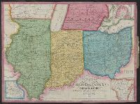
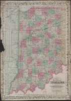
- Beinecke Rare Book and Manuscript Library > Colton's map of the state of Indiana : compiled from the United States surveys and other authentic sources. Exhibiting sections, fractional sections, railroads, canals, etc.
- Creator:
- Atwood, John M., b. ca. 1818
- Published / Created:
- 1848
- Call Number:
- 80 1848C
- Container / Volume:
- BRBL_00533
- Image Count:
- 1
- Resource Type:
- Maps, Atlases & Globes
- Alternative Title:
- through the states of Ohio, Michigan, Indiana
- Description:
- , Michigan, Indiana, Illinois, Missouri, Iowa
- Found in:
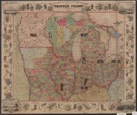
- Beinecke Rare Book and Manuscript Library > Map of the western states / drawn & engraved by J.M. Atwood.
- Published / Created:
- [1843?]
- Call Number:
- 755 1843A
- Container / Volume:
- BRBL_00441
- Image Count:
- 1
- Resource Type:
- Maps, Atlases & Globes
- Found in:
- Beinecke Rare Book and Manuscript Library > Map exhibiting the country between Lakes Michigan and Erie and the contested boundary lines.