Search
You Searched For
Search Results
- Creator:
- Canada. Dept. of the Interior
- Published / Created:
- [1914?]
- Call Number:
- 737 C88 1914
- Container / Volume:
- BRBL_00385
- Image Count:
- 5
- Resource Type:
- Maps, Atlases & Globes
- Found in:
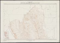
- Beinecke Rare Book and Manuscript Library > Map of Crowsnest Forest and Waterton Lakes Park, Rocky Mountains Forest Reserve / drawn and printed at the Surveyor General's Office.
- Creator:
- Canada. Natural Resources Intelligence Branch
- Published / Created:
- [1922]
- Call Number:
- 735gb 1922
- Container / Volume:
- BRBL_00382
- Image Count:
- 1
- Resource Type:
- Maps, Atlases & Globes
- Found in:
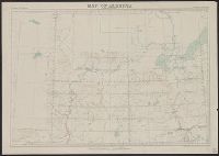
- Beinecke Rare Book and Manuscript Library > Map of Algoma district, Ontario, showing natural resources / prepared in the Natural Resources Intelligence Branch, Department of the Interior.
- Creator:
- Canada. Dept. of the Interior
- Published / Created:
- 1886
- Call Number:
- 74FBC 1886
- Container / Volume:
- BRBL_00394
- Image Count:
- 1
- Resource Type:
- Maps, Atlases & Globes
- Found in:
- Beinecke Rare Book and Manuscript Library > Map shewing mounted police stations & patrols throughout the North-West Territories : during the year 1886 / compiled, drawn and published under the superintendence of J. Johnston, chief draftsman, Department of the Interior.
- Creator:
- Canada Dept. of Mines
- Published / Created:
- 1918
- Call Number:
- 733 Sa232 1918
- Container / Volume:
- BRBL_00379
- Image Count:
- 1
- Resource Type:
- Maps, Atlases & Globes
- Found in:
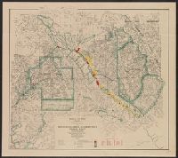
- Beinecke Rare Book and Manuscript Library > St. John : St. John and Kings Counties New Brunswick. Map 164A (issued 1918) / Canada, Dept. of Mines, Geological Survey.
- Creator:
- Canada. Natural Resources Intelligence Branch
- Published / Created:
- [1917]
- Call Number:
- 73gr 1917
- Container / Volume:
- BRBL_00376
- Image Count:
- 1
- Resource Type:
- Maps, Atlases & Globes
- Found in:
- Beinecke Rare Book and Manuscript Library > Map showing branches of chartered banks in Manitoba, Saskatchewan and Alberta.
- Creator:
- Canada. Natural Resources Intelligence Branch
- Published / Created:
- 1921
- Call Number:
- 733gb 1921
- Container / Volume:
- BRBL_00379
- Image Count:
- 1
- Resource Type:
- Maps, Atlases & Globes
- Found in:
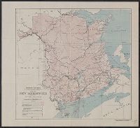
- Beinecke Rare Book and Manuscript Library > Map of New Brunswick, indicating natural resources / prepared in the Natural Resources Intelligence Branch.
- Creator:
- Canada. Dept. of the Interior
- Published / Created:
- 1913
- Call Number:
- 739gme 1913
- Container / Volume:
- BRBL_00393
- Image Count:
- 4
- Resource Type:
- Maps, Atlases & Globes
- Found in:
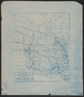
- Beinecke Rare Book and Manuscript Library > British Columbia railway belt : map showing disposition of Lands / prepared under the direction of F.C.C. Lynch, Superintendent of Railway Lands.
- Creator:
- Canada. Mapping and Charting Establishment
- Published / Created:
- c1979.
- Call Number:
- 738 R26 1977B
- Container / Volume:
- BRBL_00387
- Image Count:
- 2
- Resource Type:
- Maps, Atlases & Globes
- Found in:
- Beinecke Rare Book and Manuscript Library > Regina, military city map = Carte militaire de la ville [map] / produced by the Mapping and Charting Establishment, Department of National Defence, Canada.
- Creator:
- Topographical Survey of Canada
- Published / Created:
- 1923-1928.
- Call Number:
- 737 1928A
- Container / Volume:
- BRBL_00384
- Image Count:
- 3
- Resource Type:
- Maps, Atlases & Globes
- Found in:
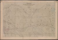
- Beinecke Rare Book and Manuscript Library > Map of Alberta : showing elevations.
- Creator:
- Canada. Topographical Surveys Branch
- Published / Created:
- [1920?]
- Call Number:
- 73fcm 1920
- Container / Volume:
- BRBL_00375B
- Image Count:
- 1
- Resource Type:
- Maps, Atlases & Globes
- Found in:
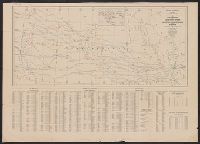
- Beinecke Rare Book and Manuscript Library > Index to townships in Manitoba, Saskatchewan, Alberta and British Columbia : showing the townships for which official and preliminary plans have been issued up to January 1, 1920.