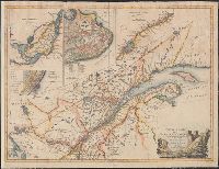
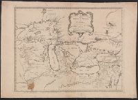
Insets: Isle Montreal -- Plan de Quebec -- Fleuve St. Laurent, depuis la Valterie a Quebec -- Plan de Montreal ou Villemarie., Prime meridian: London., Relief shown pictorially., and Stamped on verso: Yale University Library, Karpinski-Von Wieser Map Collection.
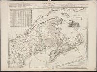
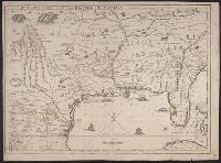
Covers Great Lakes region, extending as far southeast as Delaware Bay and Upper Chesapeake Bay., Mounted on linen. Stamp: Thorne Collection of Cartography and Geography. Stamp: Karpinski-von Wieser Map Collection., Prime meridian: Ferro., and Relief shown pictorially.
Publisher:
Chez R.J. Julien a l'Hôtel Soubise,
Subject (Geographic):
Canada--Maps--Early works to 1800, Great Lakes (North America)--Maps--Early works to 1800, and New France--Maps--Early works to 1800
Subject (Name):
Julien, R. J. (Roche Joseph) and Thorne Collection of Cartogaphy and Geography Stamp