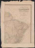
"Dédiée à l'Académie des sciences de l'Institut de France.", Includes inset maps: Archipel des Îles Gallapagos -- [Île Pierre Ier.] -- [Île Alexandre Ier.] -- [Penedo de S. Pedro ou S. Paul] -- [Î. de la Trinité] -- Archipels des Îles Shetland et des Orcades méridionales -- Terres antarctiques au sud-est de l'Amérique., Principal meridian: Paris., and Relief shown by hachures.
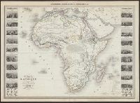
"Les illustrations dessinées par A. Testard et gravées par Guesnu"., "Pl. 13." in upper right corner., Illustrations and text in left and right margins., Printed in upper margin "Géographie Commerciale et Industrielle"., and Shows borders in colored lines, vil
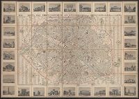
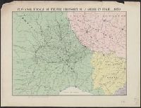
In bottom margin: "29 Avril. - Les troupes Autrichiennes entrent sur le territoire Piémontais ; 20 Mai. Victoire remportée a Montebello par l'armée Franco-Sarde."
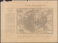
Atlas universel plan de Melbourne (Australie) and Melbourne (Australie)
Description:
"Atlas universal, Fayard Frères, editeurs, 78, Boul. St. Michel, Paris.", At head of title: Atlas universel., Coordinates not on map and are approximated., From Arthème Fayard's Atlas universal (1877)., Pages 565/566 of atlas pasted to verso., and Street map of Melbourne showing the inner suburbs of Melbourne from Northcote in the north to Brighton in the south including parks, railways and gardens.
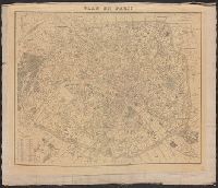
"Impie. E. Dufrénoy.", Cover and, Date of publication from cover., Front free pastedown inscribed "Greenough, Paris, July 28th, 1881.", Includes "Liste alphabetique des rues de Paris (44, 4 p.)., Includes table listing arrondissements., and Relief not shown.