Skip to search
Skip to main content
Skip to first result
Search
You Searched For
Extent of Digitization
Completely digitized
Format
cartographic
Language
English
Publication Place
Philadelphia :
New Search
Search Results
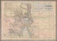
Creator:
Published / Created:
1865, c1862
Call Number:
834 1865
Container / Volume:
BRBL_00587
Image Count:
1
Resource Type:
Maps, Atlases & Globes
Description:
Relief shown by hachures.
Publisher:
Jacob Monk,
Subject (Geographic):
Colorado--Maps
Subject (Name):
Monk, Jacob
Found in:
Beinecke Rare Book and Manuscript Library > Map of Colorado territory, shewing the system of parks / drawn by Frederick J. Ebert.
Creator:
Published / Created:
[1892?]
Call Number:
783 EL48 1890
Container / Volume:
BRBL_00510
Image Count:
1
Resource Type:
Maps, Atlases & Globes
Description:
Oriented with north to the upper right.
Publisher:
E.W. Smith & Co., Map Establishment, 17 & 19 South 6th St.,
Subject (Geographic):
Hampton (Va.)--19th century--Maps
Subject (Name):
E.W. Smith & Co, Hubbard, C., surveyor, and Ivy, Wm
Found in:
Beinecke Rare Book and Manuscript Library > Map of Elizabeth City Co., Va. : from actual surveys by E.A. Semple, Wm. Ivy and C. Hubbard / compiled and platted by E.A. Semple, civil engineer and county surveyor.
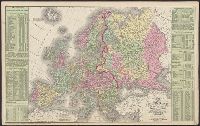
Creator:
Published / Created:
1854
Call Number:
30 1854
Container / Volume:
BRBL_00032
Image Count:
1
Resource Type:
Maps, Atlases & Globes
Alternative Title:
Europe
Description:
Index., Information provided on the European population., Prime meridians: Greenwich, Washington., Relief shown by hachures., and Scale: "164 miles to an inch or 1/10,400,000 of nature."
Publisher:
Cowperthwait, Desilver & Butler,
Subject (Geographic):
Europe--Maps
Found in:
Beinecke Rare Book and Manuscript Library > Map of Europe : compiled from the latest authorities / by J.H. Young.
Creator:
Published / Created:
1856
Call Number:
804 F854 1856
Container / Volume:
BRBL_00544
Image Count:
4
Resource Type:
Maps, Atlases & Globes
Alternative Title:
Map of Franklin County, Ohio
Description:
Includes illustrations of notable buildings, a list of the faculty of Starling Medical College, a Columbus business directory, statistics of Franklin Co, for 1855. and Insets: Map of the city of Columbus, Ohio -- Grove City, Jackson Tp. -- Hilliard -- North C
Publisher:
R.C. Foote Jr.,
Subject (Geographic):
Columbus (Ohio)--Maps and Franklin County (Ohio)--Maps
Subject (Name):
Foote, R. C., publisher
Found in:
Beinecke Rare Book and Manuscript Library > Map of Franklin Co. Ohio : from actual survey & records / by John Graham Esq., Surveyor & Civil Engineer, Columbus, O.
Published / Created:
1818
Call Number:
774 H92 1818
Container / Volume:
BRBL_00499
Image Count:
1
Resource Type:
Maps, Atlases & Globes
Description:
Engraved by Sam Harrison. and Tables of Huntingdon County data.
Publisher:
John Melish & Sam Harrison,
Subject (Geographic):
Huntingdon County (Pa.)--Maps
Found in:
Beinecke Rare Book and Manuscript Library > Map of Huntingdon County ... by John Morrison.
Published / Created:
1833
Call Number:
755 1833
Container / Volume:
BRBL_00440
Image Count:
1
Resource Type:
Maps, Atlases & Globes
Description:
Preliminary record.
Publisher:
S. Augustus Mitchell,
Subject (Geographic):
East (U.S.)--Maps
Found in:
Beinecke Rare Book and Manuscript Library > Map of Louisiana, Mississippi and Alabama, constructed from the latest authorities.
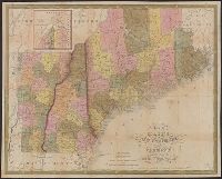
Creator:
Published / Created:
1831
Call Number:
76 1831A
Container / Volume:
BRBL_00444
Image Count:
1
Resource Type:
Maps, Atlases & Globes
Alternative Title:
Maine, New Hampshire & Vermont
Description:
"J.H. Young Sc.", Hand col. Sheet measures 43 x 55.5 cm., Includes statistical table and inset of northern Maine., Prime meridian: Washington., and Relief shown by hachures.
Publisher:
S.A. Mitchell,
Subject (Geographic):
Maine--Maps, New Hampshire--Maps, and Vermont--Maps
Subject (Name):
Young, J. H. (James Hamilton)
Found in:
Beinecke Rare Book and Manuscript Library > Map of Maine, New Hampshire, and Vermont / compiled from the latest authorities.
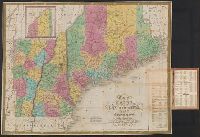
Creator:
Published / Created:
1847
Call Number:
76 1847A
Container / Volume:
BRBL_00445
Image Count:
1
Resource Type:
Maps, Atlases & Globes
Description:
Col. Sheet measures 45 x 56 cm. and Continuation inset: Northern part of Maine [10 x 10 cm.].
Publisher:
S.A. Mitchell,
Subject (Geographic):
Maine--Maps, New England--Maps, New Hampshire--Maps, and Vermont--Maps
Subject (Name):
Thomas, Cowperthwait & Co., bookseller and Young, J. H. (James Hamilton)
Found in:
Beinecke Rare Book and Manuscript Library > Map of Maine, New Hampshire, and Vermont : compiled from the latest authorities / published by S. Augustus Mitchell ; J.H. Young Sc. ; sold by Thomas, Cowperthwait & Co.
Published / Created:
1834
Call Number:
76 1834M
Container / Volume:
BRBL_00444
Image Count:
1
Resource Type:
Maps, Atlases & Globes
Description:
Censusu of 1820 and 1830 on insude cover., Engraving tinted to show counties, proposed canals, and existing canals. Roads., and Inset: North part of Maine.
Publisher:
S. Augustus Mitchell,
Subject (Geographic):
New England--Maps
Found in:
Beinecke Rare Book and Manuscript Library > Map of Maine, New Hampshire, and Vermont, compiled from the latest authorities.
Published / Created:
1831
Call Number:
76 1831
Container / Volume:
BRBL_00444
Image Count:
1
Resource Type:
Maps, Atlases & Globes
Description:
J.H. Young sc.
Publisher:
S. Augustus Mitchell,
Subject (Geographic):
New England--Maps
Found in:
Beinecke Rare Book and Manuscript Library > Map of Maine, New Hampshire, and Vermont, compiled from the latest authorities.
Branch:v1.61.8 ,Deployed:2024-06-20T11:14:55-04:00