Search
You Searched For
Search Results
- Published / Created:
- 1870
- Call Number:
- 774 1870H
- Container / Volume:
- BRBL_00730
- Image Count:
- 4
- Resource Type:
- Maps, Atlases & Globes
- Found in:
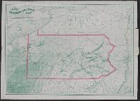
- Beinecke Rare Book and Manuscript Library > A map of the province of Pennsilvania ... / by Thomas Holme ...
- Creator:
- Tanner, Henry Schenck, 1786-1858
- Published / Created:
- [1822 or 1823]
- Call Number:
- 71 1822
- Container / Volume:
- BRBL_00369
- Image Count:
- 4
- Resource Type:
- Maps, Atlases & Globes
- Found in:
- Beinecke Rare Book and Manuscript Library > A map of North America : constructed according to the latest information / engraved & published by H.S. Tanner, Philadelphia 1822.
- Creator:
- Beers, S. N
- Published / Created:
- 1859
- Call Number:
- 771 On8 1859
- Container / Volume:
- BRBL_00490
- Image Count:
- 4
- Resource Type:
- Maps, Atlases & Globes
- Found in:
- Beinecke Rare Book and Manuscript Library > Map of Ontario County, New York : from actual surveys / by S.N. Beers, assisted by D.G. Beers.
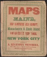
- Published / Created:
- 1846
- Call Number:
- 76 1846A
- Container / Volume:
- BRBL_00445
- Image Count:
- 7
- Resource Type:
- Maps, Atlases & Globes
- Found in:
- Beinecke Rare Book and Manuscript Library > Maps of Maine, New Hampshire and Vermont, Massachusetts & Rhode Island, Connecticut, New York and New York City.
- Published / Created:
- 1816
- Call Number:
- 755 1816
- Container / Volume:
- BRBL_00439
- Image Count:
- 1
- Resource Type:
- Maps, Atlases & Globes
- Found in:
- Beinecke Rare Book and Manuscript Library > Northern Section of the United States including Canada, etc., by John Melish. Second edition with Additions and improvements.
- Published / Created:
- [1820?]
- Call Number:
- 755 1820
- Container / Volume:
- BRBL_00439
- Image Count:
- 1
- Resource Type:
- Maps, Atlases & Globes
- Found in:
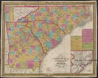
- Beinecke Rare Book and Manuscript Library > Map of North and South Carolina and Georgia, constructed from the latest authorities.
- Published / Created:
- 1837
- Call Number:
- 773 1837
- Container / Volume:
- BRBL_00495
- Image Count:
- 1
- Resource Type:
- Maps, Atlases & Globes
- Found in:
- Beinecke Rare Book and Manuscript Library > New Jersey.
- Creator:
- Howell, Reading, 1743-1827
- Published / Created:
- 1816
- Call Number:
- 774 1816
- Container / Volume:
- BRBL_00498
- Image Count:
- 1
- Resource Type:
- Maps, Atlases & Globes
- Found in:
- Beinecke Rare Book and Manuscript Library > A map of the state of Pennsylvania / [cartographic material] / by Reading Howell, MDCCCXVI ; published by Emmor Kimber.
- Creator:
- Mitchell, S. Augustus (Samuel Augustus), 1792-1868
- Published / Created:
- 1833
- Call Number:
- 80 1833
- Container / Volume:
- BRBL_00532
- Image Count:
- 1
- Resource Type:
- Maps, Atlases & Globes
- Found in:
- Beinecke Rare Book and Manuscript Library > Map of the state of Missouri and territory of Arkansas / compiled from the latest authorities ; J.H. Young, sc.
- Published / Created:
- 1853
- Call Number:
- 811 1853
- Container / Volume:
- BRBL_00552
- Image Count:
- 1
- Resource Type:
- Maps, Atlases & Globes
- Found in:
- Beinecke Rare Book and Manuscript Library > Neueste Karte von Michigan : nach den bessten Quellen bearbeitet.
- Published / Created:
- 1852
- Call Number:
- 806cfp G562 1852
- Container / Volume:
- BRBL_00549
- Image Count:
- 1
- Resource Type:
- Maps, Atlases & Globes
- Found in:
- Beinecke Rare Book and Manuscript Library > Map of the track of the tornado of April 30th 1852. : from Golconda Illinois, to Wabash River across Indiana & the Ohio River to Georgetown Kentucky, U.S. / by John Chapplesmith.
- Creator:
- Mitchell, S. Augustus (Samuel Augustus), 1792-1868
- Published / Created:
- 1847
- Call Number:
- 76 1847A
- Container / Volume:
- BRBL_00445
- Image Count:
- 1
- Resource Type:
- Maps, Atlases & Globes
- Found in:
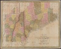
- Beinecke Rare Book and Manuscript Library > Map of Maine, New Hampshire, and Vermont : compiled from the latest authorities / published by S. Augustus Mitchell ; J.H. Young Sc. ; sold by Thomas, Cowperthwait & Co.
- Published / Created:
- 1847
- Call Number:
- 76 1847M
- Container / Volume:
- BRBL_00445
- Image Count:
- 1
- Resource Type:
- Maps, Atlases & Globes
- Found in:
- Beinecke Rare Book and Manuscript Library > Map of Massachusetts, Connecticut and Rhode Island Constructed from the latest Authorities.
- Published / Created:
- 1863
- Call Number:
- 774hc G33 1863W
- Container / Volume:
- BRBL_00502
- Image Count:
- 1
- Resource Type:
- Maps, Atlases & Globes
- Found in:
- Beinecke Rare Book and Manuscript Library > Map of the Battle of Gettysburg, Pa., July 1st, 2nd, and 3rd, 1863 ; showing line of Battle on PM. of 2d. / Prepared by W.H. Willcox. Capt. & A.D.C. on Maj. Genl. Reynold's Staff.
- Published / Created:
- [1839?]
- Call Number:
- 774GM 1840
- Container / Volume:
- BRBL_00501A
- Image Count:
- 1
- Resource Type:
- Maps, Atlases & Globes
- Found in:
- Beinecke Rare Book and Manuscript Library > Map of the canals ans railroads of Pennsylvania and New Jersey and the adjoining states. 1840.
- Published / Created:
- 1826
- Call Number:
- 783 1826
- Container / Volume:
- BRBL_00508
- Image Count:
- 1
- Resource Type:
- Maps, Atlases & Globes
- Found in:
- Beinecke Rare Book and Manuscript Library > Map of Virginia and Maryland constructed from the best authorities.
- Creator:
- O.W. Gray & Son
- Published / Created:
- 1878
- Call Number:
- 783 H189 1878
- Container / Volume:
- BRBL_00510
- Image Count:
- 1
- Resource Type:
- Maps, Atlases & Globes
- Found in:
- Beinecke Rare Book and Manuscript Library > Gray's new map of Hampton : Elizabeth City County, Va. : drawn from special surveys.
- Creator:
- Ebert, Frederick J
- Published / Created:
- 1865, c1862
- Call Number:
- 834 1865
- Container / Volume:
- BRBL_00587
- Image Count:
- 1
- Resource Type:
- Maps, Atlases & Globes
- Found in:
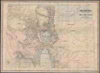
- Beinecke Rare Book and Manuscript Library > Map of Colorado territory, shewing the system of parks / drawn by Frederick J. Ebert.
- Published / Created:
- 1904
- Call Number:
- 754gme 1904A
- Container / Volume:
- BRBL_00420
- Image Count:
- 1
- Resource Type:
- Maps, Atlases & Globes
- Found in:
- Beinecke Rare Book and Manuscript Library > Trunk line railroad systems of the United States and Canada : distance to their respective termini at the several cities of the Atlantic and Canadian Seaboard and the Gulf of Mexico. How American exports of grain, flour, provisions...etc. reach the Easter
- Creator:
- Ebert, Frederick J
- Published / Created:
- 1862
- Call Number:
- 834gbc 1862
- Image Count:
- 1
- Resource Type:
- Maps, Atlases & Globes
- Found in:
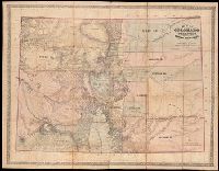
- Beinecke Rare Book and Manuscript Library > Map of Colorado Territory embracing the Central Gold Region [cartographic material] / drawn by Frederick J. Ebert ; under direction of the Governor Wm. Gilpin.
- Creator:
- Ellet, Charles, 1810-1862
- Published / Created:
- 1851
- Call Number:
- 75gme 1851
- Container / Volume:
- BRBL_00411
- Image Count:
- 1
- Resource Type:
- Maps, Atlases & Globes
- Found in:
- Beinecke Rare Book and Manuscript Library > Map of the Western Railroads tributary to Philadelphia with their rival lines / prepared under the direction of Charles Ellet Jr., civil engineer ; by W. Williams, map engraver.
- Published / Created:
- 1822
- Call Number:
- 75 1822
- Container / Volume:
- BRBL_00398
- Image Count:
- 1
- Resource Type:
- Maps, Atlases & Globes
- Found in:
- Beinecke Rare Book and Manuscript Library > United States of America Compiled from the latest & best Authorities. Engraved by Saml. Harrison.
- Published / Created:
- 1831
- Call Number:
- 75 1831
- Container / Volume:
- BRBL_00398
- Image Count:
- 1
- Resource Type:
- Maps, Atlases & Globes
- Found in:
- Beinecke Rare Book and Manuscript Library > Map of the United States constructed from the latest authorities.
- Published / Created:
- 1831
- Call Number:
- 75 1831A
- Container / Volume:
- BRBL_00398
- Image Count:
- 1
- Resource Type:
- Maps, Atlases & Globes
- Found in:
- Beinecke Rare Book and Manuscript Library > Map of the United States ... J.H. Young Sc.
- Published / Created:
- 1820
- Call Number:
- 75 1820C
- Container / Volume:
- BRBL_00397
- Image Count:
- 1
- Resource Type:
- Maps, Atlases & Globes
- Found in:
- Beinecke Rare Book and Manuscript Library > United States of America. Corrected and improved from the best authorities. Engraved by H. Anderson.
- Creator:
- Young, J. H. (James Hamilton)
- Published / Created:
- 1857
- Call Number:
- 75 1857
- Container / Volume:
- BRBL_00401
- Image Count:
- 1
- Resource Type:
- Maps, Atlases & Globes
- Found in:
- Beinecke Rare Book and Manuscript Library > A new map of the United States of America / by J.H. Young ; engraved by J.L. Hazzard & E. Yeager.
- Published / Created:
- 1809
- Call Number:
- 755 1809A
- Container / Volume:
- BRBL_00438
- Image Count:
- 1
- Resource Type:
- Maps, Atlases & Globes
- Found in:
- Beinecke Rare Book and Manuscript Library > A Map of the United States: compiled chiefly from the State Maps, and other Authentic Information, by Saml. Lewis.
- Published / Created:
- 1849
- Call Number:
- 80 1849D
- Container / Volume:
- BRBL_00533
- Image Count:
- 1
- Resource Type:
- Maps, Atlases & Globes
- Found in:
- Beinecke Rare Book and Manuscript Library > A new map of Texas, Oregon, and California : with the regions adjoining.
- Published / Created:
- 1838 [1837?]
- Call Number:
- 806 1838
- Container / Volume:
- BRBL_00547
- Image Count:
- 1
- Resource Type:
- Maps, Atlases & Globes
- Found in:
- Beinecke Rare Book and Manuscript Library > Mitchell's Map of Illinois Exhibiting its Internal Improvements, Counties, Towns, Roads &c.
- Published / Created:
- 1850
- Call Number:
- 814 1850A
- Container / Volume:
- BRBL_00557
- Image Count:
- 1
- Resource Type:
- Maps, Atlases & Globes
- Found in:
- Beinecke Rare Book and Manuscript Library > Map of Minessota Territory. J. H. Young.
- Published / Created:
- [1897?]
- Call Number:
- 855cbf 1897A
- Container / Volume:
- BRBL_00642
- Image Count:
- 1
- Resource Type:
- Maps, Atlases & Globes
- Found in:
- Beinecke Rare Book and Manuscript Library > Cuba
- Creator:
- Smith, John L., 1846-1921
- Published / Created:
- 1897
- Call Number:
- 855 1897B
- Container / Volume:
- BRBL_00641
- Image Count:
- 1
- Resource Type:
- Maps, Atlases & Globes
- Found in:
- Beinecke Rare Book and Manuscript Library > Mapa de la isla de Cuba.
- Creator:
- Mitchell, S. Augustus (Samuel Augustus), 1792-1868
- Published / Created:
- 1831
- Call Number:
- 76 1831A
- Container / Volume:
- BRBL_00444
- Image Count:
- 1
- Resource Type:
- Maps, Atlases & Globes
- Found in:
- Beinecke Rare Book and Manuscript Library > Map of Maine, New Hampshire, and Vermont / compiled from the latest authorities.
- Published / Created:
- 1834
- Call Number:
- 76 1834M
- Container / Volume:
- BRBL_00444
- Image Count:
- 1
- Resource Type:
- Maps, Atlases & Globes
- Found in:
- Beinecke Rare Book and Manuscript Library > Map of Maine, New Hampshire, and Vermont, compiled from the latest authorities.
- Published / Created:
- 1831
- Call Number:
- 76 1831
- Container / Volume:
- BRBL_00444
- Image Count:
- 1
- Resource Type:
- Maps, Atlases & Globes
- Found in:
- Beinecke Rare Book and Manuscript Library > Map of Maine, New Hampshire, and Vermont, compiled from the latest authorities.
- Published / Created:
- [1827]
- Call Number:
- 76 1827A
- Container / Volume:
- BRBL_00444
- Image Count:
- 1
- Resource Type:
- Maps, Atlases & Globes
- Found in:
- Beinecke Rare Book and Manuscript Library > Map of Massachusetts, Connecticut and Rhode Island. Constructed from the Latest Authorities.
- Creator:
- Mitchell, S. Augustus (Samuel Augustus), 1792-1868
- Published / Created:
- 1843
- Call Number:
- 771 1843
- Container / Volume:
- BRBL_00478
- Image Count:
- 1
- Resource Type:
- Maps, Atlases & Globes
- Found in:
- Beinecke Rare Book and Manuscript Library > Map of the State of New York [cartographic material] : compiled from the latest authorities.
- Creator:
- Howell, Reading, 1743-1827
- Published / Created:
- 1811
- Call Number:
- 774 1811
- Container / Volume:
- BRBL_00498
- Image Count:
- 1
- Resource Type:
- Maps, Atlases & Globes
- Found in:
- Beinecke Rare Book and Manuscript Library > A map of the state of Pennsylvania / [cartographic material] / by Reading Howell, MDCCCXI ; engraved by J. Vallance.
- Published / Created:
- [1825?]
- Call Number:
- 774 P68 1825
- Container / Volume:
- BRBL_00500
- Image Count:
- 1
- Resource Type:
- Maps, Atlases & Globes
- Found in:
- Beinecke Rare Book and Manuscript Library > Plan of Pittsburgh and adyacent country, surveyed by Wm. Darby.
- Creator:
- Tanner, Henry Schenck, 1786-1858
- Published / Created:
- [1823]
- Call Number:
- 774 1823
- Container / Volume:
- BRBL_00498
- Image Count:
- 1
- Resource Type:
- Maps, Atlases & Globes
- Found in:
- Beinecke Rare Book and Manuscript Library > Map of Pennsylvania and New Jersey / by H.S. Tanner ; engraved by H.S. Tanner & assistants.
- Creator:
- O.W. Gray & Son
- Published / Created:
- c1876.
- Call Number:
- 774 P53 1876A
- Container / Volume:
- BRBL_00500
- Image Count:
- 1
- Resource Type:
- Maps, Atlases & Globes
- Found in:
- Beinecke Rare Book and Manuscript Library > Philadelphia / [cartographic material] / O.W. Gray & Son.
- Creator:
- Torrey, Jason, 1772-1848
- Published / Created:
- 1814
- Call Number:
- 774fb W367 1814A
- Container / Volume:
- BRBL_00501
- Image Count:
- 1
- Resource Type:
- Maps, Atlases & Globes
- Found in:
- Beinecke Rare Book and Manuscript Library > A map of Wayne & Pike counties, Pennsylvania [cartographic material] : shewing the situations & forms of the warrantee tracts, with the numbers by which the respective tracts are distinguished in the maps & books in the Office of the Commissioners of plac
- Published / Created:
- 1876
- Call Number:
- 774 P53 1876
- Container / Volume:
- BRBL_00500
- Image Count:
- 1
- Resource Type:
- Maps, Atlases & Globes
- Found in:
- Beinecke Rare Book and Manuscript Library > Centennial memento map of Philadelphia.
- Published / Created:
- 1857
- Call Number:
- 774 1857
- Container / Volume:
- BRBL_00498
- Image Count:
- 1
- Resource Type:
- Maps, Atlases & Globes
- Found in:
- Beinecke Rare Book and Manuscript Library > A new county map of Pennsylvania and adjoining states showing the route of the rail roads, &c.
- Published / Created:
- 1818
- Call Number:
- 774 H92 1818
- Container / Volume:
- BRBL_00499
- Image Count:
- 1
- Resource Type:
- Maps, Atlases & Globes
- Found in:
- Beinecke Rare Book and Manuscript Library > Map of Huntingdon County ... by John Morrison.
- Creator:
- Austin, Stephen F. (Stephen Fuller), 1793-1836
- Published / Created:
- 1839
- Call Number:
- 796 1839D
- Container / Volume:
- BRBL_00524
- Image Count:
- 1
- Resource Type:
- Maps, Atlases & Globes
- Found in:
- Beinecke Rare Book and Manuscript Library > Map of Texas with parts of the adjoining states / compiled by Stephen F. Austin ; engraved by John & Wm. W. Warr.
- Published / Created:
- 1859
- Call Number:
- 796 1859C
- Container / Volume:
- BRBL_00525
- Image Count:
- 1
- Resource Type:
- Maps, Atlases & Globes
- Found in:
- Beinecke Rare Book and Manuscript Library > Richardsons new map of the state of Texas, including part of Mexico.
- Published / Created:
- 1860
- Call Number:
- 796 1860
- Container / Volume:
- BRBL_00525
- Image Count:
- 1
- Resource Type:
- Maps, Atlases & Globes
- Found in:
- Beinecke Rare Book and Manuscript Library > Richardsons new map of the state of Texas, including part of Mexico.
- Creator:
- Holmes, William Henry, 1846-1933
- Published / Created:
- [1859?]
- Call Number:
- 825 1859A
- Container / Volume:
- BRBL_00573
- Image Count:
- 1
- Resource Type:
- Maps, Atlases & Globes
- Found in:
- Beinecke Rare Book and Manuscript Library > A new map of Kansas / by W.H. Holmes.
- Published / Created:
- [1847]
- Call Number:
- 844 1847
- Container / Volume:
- BRBL_00601
- Image Count:
- 1
- Resource Type:
- Maps, Atlases & Globes
- Found in:
- Beinecke Rare Book and Manuscript Library > [Occupation of California map : disposal of U.S. Army, June 19th, 1847].
- Creator:
- Mitchell, S. Augustus (Samuel Augustus), 1792-1868
- Published / Created:
- 1847
- Call Number:
- 88 1847A
- Container / Volume:
- BRBL_00645
- Image Count:
- 1
- Resource Type:
- Maps, Atlases & Globes
- Found in:
- Beinecke Rare Book and Manuscript Library > Map of Mexico : including Yucatan & Upper California, exhibiting the chief cities and towns, the principal travelling routes &c.
- Creator:
- Mitchell, S. Augustus (Samuel Augustus), 1792-1868
- Published / Created:
- 1846
- Call Number:
- 88 1846H
- Container / Volume:
- BRBL_00645
- Image Count:
- 1
- Resource Type:
- Maps, Atlases & Globes
- Found in:
- Beinecke Rare Book and Manuscript Library > Map of Mexico : including Yucatan & Upper California, exhibiting the chief cities and towns, the principal travelling routes &c.
- Published / Created:
- 1847
- Call Number:
- 88 1847M
- Container / Volume:
- BRBL_00645
- Image Count:
- 1
- Resource Type:
- Maps, Atlases & Globes
- Found in:
- Beinecke Rare Book and Manuscript Library > Map of Mexico, including Yucatan & Upper California, exibiting the chief cities and towns, the principal travelling routes &c.
- Published / Created:
- 1833
- Call Number:
- 755 1833
- Container / Volume:
- BRBL_00440
- Image Count:
- 1
- Resource Type:
- Maps, Atlases & Globes
- Found in:
- Beinecke Rare Book and Manuscript Library > Map of Louisiana, Mississippi and Alabama, constructed from the latest authorities.
- Published / Created:
- 1835
- Call Number:
- 755 1835B
- Container / Volume:
- BRBL_00440
- Image Count:
- 1
- Resource Type:
- Maps, Atlases & Globes
- Found in:
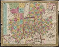
- Beinecke Rare Book and Manuscript Library > Map of the States of Ohio, Indiana, and Illinois with the settled part of Michigan.
- Creator:
- Young, J. H. (James Hamilton)
- Published / Created:
- 1835
- Call Number:
- 755 1835D
- Container / Volume:
- BRBL_00440
- Image Count:
- 1
- Resource Type:
- Maps, Atlases & Globes
- Found in:
- Beinecke Rare Book and Manuscript Library > Map of the states of North Carolina, South Carolina, and Georgia [cartographic material] / engraved by J.H. Young.
- Published / Created:
- 1835
- Call Number:
- 755 1835B
- Container / Volume:
- BRBL_00440
- Image Count:
- 1
- Resource Type:
- Maps, Atlases & Globes
- Found in:
- Beinecke Rare Book and Manuscript Library > Map of the States of Ohio, Indiana, and Illinois with the settled part of Michigan.
- Published / Created:
- 1846
- Call Number:
- 766 1846T
- Container / Volume:
- BRBL_00466
- Image Count:
- 1
- Resource Type:
- Maps, Atlases & Globes
- Found in:
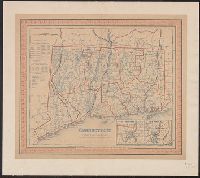
- Beinecke Rare Book and Manuscript Library > Connecticut.
- Creator:
- Sheafer, P. W. (Peter Wenrick), 1819-
- Published / Created:
- 1867
- Call Number:
- 774G 1867
- Container / Volume:
- BRBL_00501
- Image Count:
- 1
- Resource Type:
- Maps, Atlases & Globes
- Found in:
- Beinecke Rare Book and Manuscript Library > Iron, railroad, canal and coal map of Pennsylvania, &c. : showing the relative position of the various anthracite and bituminous coal fields, the railroads, canals and navigable waters by which they are connected forming their respective avenues to market
- Creator:
- Darby, William, 1775-1854
- Published / Created:
- May the 1st, 1816.
- Call Number:
- 795 1816B
- Container / Volume:
- BRBL_00521
- Image Count:
- 1
- Resource Type:
- Maps, Atlases & Globes
- Found in:
- Beinecke Rare Book and Manuscript Library > Map of the state of Louisiana : with part of the Mississippi Territory, from actual survey / by Wm. Darby ; Saml. Harrison sct. Philaa.
- Creator:
- Austin, Stephen F. (Stephen Fuller), 1793-1836
- Published / Created:
- [1830?]
- Call Number:
- 796 1830
- Container / Volume:
- BRBL_00524
- Image Count:
- 1
- Resource Type:
- Maps, Atlases & Globes
- Found in:
- Beinecke Rare Book and Manuscript Library > Map of Texas with parts of the adjoining states / compiled by Stephen F. Austin ; engraved by John & Wm. W. Warr.
- Published / Created:
- c1875.
- Call Number:
- 804 1875
- Container / Volume:
- BRBL_00543
- Image Count:
- 1
- Resource Type:
- Maps, Atlases & Globes
- Found in:
- Beinecke Rare Book and Manuscript Library > New railroad map of Ohio : compiled and drawn by Frank A. Gray / prepared for the report of the commissioner of railroads.
- Published / Created:
- 1893
- Call Number:
- 804 C724 1893
- Container / Volume:
- BRBL_00544
- Image Count:
- 1
- Resource Type:
- Maps, Atlases & Globes
- Found in:
- Beinecke Rare Book and Manuscript Library > Columbus [Ohio] : showing terminal facilities of the Norfolk & Western railroad and the Columbus connecting & terminal railroad.
- Published / Created:
- 1900
- Call Number:
- 801 C39 1900
- Container / Volume:
- BRBL_00541
- Image Count:
- 1
- Resource Type:
- Maps, Atlases & Globes
- Found in:
- Beinecke Rare Book and Manuscript Library > City of Chattanooga, Tennessee and vicinity.
- Published / Created:
- 1889
- Call Number:
- 801 C39 1889
- Container / Volume:
- BRBL_00541
- Image Count:
- 1
- Resource Type:
- Maps, Atlases & Globes
- Found in:
- Beinecke Rare Book and Manuscript Library > City of Chattanooga, Tennessee and vicinity.
- Published / Created:
- 1795
- Call Number:
- 85 1795
- Container / Volume:
- BRBL_00637
- Image Count:
- 1
- Resource Type:
- Maps, Atlases & Globes
- Found in:
- Beinecke Rare Book and Manuscript Library > A chart of the West Indies, from the latest marine Journals and Surveys.
- Published / Created:
- 1915
- Call Number:
- 774 Y82 1915
- Container / Volume:
- BRBL_00500
- Image Count:
- 1
- Resource Type:
- Maps, Atlases & Globes
- Found in:
- Beinecke Rare Book and Manuscript Library > Farm journal map of York County, Pennsylvania.
- Published / Created:
- 1909
- Call Number:
- 774gmb P53 1909
- Container / Volume:
- BRBL_00501A
- Image Count:
- 1
- Resource Type:
- Maps, Atlases & Globes
- Found in:
- Beinecke Rare Book and Manuscript Library > Authentic automobile map of Philadelphia and vicinity.
- Published / Created:
- 1912 .
- Call Number:
- 774gmb M766 1912
- Container / Volume:
- BRBL_00501A
- Image Count:
- 1
- Resource Type:
- Maps, Atlases & Globes
- Found in:
- Beinecke Rare Book and Manuscript Library > Good Road Map : embracing parts of Montgomery, Delaware and Chester Counties, Pennsylvania.
- Published / Created:
- 1872
- Call Number:
- 75 1872
- Container / Volume:
- BRBL_00405
- Image Count:
- 1
- Resource Type:
- Maps, Atlases & Globes
- Found in:
- Beinecke Rare Book and Manuscript Library > Map of the United States and Territories.
- Creator:
- Young, J. H. (James Hamilton)
- Published / Created:
- [1864]
- Call Number:
- 75 1864B
- Container / Volume:
- BRBL_00403
- Image Count:
- 1
- Resource Type:
- Maps, Atlases & Globes
- Found in:
- Beinecke Rare Book and Manuscript Library > A new map of the United States of America [cartographic material] / by J.H. Young ; engraved by J.L. Hazzard & E. Yeager.
- Published / Created:
- [1819?]
- Call Number:
- 75 1819S
- Container / Volume:
- BRBL_00397
- Image Count:
- 1
- Resource Type:
- Maps, Atlases & Globes
- Found in:
- Beinecke Rare Book and Manuscript Library > United States of America. Engraved by J. Warr, Jr.
- Published / Created:
- 1818
- Call Number:
- 75 1819H
- Container / Volume:
- BRBL_00397
- Image Count:
- 1
- Resource Type:
- Maps, Atlases & Globes
- Found in:
- Beinecke Rare Book and Manuscript Library > United States of America Compiled from the latest & best Authorities by John Melish 1819.
- Creator:
- Drake, Ira S
- Published / Created:
- 1850, c1849.
- Call Number:
- 754 1850
- Container / Volume:
- BRBL_00416
- Image Count:
- 1
- Resource Type:
- Maps, Atlases & Globes
- Found in:
- Beinecke Rare Book and Manuscript Library > Map of the states of Missouri, Illinois, Iowa and Wisconsin : the territory of Minnesota, and the mineral lands of Lake Superior / compiled by I.S. Drake ; engraved by Ira S. Drake and J.L. Hazzard.
- Published / Created:
- [1885?]
- Call Number:
- 754 1885
- Container / Volume:
- BRBL_00417
- Image Count:
- 1
- Resource Type:
- Maps, Atlases & Globes
- Found in:
- Beinecke Rare Book and Manuscript Library > Topographical map of Virginia : also showing the states of Maryland and Delaware.
- Creator:
- O.W. Gray & Son
- Published / Created:
- 1876
- Call Number:
- 811 1876
- Container / Volume:
- BRBL_00552
- Image Count:
- 1
- Resource Type:
- Maps, Atlases & Globes
- Found in:
- Beinecke Rare Book and Manuscript Library > Railroad map of Michigan / prepared for the Commissioner of Railroads by O.W. Gray & Son.
- Creator:
- Parker, Nathan H. (Nathan Howe)
- Published / Created:
- 1865
- Call Number:
- 816ca 1865
- Container / Volume:
- BRBL_00563
- Image Count:
- 1
- Resource Type:
- Maps, Atlases & Globes
- Found in:
- Beinecke Rare Book and Manuscript Library > Parker's geological map of the state of Missouri : showing the location of the principal deposits of iron, lead, zinc, tin, copper, diamonds, gold, silver, platina, nickel, manganese, alabaster, kaolin, coal, oil springs, &c. / by Nathan H. Parker ; Macke
- Creator:
- Thompson, G. (Gilbert), 1839-1909
- Published / Created:
- 1866
- Call Number:
- 894gme 1866
- Container / Volume:
- BRBL_00659
- Image Count:
- 1
- Resource Type:
- Maps, Atlases & Globes
- Found in:
- Beinecke Rare Book and Manuscript Library > Map and vertical section of the proposed Honduras Interoceanic Railway : Located 1857 & 58. / Drawn by G. Thompson, 1866.
- Creator:
- Semple, E. A. (Edward Armistead), 1842-1910
- Published / Created:
- [1892?]
- Call Number:
- 783 EL48 1890
- Container / Volume:
- BRBL_00510
- Image Count:
- 1
- Resource Type:
- Maps, Atlases & Globes
- Found in:
- Beinecke Rare Book and Manuscript Library > Map of Elizabeth City Co., Va. : from actual surveys by E.A. Semple, Wm. Ivy and C. Hubbard / compiled and platted by E.A. Semple, civil engineer and county surveyor.
- Creator:
- Price, Jacob, fl. 1850
- Published / Created:
- 1850
- Call Number:
- 776 1850
- Container / Volume:
- BRBL_00502
- Image Count:
- 4
- Resource Type:
- Maps, Atlases & Globes
- Found in:
- Beinecke Rare Book and Manuscript Library > A map of the state of Delaware / [cartographic material] / from original surveys of Jacob Price & Samuel M. Rea, assisted by H. Paxon.
- Creator:
- Graham, John, Esq
- Published / Created:
- 1856
- Call Number:
- 804 F854 1856
- Container / Volume:
- BRBL_00544
- Image Count:
- 4
- Resource Type:
- Maps, Atlases & Globes
- Found in:
- Beinecke Rare Book and Manuscript Library > Map of Franklin Co. Ohio : from actual survey & records / by John Graham Esq., Surveyor & Civil Engineer, Columbus, O.
- Published / Created:
- 1859
- Call Number:
- 766 L71 1859
- Container / Volume:
- BRBL_00469
- Image Count:
- 4
- Resource Type:
- Maps, Atlases & Globes
- Found in:
- Beinecke Rare Book and Manuscript Library > Clark's map of Litchfield County, Connecticut.
- Published / Created:
- 1861
- Call Number:
- 75 1861N
- Container / Volume:
- BRBL_00402
- Image Count:
- 1
- Resource Type:
- Maps, Atlases & Globes
- Found in:
- Beinecke Rare Book and Manuscript Library > A new map of the United States of America / by J.H. Young.
- Creator:
- Young, J. H. (James Hamilton)
- Published / Created:
- 1860, c1859.
- Call Number:
- 75 1859D
- Container / Volume:
- BRBL_00401
- Image Count:
- 1
- Resource Type:
- Maps, Atlases & Globes
- Found in:
- Beinecke Rare Book and Manuscript Library > A new map of the United States of America / by J.H. Young ; engraved by J.L. Hazzard & E. Yeager.
- Creator:
- Desilver, Charles
- Published / Created:
- [1856]
- Call Number:
- 80 1856C
- Container / Volume:
- BRBL_00534
- Image Count:
- 1
- Resource Type:
- Maps, Atlases & Globes
- Found in:
- Beinecke Rare Book and Manuscript Library > A new map of the state of California, the territories of Oregon, Washington, Utah & New Mexico.
- Published / Created:
- 1917
- Call Number:
- 774ad W251 1917
- Container / Volume:
- BRBL_00500
- Image Count:
- 1
- Resource Type:
- Maps, Atlases & Globes
- Found in:
- Beinecke Rare Book and Manuscript Library > Official map of the Penna. oil region ; showing the southwestern portion of Warren County.
- Published / Created:
- 1855
- Call Number:
- 774 SCH89 1855
- Container / Volume:
- BRBL_00500
- Image Count:
- 2
- Resource Type:
- Maps, Atlases & Globes
- Found in:
- Beinecke Rare Book and Manuscript Library > Map of Schuykill County, Penna. : by P.W. Sheafer.
- Creator:
- Young, J. H. (James Hamilton)
- Published / Created:
- 1832
- Call Number:
- 774 1832Y
- Container / Volume:
- BRBL_00498
- Image Count:
- 2
- Resource Type:
- Maps, Atlases & Globes
- Found in:
- Beinecke Rare Book and Manuscript Library > The tourist's pocket map of Pennsylvania [cartographic material] : exhibiting its internal improvements, roads, distances &c. / by J.H. Young ; D. Haines sc.
- Published / Created:
- 1915
- Call Number:
- 774gbc 1915
- Container / Volume:
- BRBL_00501A
- Image Count:
- 2
- Resource Type:
- Maps, Atlases & Globes
- Found in:
- Beinecke Rare Book and Manuscript Library > North Western Pennsylvania oil fields. / by Joseph Smith, C.E.
- Published / Created:
- 1918
- Call Number:
- 774 P53 1918
- Container / Volume:
- BRBL_00500
- Image Count:
- 2
- Resource Type:
- Maps, Atlases & Globes
- Found in:
- Beinecke Rare Book and Manuscript Library > All roads lead to Hotel DuPont, Wilmington, Del.
- Creator:
- Robb, A. J. (Alan J.)
- Published / Created:
- ca. 1916.
- Call Number:
- 774 P53 1916
- Container / Volume:
- BRBL_00500
- Image Count:
- 2
- Resource Type:
- Maps, Atlases & Globes
- Found in:
- Beinecke Rare Book and Manuscript Library > The up-to-date complete map of Philadelphia and vicinity / by A.J. Robb ; Royal Publishing Co. Distributers.
- Published / Created:
- [ca. 1915]
- Call Number:
- 307ag 1915
- Container / Volume:
- BRBL_00036
- Image Count:
- 2
- Resource Type:
- Maps, Atlases & Globes
- Found in:
- Beinecke Rare Book and Manuscript Library > Map of Western Europe / Sample Tours and Itineraries.
- Creator:
- Allen, Lane & Scott
- Published / Created:
- 1880
- Call Number:
- 75gme 1880B
- Container / Volume:
- BRBL_00413
- Image Count:
- 2
- Resource Type:
- Maps, Atlases & Globes
- Found in:
- Beinecke Rare Book and Manuscript Library > Pennsylvania Railroad : Great Trunk Line and U.S. Mail Route.
- Creator:
- Young, J. H. (James Hamilton)
- Published / Created:
- [1864]
- Call Number:
- 75 1864B
- Container / Volume:
- BRBL_00403
- Image Count:
- 2
- Resource Type:
- Maps, Atlases & Globes
- Found in:
- Beinecke Rare Book and Manuscript Library > A new map of the United States of America [cartographic material] / by J.H. Young ; engraved by J.L. Hazzard & E. Yeager.
- Published / Created:
- 1844
- Call Number:
- 75AM 1844
- Container / Volume:
- BRBL_00407A
- Image Count:
- 2
- Resource Type:
- Maps, Atlases & Globes
- Found in:
- Beinecke Rare Book and Manuscript Library > National game of the Star Spangled Banner or Geographical & Historical Tourist through the United States & Canada.
- Creator:
- Allen, Lane & Scott
- Published / Created:
- 1884
- Call Number:
- 75gme 1884
- Container / Volume:
- BRBL_00414
- Image Count:
- 2
- Resource Type:
- Maps, Atlases & Globes
- Found in:
- Beinecke Rare Book and Manuscript Library > Pennsylvania Railroad : Great Trunk Line of the United States / Chas. E. Pugh, General Manager ; J.R. Wood, General Passenger Agent.
- Creator:
- Scull, Nicholas, 1686?-1761?
- Published / Created:
- 1759
- Call Number:
- 774 1759
- Container / Volume:
- BRBL_00497
- Image Count:
- 3
- Resource Type:
- Maps, Atlases & Globes
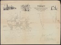
- Found in:
- Beinecke Rare Book and Manuscript Library > To the honourable Thomas Penn and Richard Penn...this map of the improved part of the province of Pennsylvania is humbly dedicated / by Nicholas Scull ; engraved by Ja. Turner.
- Published / Created:
- 1885
- Call Number:
- 774AM P53 1886
- Container / Volume:
- BRBL_00500
- Image Count:
- 6
- Resource Type:
- Maps, Atlases & Globes
- Found in:
- Beinecke Rare Book and Manuscript Library > Pennsylvania in 1886.
- Creator:
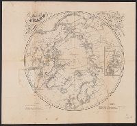
- Berghaus, Heinrich Karl Wilhelm, 1797-1884
Boell, William
Bowen & Co
Kane, Elisha Kent, 1820-1857
Petermann, A. (August), 1822-1878
- Published / Created:
- [1860]
- Call Number:
- 18 1860A
- Container / Volume:
- BRBL_00013
- Image Count:
- 1
- Resource Type:
- Maps, Atlases & Globes
- Found in:
- Beinecke Rare Book and Manuscript Library > A chart of the arctic regions : projected from Berghaus & Petermann, the charts of E.K. Kane, materials in the British Hydrographic office, etc. / eng. by W. Boell.