Search
You Searched For
Search Results
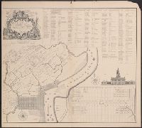
- Published / Created:
- 1870
- Call Number:
- 774 1870H
- Container / Volume:
- BRBL_00730
- Image Count:
- 4
- Resource Type:
- Maps, Atlases & Globes
- Found in:
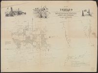
- Beinecke Rare Book and Manuscript Library > A map of the province of Pennsilvania ... / by Thomas Holme ...
- Creator:
- Tanner, Henry Schenck, 1786-1858
- Published / Created:
- [1822 or 1823]
- Call Number:
- 71 1822
- Container / Volume:
- BRBL_00369
- Image Count:
- 4
- Resource Type:
- Maps, Atlases & Globes
- Found in:
- Beinecke Rare Book and Manuscript Library > A map of North America : constructed according to the latest information / engraved & published by H.S. Tanner, Philadelphia 1822.
- Creator:
- Beers, S. N
- Published / Created:
- 1859
- Call Number:
- 771 On8 1859
- Container / Volume:
- BRBL_00490
- Image Count:
- 4
- Resource Type:
- Maps, Atlases & Globes
- Found in:
- Beinecke Rare Book and Manuscript Library > Map of Ontario County, New York : from actual surveys / by S.N. Beers, assisted by D.G. Beers.
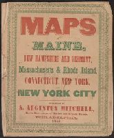
- Published / Created:
- 1846
- Call Number:
- 76 1846A
- Container / Volume:
- BRBL_00445
- Image Count:
- 7
- Resource Type:
- Maps, Atlases & Globes
- Found in:
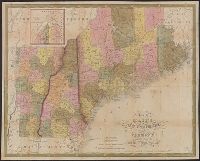
- Beinecke Rare Book and Manuscript Library > Maps of Maine, New Hampshire and Vermont, Massachusetts & Rhode Island, Connecticut, New York and New York City.
- Published / Created:
- 1816
- Call Number:
- 755 1816
- Container / Volume:
- BRBL_00439
- Image Count:
- 1
- Resource Type:
- Maps, Atlases & Globes
- Found in:
- Beinecke Rare Book and Manuscript Library > Northern Section of the United States including Canada, etc., by John Melish. Second edition with Additions and improvements.
- Published / Created:
- [1820?]
- Call Number:
- 755 1820
- Container / Volume:
- BRBL_00439
- Image Count:
- 1
- Resource Type:
- Maps, Atlases & Globes
- Found in:
- Beinecke Rare Book and Manuscript Library > Map of North and South Carolina and Georgia, constructed from the latest authorities.
- Published / Created:
- 1837
- Call Number:
- 773 1837
- Container / Volume:
- BRBL_00495
- Image Count:
- 1
- Resource Type:
- Maps, Atlases & Globes
- Found in:
- Beinecke Rare Book and Manuscript Library > New Jersey.
- Creator:
- Howell, Reading, 1743-1827
- Published / Created:
- 1816
- Call Number:
- 774 1816
- Container / Volume:
- BRBL_00498
- Image Count:
- 1
- Resource Type:
- Maps, Atlases & Globes
- Found in:
- Beinecke Rare Book and Manuscript Library > A map of the state of Pennsylvania / [cartographic material] / by Reading Howell, MDCCCXVI ; published by Emmor Kimber.
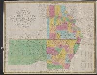
- Creator:
- Mitchell, S. Augustus (Samuel Augustus), 1792-1868
- Published / Created:
- 1833
- Call Number:
- 80 1833
- Container / Volume:
- BRBL_00532
- Image Count:
- 1
- Resource Type:
- Maps, Atlases & Globes
- Found in:
- Beinecke Rare Book and Manuscript Library > Map of the state of Missouri and territory of Arkansas / compiled from the latest authorities ; J.H. Young, sc.
- Published / Created:
- 1853
- Call Number:
- 811 1853
- Container / Volume:
- BRBL_00552
- Image Count:
- 1
- Resource Type:
- Maps, Atlases & Globes
- Found in:
- Beinecke Rare Book and Manuscript Library > Neueste Karte von Michigan : nach den bessten Quellen bearbeitet.
- Published / Created:
- 1852
- Call Number:
- 806cfp G562 1852
- Container / Volume:
- BRBL_00549
- Image Count:
- 1
- Resource Type:
- Maps, Atlases & Globes
- Found in:
- Beinecke Rare Book and Manuscript Library > Map of the track of the tornado of April 30th 1852. : from Golconda Illinois, to Wabash River across Indiana & the Ohio River to Georgetown Kentucky, U.S. / by John Chapplesmith.
- Creator:
- Mitchell, S. Augustus (Samuel Augustus), 1792-1868
- Published / Created:
- 1847
- Call Number:
- 76 1847A
- Container / Volume:
- BRBL_00445
- Image Count:
- 1
- Resource Type:
- Maps, Atlases & Globes
- Found in:
- Beinecke Rare Book and Manuscript Library > Map of Maine, New Hampshire, and Vermont : compiled from the latest authorities / published by S. Augustus Mitchell ; J.H. Young Sc. ; sold by Thomas, Cowperthwait & Co.
- Published / Created:
- 1847
- Call Number:
- 76 1847M
- Container / Volume:
- BRBL_00445
- Image Count:
- 1
- Resource Type:
- Maps, Atlases & Globes
- Found in:
- Beinecke Rare Book and Manuscript Library > Map of Massachusetts, Connecticut and Rhode Island Constructed from the latest Authorities.
- Published / Created:
- 1863
- Call Number:
- 774hc G33 1863W
- Container / Volume:
- BRBL_00502
- Image Count:
- 1
- Resource Type:
- Maps, Atlases & Globes
- Found in:
- Beinecke Rare Book and Manuscript Library > Map of the Battle of Gettysburg, Pa., July 1st, 2nd, and 3rd, 1863 ; showing line of Battle on PM. of 2d. / Prepared by W.H. Willcox. Capt. & A.D.C. on Maj. Genl. Reynold's Staff.
- Published / Created:
- [1839?]
- Call Number:
- 774GM 1840
- Container / Volume:
- BRBL_00501A
- Image Count:
- 1
- Resource Type:
- Maps, Atlases & Globes
- Found in:
- Beinecke Rare Book and Manuscript Library > Map of the canals ans railroads of Pennsylvania and New Jersey and the adjoining states. 1840.
- Published / Created:
- 1826
- Call Number:
- 783 1826
- Container / Volume:
- BRBL_00508
- Image Count:
- 1
- Resource Type:
- Maps, Atlases & Globes
- Found in:
- Beinecke Rare Book and Manuscript Library > Map of Virginia and Maryland constructed from the best authorities.
- Creator:
- O.W. Gray & Son
- Published / Created:
- 1878
- Call Number:
- 783 H189 1878
- Container / Volume:
- BRBL_00510
- Image Count:
- 1
- Resource Type:
- Maps, Atlases & Globes
- Found in:
- Beinecke Rare Book and Manuscript Library > Gray's new map of Hampton : Elizabeth City County, Va. : drawn from special surveys.
- Creator:
- Ebert, Frederick J
- Published / Created:
- 1865, c1862
- Call Number:
- 834 1865
- Container / Volume:
- BRBL_00587
- Image Count:
- 1
- Resource Type:
- Maps, Atlases & Globes
- Found in:
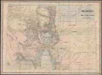
- Beinecke Rare Book and Manuscript Library > Map of Colorado territory, shewing the system of parks / drawn by Frederick J. Ebert.
- Published / Created:
- 1904
- Call Number:
- 754gme 1904A
- Container / Volume:
- BRBL_00420
- Image Count:
- 1
- Resource Type:
- Maps, Atlases & Globes
- Found in:
- Beinecke Rare Book and Manuscript Library > Trunk line railroad systems of the United States and Canada : distance to their respective termini at the several cities of the Atlantic and Canadian Seaboard and the Gulf of Mexico. How American exports of grain, flour, provisions...etc. reach the Easter
- Creator:
- Ebert, Frederick J
- Published / Created:
- 1862
- Call Number:
- 834gbc 1862
- Image Count:
- 1
- Resource Type:
- Maps, Atlases & Globes
- Found in:
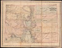
- Beinecke Rare Book and Manuscript Library > Map of Colorado Territory embracing the Central Gold Region [cartographic material] / drawn by Frederick J. Ebert ; under direction of the Governor Wm. Gilpin.