Skip to search
Skip to main content
Skip to first result
Search
You Searched For
Access
Public
Format
cartographic
Publication Place
Philadelphia :
New Search
Search Results
Published / Created:
1876
Call Number:
774 P53 1876
Container / Volume:
BRBL_00500
Image Count:
1
Resource Type:
Maps, Atlases & Globes
Publisher:
John P. Hunt, publisher ,
Subject (Geographic):
Philadelphia (Pennsylvania)--Maps
Found in:
Beinecke Rare Book and Manuscript Library > Centennial memento map of Philadelphia.
Published / Created:
1900
Call Number:
801 C39 1900
Container / Volume:
BRBL_00541
Image Count:
1
Resource Type:
Maps, Atlases & Globes
Description:
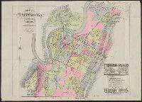
"Ferger Place. The most attractive residence park in the South" advertisement in bottom right corner.
Publisher:
G.M. Hopkins,
Subject (Geographic):
Chattanooga (Tenn.)--Maps
Found in:
Beinecke Rare Book and Manuscript Library > City of Chattanooga, Tennessee and vicinity.
Published / Created:
1889
Call Number:
801 C39 1889
Container / Volume:
BRBL_00541
Image Count:
1
Resource Type:
Maps, Atlases & Globes
Description:
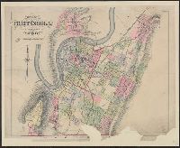
"Entered ... in the year 1889 by G.M. Hopkins in the Office of the Librarian of Congress at Washington."
Publisher:
G.M. Hopkins,
Subject (Geographic):
Chattanooga (Tenn.)--Maps
Subject (Name):
Hopkins, Griffith Morgan, Jr
Found in:
Beinecke Rare Book and Manuscript Library > City of Chattanooga, Tennessee and vicinity.
Published / Created:
1859
Call Number:
766 L71 1859
Container / Volume:
BRBL_00469
Image Count:
4
Resource Type:
Maps, Atlases & Globes
Description:
Border of views and villages insets.
Publisher:
Richard Clark,
Subject (Geographic):
Litchfield County (Conn.)--Maps
Found in:
Beinecke Rare Book and Manuscript Library > Clark's map of Litchfield County, Connecticut.
Published / Created:
1893
Call Number:
804 C724 1893
Container / Volume:
BRBL_00544
Image Count:
1
Resource Type:
Maps, Atlases & Globes
Description:
RR lines noted in var. col..
Publisher:
Century Lith. Co.,
Subject (Geographic):
Columbus (Ohio)--Maps
Found in:
Beinecke Rare Book and Manuscript Library > Columbus [Ohio] : showing terminal facilities of the Norfolk & Western railroad and the Columbus connecting & terminal railroad.
Published / Created:
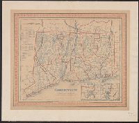
1846
Call Number:
766 1846T
Container / Volume:
BRBL_00466
Image Count:
1
Resource Type:
Maps, Atlases & Globes
Description:
Insets: 1. Hartford &c. 2. New Haven &c., Shows county outlines in color; also townships, roads, canals, railroads, courthouses, churches & taverns., table: Statistical table of pop of counties and towns in 1840. Also pop of Conn. from 1701 to 1840., and Wash. P
Publisher:
S. Augustus Mitchell,
Subject (Geographic):
Connecticut--Maps--Early works to 1800
Found in:
Beinecke Rare Book and Manuscript Library > Connecticut.
Published / Created:
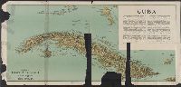
[1897?]
Call Number:
855cbf 1897A
Container / Volume:
BRBL_00642
Image Count:
1
Resource Type:
Maps, Atlases & Globes
Description:
Imperfect. Mutilated. Map torn into 2 sheets, each encased in mylar. and Text detailing historical and geographic information.
Publisher:
James McConnell School Supply Co.,
Subject (Geographic):
Cuba--Maps
Found in:
Beinecke Rare Book and Manuscript Library > Cuba
Published / Created:
1915
Call Number:
774 Y82 1915
Container / Volume:
BRBL_00500
Image Count:
1
Resource Type:
Maps, Atlases & Globes
Description:
Also shows railroads, inter-urban electric lines, main roads., Roads in each townships are numbered., and Zincograph colored to show townships.
Publisher:
Wilmer Atkinson Company ,
Subject (Geographic):
York County (Pennsylvania)--Maps
Found in:
Beinecke Rare Book and Manuscript Library > Farm journal map of York County, Pennsylvania.
Published / Created:
1912 .
Call Number:
774gmb M766 1912
Container / Volume:
BRBL_00501A
Image Count:
1
Resource Type:
Maps, Atlases & Globes
Publisher:
A.H. Mueller ,
Subject (Geographic):
Chester County (Pennsylvania)--Maps and Montgomery County (Delaware)--Maps
Found in:
Beinecke Rare Book and Manuscript Library > Good Road Map : embracing parts of Montgomery, Delaware and Chester Counties, Pennsylvania.
Creator:
Published / Created:
1878
Call Number:
783 H189 1878
Container / Volume:
BRBL_00510
Image Count:
1
Resource Type:
Maps, Atlases & Globes
Alternative Title:
Map of Hampton and New map of Hampton
Description:
Includes some historic notes for specific sites. and Shows names of streets, landowners, Hampton Creek and Hampton Road, location of businesses, and other points of interest.
Publisher:
Drawn, engraved, and published by O. W. Gray & Son,
Subject (Geographic):
Hampton (Va.)--Maps
Subject (Topic):
Real property--Virginia--Hampton--Maps
Found in:
Beinecke Rare Book and Manuscript Library > Gray's new map of Hampton : Elizabeth City County, Va. : drawn from special surveys.
Branch:v1.61.8 ,Deployed:2024-06-20T11:15:15-04:00