Search
You Searched For
Search Results
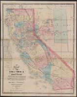
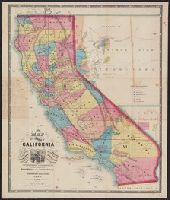
- Creator:
- Ransom, Leander, 1800-1874
- Published / Created:
- 1863
- Call Number:
- 844 1863
- Container / Volume:
- BRBL_00602
- Image Count:
- 1
- Resource Type:
- Maps, Atlases & Globes
- Found in:
- Beinecke Rare Book and Manuscript Library > A new map of the state of California and Nevada Territory : exhibiting the rivers, lakes, bays and islands, with the principal towns, roads, railroads, and transit routes to the silver mining districts of Nevada Territory ... / carefully compiled ... by L
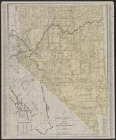
- Creator:
- Southern Pacific Company
- Published / Created:
- 1914
- Call Number:
- 837 1914
- Container / Volume:
- BRBL_00594
- Image Count:
- 2
- Resource Type:
- Maps, Atlases & Globes
- Found in:
- Beinecke Rare Book and Manuscript Library > Map of Nevada : with a brief description of its resources, development, topography, and climate.
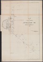
- Published / Created:
- 1862
- Call Number:
- 837fcm 1862
- Container / Volume:
- BRBL_00594
- Image Count:
- 1
- Resource Type:
- Maps, Atlases & Globes
- Found in:
- Beinecke Rare Book and Manuscript Library > Map of public surveys in Nevada territory to accompany report of Surveyor Gen'l.
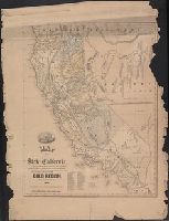
- Creator:
- Butler, Benjamin F. (Benjamin Franklin), 1795-1858
- Published / Created:
- 1851
- Call Number:
- 844 1851
- Container / Volume:
- BRBL_00601
- Image Count:
- 1
- Resource Type:
- Maps, Atlases & Globes
- Found in:
- Beinecke Rare Book and Manuscript Library > Map of the state of California : compiled from the most recent surveys and explorations, and comprising an accurate description of the county boundaries, according to an act passed by the Legislature, April 25th, 1851, also a complete delineation of the g
- Creator:
- Ransom, Leander, 1800-1874
- Published / Created:
- 1862
- Call Number:
- 844 1862
- Container / Volume:
- BRBL_00602
- Image Count:
- 1
- Resource Type:
- Maps, Atlases & Globes
- Found in:
- Beinecke Rare Book and Manuscript Library > New map of the state of California : exhibiting the rivers, lakes, bays, and islands, with the principal towns, roads, railroads, and transit routes to the silver mining distrts. of Nevada Territory; also the established meridian, standard, range and town
- Creator:
- Nell, Louis
- Published / Created:
- 1868
- Call Number:
- 844gme 1868
- Container / Volume:
- BRBL_00619
- Image Count:
- 1
- Resource Type:
- Maps, Atlases & Globes
- Found in:
- Beinecke Rare Book and Manuscript Library > Topographical railroad & county map of the states of California and Nevada : compiled from the latest explorations and other official information / by L. Nell.