Search
You Searched For
Search Results
- Creator:
- Great Britain. War Office. General Staff. Geographical Section
- Published / Created:
- 1909
- Call Number:
- 633 1909
- Container / Volume:
- BRBL_00336
- Image Count:
- 1
- Resource Type:
- Maps, Atlases & Globes
- Found in:
- Beinecke Rare Book and Manuscript Library > Africa 1:1 000 000. Kilimanjaro. Sheets 94 and 95 [cartographic material] / compiled in the Geographical Section, General Staff, 1905.
- Creator:
- Great Britain. War Office. General Staff. Geographical Section
- Published / Created:
- 1901
- Call Number:
- 6415 1902
- Container / Volume:
- BRBL_00338
- Image Count:
- 1
- Resource Type:
- Maps, Atlases & Globes
- Found in:
- Beinecke Rare Book and Manuscript Library > Africa 1:250 000. British Central Africa. Blantyre. Sheet III-P [cartographic material].
- Creator:
- Great Britain. Ordnance Survey
- Published / Created:
- 1913
- Call Number:
- 634 P37 1913
- Container / Volume:
- BRBL_00336
- Image Count:
- 2
- Resource Type:
- Maps, Atlases & Globes
- Found in:
- Beinecke Rare Book and Manuscript Library > Africa 1:63 360. Pemba Island [cartographic material] / drawn and printed at the Ordnance Survey Office, Southampton, 1913.
- Published / Created:
- 1899
- Call Number:
- 3229 1899
- Container / Volume:
- BRBL_00063
- Image Count:
- 1
- Resource Type:
- Maps, Atlases & Globes
- Found in:
- Beinecke Rare Book and Manuscript Library > Cheshire Sheet XIII.3 / Second Edition 1899.
- Creator:
- Great Britain. General Staff. Geographical Section
- Published / Created:
- 1909
- Call Number:
- 6554 1909
- Container / Volume:
- BRBL_00346
- Image Count:
- 1
- Resource Type:
- Maps, Atlases & Globes
- Found in:
- Beinecke Rare Book and Manuscript Library > Gambia.
- Published / Created:
- 1910
- Call Number:
- 3215ad 1910
- Container / Volume:
- BRBL_00056
- Image Count:
- 6
- Resource Type:
- Maps, Atlases & Globes
- Found in:
- Beinecke Rare Book and Manuscript Library > Great Britain Ordnance Survey cadastral Plan.
- Published / Created:
- 1920
- Call Number:
- 32 L84 1920
- Container / Volume:
- BRBL_00051
- Image Count:
- 1
- Resource Type:
- Maps, Atlases & Globes
- Found in:
- Beinecke Rare Book and Manuscript Library > Great Britain Ordnance Survey edition of 1920.
- Creator:
- Ordnance Survey of Ireland
- Published / Created:
- 1913
- Call Number:
- 327 K55 1913
- Container / Volume:
- BRBL_00073
- Image Count:
- 1
- Resource Type:
- Maps, Atlases & Globes
- Found in:
- Beinecke Rare Book and Manuscript Library > Killarney district.
- Published / Created:
- 1864
- Call Number:
- 32631 1864
- Container / Volume:
- BRBL_00071
- Image Count:
- 1
- Resource Type:
- Maps, Atlases & Globes
- Found in:
- Beinecke Rare Book and Manuscript Library > Lanarkshire. Sheet IX.
- Creator:
- Great Britain. War Office. General Staff. Geographical Section
- Published / Created:
- 1919
- Call Number:
- 533 1919
- Container / Volume:
- BRBL_00287
- Image Count:
- 1
- Resource Type:
- Maps, Atlases & Globes
- Found in:
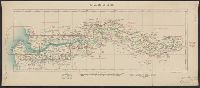
- Beinecke Rare Book and Manuscript Library > Lower Mesopotamia, between Baghdad and the Persian Gulf [cartographic material].
- Creator:
- Great Britain. Ordnance Survey
- Published / Created:
- 1913
- Call Number:
- 56 1913
- Container / Volume:
- BRBL_00296
- Image Count:
- 1
- Resource Type:
- Maps, Atlases & Globes
- Found in:
- Beinecke Rare Book and Manuscript Library > Map of China [cartographic material] : shewing railways, telegraphs and treaty ports.
- Published / Created:
- 1918
- Call Number:
- 32gma 1918
- Container / Volume:
- BRBL_00076
- Image Count:
- 2
- Resource Type:
- Maps, Atlases & Globes
- Found in:
- Beinecke Rare Book and Manuscript Library > Map showing controlled canals in England & Wales.
- Published / Created:
- 1885
- Call Number:
- 32 L84 1885A
- Container / Volume:
- BRBL_00051
- Image Count:
- 1
- Resource Type:
- Maps, Atlases & Globes
- Found in:
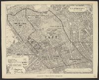
- Beinecke Rare Book and Manuscript Library > Marylebone Divisions of New Borough.
- Creator:
- Great Britain. Ordnance Survey
- Published / Created:
- [1886-1892]
- Call Number:
- 3218 1887
- Container / Volume:
- BRBL_00058
- Image Count:
- 6
- Resource Type:
- Maps, Atlases & Globes
- Found in:
- Beinecke Rare Book and Manuscript Library > Ordnance Survey of England / engraved and published at the Ordnance Survey Office.
- Creator:
- Great Britain. Ordnance Survey
- Published / Created:
- 1940-
- Call Number:
- 32 1940
- Container / Volume:
- BRBL_00745
- Image Count:
- 1
- Resource Type:
- Maps, Atlases & Globes
- Found in:
- Beinecke Rare Book and Manuscript Library > Ordnance Survey of Great Britain [cartographic material] : England & Wales.
- Published / Created:
- 1913
- Call Number:
- 32612 1913
- Container / Volume:
- BRBL_00071
- Image Count:
- 1
- Resource Type:
- Maps, Atlases & Globes
- Found in:
- Beinecke Rare Book and Manuscript Library > Ordnance Survey of Scotland, Dornoch and Cromarty, Sheet 9.
- Published / Created:
- 1900
- Call Number:
- 32 Ox1 1900
- Container / Volume:
- BRBL_00053
- Image Count:
- 6
- Resource Type:
- Maps, Atlases & Globes
- Found in:
- Beinecke Rare Book and Manuscript Library > Oxfordshire Second Edition 1899.
- Published / Created:
- 1900
- Call Number:
- 32 Ox1 1900A
- Container / Volume:
- BRBL_00053
- Image Count:
- 1
- Resource Type:
- Maps, Atlases & Globes
- Found in:
- Beinecke Rare Book and Manuscript Library > Oxfordshire Sheet XXXIII S.E., Second edition 1900.
- Published / Created:
- 1914
- Call Number:
- 32 Ox1 1914A
- Container / Volume:
- BRBL_00054
- Image Count:
- 1
- Resource Type:
- Maps, Atlases & Globes
- Found in:
- Beinecke Rare Book and Manuscript Library > Oxfordshire, Sheet XXXIII, S.W. Edition of 1914.
- Published / Created:
- 1914
- Call Number:
- 32 Ox1 1914
- Container / Volume:
- BRBL_00053
- Image Count:
- 1
- Resource Type:
- Maps, Atlases & Globes
- Found in:
- Beinecke Rare Book and Manuscript Library > Oxfordshire, Sheet XXXIX, N.E. Edition of 1914.
- Creator:
- Great Britain. War Office. General Staff. Geographical Section
- Published / Created:
- 1909
- Call Number:
- 5615 1909
- Container / Volume:
- BRBL_00299
- Image Count:
- 1
- Resource Type:
- Maps, Atlases & Globes
- Found in:
- Beinecke Rare Book and Manuscript Library > Province of Chih-li, southern sheet [cartographic material].
- Creator:
- Great Britain. War Office. General Staff. Geographical Section
- Published / Created:
- 1905
- Call Number:
- 5616 1905
- Container / Volume:
- BRBL_00299
- Image Count:
- 1
- Resource Type:
- Maps, Atlases & Globes
- Found in:
- Beinecke Rare Book and Manuscript Library > Province of Shan-tung [cartographic material] / compiled in the Topographical section, General staff.
- Creator:
- Great Britain. War Office. General Staff. Topographical Section
- Published / Created:
- 1908]
- Call Number:
- 5621 1908
- Container / Volume:
- BRBL_00299
- Image Count:
- 1
- Resource Type:
- Maps, Atlases & Globes
- Found in:
- Beinecke Rare Book and Manuscript Library > Province of Ssŭ-ch'uan / compiled in the Topographic Section, General Staff.
- Published / Created:
- 1912
- Call Number:
- 32 R27 1912
- Container / Volume:
- BRBL_00054
- Image Count:
- 1
- Resource Type:
- Maps, Atlases & Globes
- Found in:
- Beinecke Rare Book and Manuscript Library > Reicate (south London).
- Creator:
- Great Britain. War Office. General Staff. Topographical Section
- Published / Created:
- 1908
- Call Number:
- 645 1908
- Container / Volume:
- BRBL_00340
- Image Count:
- 1
- Resource Type:
- Maps, Atlases & Globes
- Found in:
- Beinecke Rare Book and Manuscript Library > Sketch map of Zululand to illustrate Handbook, 1906 / Topographical Section, General Staff, War Office.
- Creator:
- Geological Survey of Great Britain
Great Britain. Ordnance Survey
- Published / Created:
- 1864
- Call Number:
- 32625 1865
- Container / Volume:
- BRBL_00071
- Image Count:
- 5
- Resource Type:
- Maps, Atlases & Globes
- Found in:
- Beinecke Rare Book and Manuscript Library > Stirlingshire.
- Published / Created:
- 1884
- Call Number:
- 32 Su29 1884
- Container / Volume:
- BRBL_00054
- Image Count:
- 1
- Resource Type:
- Maps, Atlases & Globes
- Found in:
- Beinecke Rare Book and Manuscript Library > Suffolk (Western Division) Sheet XIV. S.W.
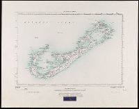
- Creator:
- Great Britain. War Office. General Staff. Geographical Section
- Published / Created:
- 1927
- Call Number:
- BrSides Folio 2018 131
- Image Count:
- 1
- Resource Type:
- Maps, Atlases & Globes
- Found in:
- Beinecke Rare Book and Manuscript Library > The islands of Bermuda [cartographic material].
- Published / Created:
- 1857-1867.
- Call Number:
- 326 1867
- Container / Volume:
- BRBL_00070
- Image Count:
- 2
- Resource Type:
- Maps, Atlases & Globes
- Found in:
- Beinecke Rare Book and Manuscript Library > [Edinburgh to Kirkinthllock]
- Creator:
- Great Britain. Ordnance Survey
- Published / Created:
- Novr. 9th, 1843 [i.e. ca. 1853-1874?]
- Call Number:
- 32 1873
- Container / Volume:
- BRBL_00744
- Image Count:
- 8
- Resource Type:
- Maps, Atlases & Globes
- Found in:
- Beinecke Rare Book and Manuscript Library > [Old series Ordnance Survey maps of England and Wales] / engraved at the Ordnance Map Office, Southampton ...
- Creator:
- Great Britain. Ordnance Survey
- Published / Created:
- Novr. 9th, 1843 [i.e. ca. 1853-1874?]
- Call Number:
- 32 1873
- Container / Volume:
- BRBL_00743
- Image Count:
- 35
- Resource Type:
- Maps, Atlases & Globes
- Found in:
- Beinecke Rare Book and Manuscript Library > [Old series Ordnance Survey maps of England and Wales] / engraved at the Ordnance Map Office, Southampton ...