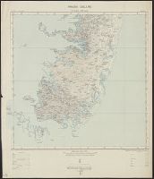
Skip to search
Skip to main content
Skip to first result
Search
You Searched For
Access
Public
Repository
Beinecke Rare Book and Manuscript Library
Publication Place
Southampton :
New Search
Search Results
Creator:
Published / Created:
1913
Call Number:
634 P37 1913
Container / Volume:
BRBL_00336
Image Count:
2
Resource Type:
Maps, Atlases & Globes
Alternative Title:
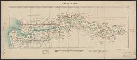
Great Britain. War Office. General Staff. Geographical Section. [G.S.G.S.], GSGS (Series) ; 2639., Pemba Island, Pemba Island. Chake Chake [cartographic material]., Pemba Island. Sheet 1 [cartographic material]., and Pemba Island. Sheet 2 [cartographic material].
Description:
Includes index to adjoining sheet. and Relief shown by contours.
Publisher:
Ordnance Survey Office,
Subject (Geographic):
Pemba Island (Tanzania)--Maps
Subject (Name):
Great Britain. War Office. General Staff. Geographical Section
Found in:
Beinecke Rare Book and Manuscript Library > Africa 1:63 360. Pemba Island [cartographic material] / drawn and printed at the Ordnance Survey Office, Southampton, 1913.
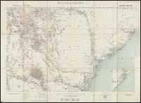
Creator:
Published / Created:
1909
Call Number:
6554 1909
Container / Volume:
BRBL_00346
Image Count:
1
Resource Type:
Maps, Atlases & Globes
Alternative Title:
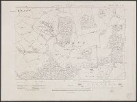
GSGS ; no. 2447 and GSGS ; no. 2447.
Description:
Ms. additions in red with note "ADDITIONS - 1928". and Shows boundaries and nearby provinces.
Publisher:
Ordnance Survey Office,
Subject (Geographic):
Gambia--Maps
Subject (Name):
Great Britain. War Office. General Staff. Geographical Section
Found in:
Beinecke Rare Book and Manuscript Library > Gambia.
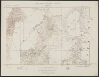
Published / Created:
1910
Call Number:
3215ad 1910
Container / Volume:
BRBL_00056
Image Count:
6
Resource Type:
Maps, Atlases & Globes
Description:
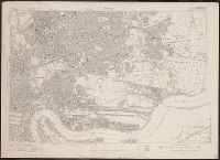
1910, Ashley; 1930 Sparsholt; 1910, Farley, Chamberlayne; 1932, Hursly & Compton; 1910, Ampfield; 1931, Hursley & Otterbourne.
Publisher:
Ordnance Survey Office,
Subject (Geographic):
Hampshire (England)--Maps
Found in:
Beinecke Rare Book and Manuscript Library > Great Britain Ordnance Survey cadastral Plan.
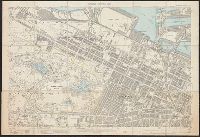
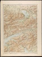
Creator:
Published / Created:
1913
Call Number:
327 K55 1913
Container / Volume:
BRBL_00073
Image Count:
1
Resource Type:
Maps, Atlases & Globes
Alternative Title:
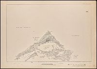
Ordnance Survey of Ireland (Third Edition), Killarney district
Description:
Relief shown by contours, altitude tints and spot heights.
Publisher:
Ordnance Survey Office,
Subject (Geographic):
Killarney Region (Kerry, Ireland)--Maps
Found in:
Beinecke Rare Book and Manuscript Library > Killarney district.
Branch:v1.61.8 ,Deployed:2024-06-20T11:14:48-04:00