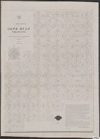
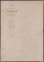
[Maury map collection ; Series C1] and Pilot chart, Cape Horn
Description:
"Series C.", Copy imperfect: Sheets 1 and 2 torn and repaired along fold-line on tracing paper., DLC, Each sheet numbered in upper left margin, e.g.: 117, 118., Includes diagrams and a note in map area with signature of M.F. Maury., and Shows prevailing wind direc
Publisher:
United States Hydrographical Office,
Subject (Geographic):
Horn, Cape, Region (Chile)--Maps
Subject (Name):
Maury, Matthew Fontaine, 1806-1873. Wind and current charts, Morris, Charles, 1784-1856, United States Naval Observatory, United States. Bureau of Ordnance and Hydrography, and United States. Hydrographic Office
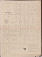
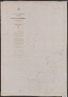
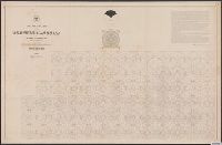
[Maury map collection ; Series C5] and North Indian Ocean
Description:
"Series C. nos. 1 & 2.", Copy imperfect: Torn fold-lined with minor losses. Torn and repaired along right edge. Mounted on cloth., Shows prevailing wind direction by month., and The pilot charts were released as series C a part of Maury's "Wind and current chart
Publisher:
United States Hydrographical Office,
Subject (Geographic):
Indian Ocean--Maps
Subject (Name):
Fitzgerald, W. B, Maury, Matthew Fontaine, 1806-1873. Wind and current charts, Morris, Charles, 1784-1856, United States Naval Observatory, United States. Bureau of Ordnance and Hydrography, United States. Hydrographic Office, and West, Wm. C. (William C.)
Subject (Topic):
Nautical charts--Indian Ocean and Winds--Indian Ocean--Maps
[Maury map collection ; Series C5] and North Indian Ocean
Description:
"Series C. nos. 1 & 2.", Copy imperfect: Torn fold-lined with minor losses. Torn and repaired along right edge. Mounted on cloth., DLC, and The pilot charts were released as series C a part of Maury's "Wind and current charts", series A-F. These charts were desi
Publisher:
United States Hydrographical Office,
Subject (Geographic):
Indian Ocean--Maps
Subject (Name):
Fitzgerald, W. B, Maury, Matthew Fontaine, 1806-1873. Wind and current charts, Morris, Charles, 1784-1856, United States Naval Observatory, United States. Bureau of Ordnance and Hydrography, United States. Hydrographic Office, and West, Wm. C. (William C.)
Subject (Topic):
Nautical charts--Indian Ocean and Winds--Indian Ocean--Maps
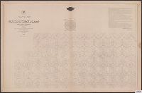
[Maury map collection ; Series D2], Maury's wind & current chart : South Atlantic, and South Atlantic
Description:
"Series D.", Copy imperfect: Sheets 1-4 torn and repaired along fold line, Does not cover the southeastern Atlantic south of latitude 40° S., and Originally intended to be complete in 6 sheets. Sheets 5 and 6, covering the southeastern Atlantic, were not issued.
Publisher:
United States Hydrographical Office,
Subject (Geographic):
South Atlantic Ocean--Maps
Subject (Name):
Maury, Matthew Fontaine, 1806-1873. Wind and current charts, Morris, Charles, 1784-1856, United States Naval Observatory, United States. Bureau of Ordnance and Hydrography, and United States. Hydrographic Office
Subject (Topic):
Nautical charts--South Atlantic Ocean and Ocean temperature--South Atlantic Ocean--Maps
[Maury map collection ; Series D2], Maury's wind & current chart : South Atlantic, and South Atlantic
Description:
Copy imperfect: Sheets 1-4 torn and repaired along fold line., DLC, Does not cover the southeastern Atlantic south of latitude 40° S., Each sheet numbered in upper left margin, e.g.: 72, 73, 74, 75., Includes notes in map area and signature of M.F. Maury., and She
Publisher:
United States Hydrographical Office,
Subject (Geographic):
South Atlantic Ocean--Maps
Subject (Name):
Maury, Matthew Fontaine, 1806-1873. Wind and current charts, Morris, Charles, 1784-1856, United States Naval Observatory, United States. Bureau of Ordnance and Hydrography, and United States. Hydrographic Office
Subject (Topic):
Nautical charts--South Atlantic Ocean and Ocean temperature--South Atlantic Ocean--Maps
[Maury map collection ; Series D2], Maury's wind & current chart : South Atlantic, and South Atlantic
Description:
Copy imperfect: Sheets 1-4 torn and repaired along fold line., DLC, Does not cover the southeastern Atlantic south of latitude 40° S., Each sheet numbered in upper left margin, e.g.: 72, 73, 74, 75., Includes notes in map area and signature of M.F. Maury., and Ori
Publisher:
United States Hydrographical Office,
Subject (Geographic):
South Atlantic Ocean--Maps
Subject (Name):
Maury, Matthew Fontaine, 1806-1873. Wind and current charts, Morris, Charles, 1784-1856, United States Naval Observatory, United States. Bureau of Ordnance and Hydrography, and United States. Hydrographic Office
Subject (Topic):
Nautical charts--South Atlantic Ocean and Ocean temperature--South Atlantic Ocean--Maps