Skip to search
Skip to main content
Skip to first result
Search
You Searched For
Extent of Digitization
Completely digitized
Language
English
Creator
U.S. Coast and Geodetic Survey
Publication Place
Washington, D.C. :
New Search
Search Results
Creator:
Published / Created:
1944
Call Number:
50 1945I
Container / Volume:
BRBL_00273
Image Count:
2
Resource Type:
Maps, Atlases & Globes
Description:
Cloth map., Includes text., Relief shown by gradient tints, contours, and spot heights., and Text in English and 6 other languages.
Publisher:
Amy Map Service,
Subject (Geographic):
Kunming Region (China)--Maps
Subject (Name):
United States. Aeronautical Chart Service, United States. Army Air Forces, and United States. Army Map Service
Subject (Topic):
Military maps
Found in:
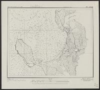
Beinecke Rare Book and Manuscript Library > AAF cloth chart. No. 133, Kun-Ming, Yunnan, China to Chabua, Assam, India Forces / prepared under the direction of the Commanding General, Army Air Forces, for the Aeronautical Chart Service, by the U.S. Coast and Geodetic Survey, Washington, D.C., Januar
Creator:
Published / Created:
1944
Call Number:
50 1945I
Container / Volume:
BRBL_00273
Image Count:
2
Resource Type:
Maps, Atlases & Globes
Description:
Cloth map., Includes text., Relief shown by gradient tints, contours, and spot heights., and Text in English and 6 other languages.
Publisher:
Amy Map Service,
Subject (Geographic):
Kunming Region (China)--Maps
Subject (Name):
United States. Aeronautical Chart Service, United States. Army Air Forces, and United States. Army Map Service
Subject (Topic):
Military maps
Found in:
Beinecke Rare Book and Manuscript Library > AAF cloth chart. No. 133, Kun-Ming, Yunnan, China to Chabua, Assam, India Forces / prepared under the direction of the Commanding General, Army Air Forces, for the Aeronautical Chart Service, by the U.S. Coast and Geodetic Survey, Washington, D.C., Januar
Creator:
Published / Created:
1900
Call Number:
767cea 1900
Container / Volume:
BRBL_00476
Image Count:
1
Resource Type:
Maps, Atlases & Globes
Alternative Title:
Connecticut River, Connecticut River, Deep River to Higganum, U.S.C. & G.S. (Series) ; 254., and U.S.C. & G.S. ; 254
Description:
"Date of first publication 1895.", "Electrotype copy no. 1 U.S.C. & G.S."--Upper right margin., "Soundings in feet.", Depths shown by shading and soundings., Includes tidal information., Oriented with north toward upper right corner., Plate no. 2659., and Relief sho
Publisher:
U.S. Coast and Geodetic Survey,
Subject (Geographic):
Connecticut River--Navigation
Subject (Topic):
Nautical charts--Connecticut River
Found in:
Beinecke Rare Book and Manuscript Library > Connecticut River, Deep River to Higganum, Connecticut / U.S. Coast and Geodetic Survey.
Creator:
Published / Created:
1944
Call Number:
28 Ap11 1944
Container / Volume:
BRBL_00023E
Image Count:
1
Resource Type:
Maps, Atlases & Globes
Alternative Title:
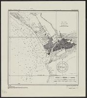
A.M.S. ; S901, Aparri, Philippine Islands, Cagayan Province, and Series (Standard map series designation system) ; S901.
Description:
"Copied from U.S.C. & G.S. chart 4260." and Important buildings are named; soundings are given.
Publisher:
The Service,
Subject (Geographic):
Aparri (Philippines)--Maps
Found in:
Beinecke Rare Book and Manuscript Library > Philippine Islands city plans. Aparri.
Creator:
Published / Created:
1944
Call Number:
28 SA522 1944
Container / Volume:
BRBL_00024
Image Count:
1
Resource Type:
Maps, Atlases & Globes
Alternative Title:
A.M.S. ; S901, San Fernando, Philippine Islands, La Union Province, and Series (Standard map series designation system) ; S901.
Description:
"Copied from U.S.C. & G.S. chart 4246." and Depth given in soundings.
Publisher:
The Service,
Subject (Geographic):
San Fernando (La Union, Philippines)--Maps
Found in:
Beinecke Rare Book and Manuscript Library > Philippine Islands city plans. San Fernando.
Creator:
Published / Created:
1944
Call Number:
28 T11 1944
Container / Volume:
BRBL_00024
Image Count:
1
Resource Type:
Maps, Atlases & Globes
Alternative Title:
A.M.S. ; S901, Series (Standard map series designation system) ; S901., and Taal and Lemery, Philippine Islands, Batangas Province
Description:
"Copied from U.S.C. & G.S. chart 4257 ... From survey in 1905." and "Soundings in feet at mean lower low water."
Publisher:
The Service,
Subject (Geographic):
Lemery (Batangas, Philippines)--Maps and Taal (Batangas, Philippines)--Maps
Found in:
Beinecke Rare Book and Manuscript Library > Philippine Islands city plans. Taal and Lemery.
Branch:v1.61.6 ,Deployed:2024-06-12T09:55:19-04:00