Its A.M.S. 9101 and Series (Standard map series designation system) ; 9101.
Description:
Elevations are shown by hachures and spot heights in meters., Inset shows area with detailed transportation information., and Three classes of roads and trails and four classes of railroads are shown.
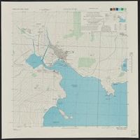
[Series] L951, Chinnamp'o (Chinnampo) P'yongan-namdo (Heian-nando), Korea, and Chinnamp'o, Korea
Description:
"5-45.", "AMS L951.", "Contour interval 10 meters ... Heights in meters, depths in fathoms at nearly lowest low water.", and "Korean names transcribed according to the McCune-Reischauer system: Japanese forms of Korean names (in parenthesis) transcribed accordin
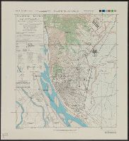
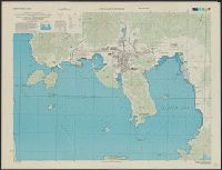
[Series] L951, Hamhung (Kanko) Hamgyong-namdo (Kankyo-nando), Korea, and Hamhung (Kanko) Korea
Description:
"6-45.", "AMS L951.", "Contour interval 5 meters.", "Korean names transcribed according to the McCune-Reischauer system; Japanese forms of Korean names (in parentheses) transcribed according to the modified Hepburn (Romaji) system.", and Includes glossary to Kore
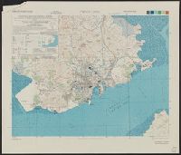
[Series] L951, Yosu (Reisui) Cholla-namdo (Zenra-nando), Korea, and Yosu, Korea
Description:
"5-45.", "AMS L951.", "Korean names transcribed according to the McCune-Reischauer system, Japanese forms of Korean names (shown in parentheses) transcribed according to the modified Hepburn (Romaji) system.", and Includes glossary to Korean, Japanese and Englis
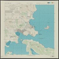
[Series] L951, Chinhae (Chinkai) Kongsang-namdo (Keisho-nando), Korea, and Chinhae (Chinkai), Korea
Description:
"6-45.", "AMS L951.", "Korean names are transcribed according to the McCune-Reischauer system; Japanese forms of Korean names (shown in parentheses) are transcribed according to the modified Hepburn (Romaji) system.", and "Relief shown by form lines ... Heights
Unggi (Yuki) Hamgyong-pukto(Kankyo-hokudo), Korea and Unggi (Yuki), Korea
Description:
"12-45.", "AMS L951.", "Korean names are transcribed according to the McCune-Reischauer system. Japanese forms of Korean names, (shown in parentheses) are transcribed according to the modified Hepburn (Romaji) system.", and Includes glossary and inset map "Index
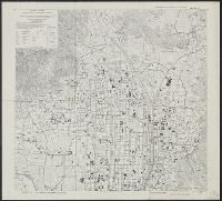
"4-45.", "Reproduced by 650th Engineer Bn. Sixth Army, August 1945.", "Sixth Army town plan no. 18.", Includes location map, administrative diagram, and glossary., and Relief shown by contours and spot heights.
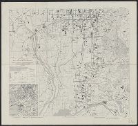
"Reproduced by 650th Engineer Bn. Sixth Army, August 1945.", "Sixth Army town plan no. 19.", Includes location map, administrative diagram, and glossary., and Relief shown by contours and spot heights.
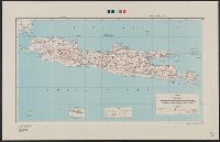
"Army Map Service, U.S. Army ... Reprint January 1943.", "Copied from a map published by the F.M.S. & S.S. Survey Dept. 1928.", "Geographical Section, General Staff, No. 4253. War Office 1942.", 5844 1943:, and Includes reference chart and index to sheets.