Search
You Searched For
Search Results
- Creator:
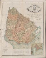
- Reyes, José Maria, 1803-1864
- Published / Created:
- c1893.
- Call Number:
- 93 1893
- Container / Volume:
- BRBL_00674
- Image Count:
- 1
- Resource Type:
- Maps, Atlases & Globes
- Found in:
- Beinecke Rare Book and Manuscript Library > Carta geográfica de la Republica Oriental del Uruguay [cartographic material] / reduccion dela del general ingeniero Don José M. Reyes. Aumentada y correjida en parte con antecedentes del archivo dela direccion gral de obras publicas por el vocal dela s
- Published / Created:
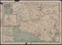
- [1896?]
- Call Number:
- 36hc 1896
- Container / Volume:
- BRBL_00133
- Image Count:
- 1
- Resource Type:
- Maps, Atlases & Globes
- Found in:
- Beinecke Rare Book and Manuscript Library > German Maneuvers, 1896.
- Creator:
- Tyrrell, Joseph Burr, 1858-1957
- Published / Created:
- c1897
- Call Number:
- 848 1897E
- Container / Volume:
- BRBL_00630
- Image Count:
- 1
- Resource Type:
- Maps, Atlases & Globes
- Found in:
- Beinecke Rare Book and Manuscript Library > Gold region approaches by Copper River and the Dalton Trail / compiled from latest U.S. surveys, British authorities and other sources by J.B. Tyrrell.
- Published / Created:
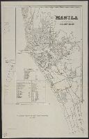
- [1898?]
- Call Number:
- 28 M314 1898
- Container / Volume:
- BRBL_00023F
- Image Count:
- 1
- Resource Type:
- Maps, Atlases & Globes
- Found in:
- Beinecke Rare Book and Manuscript Library > Manila, sus arrabales.
- Creator:
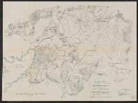
- United States. Adjutant-General's Office. Military Information Division
- Published / Created:
- [1898]
- Call Number:
- 855hc 1898A
- Container / Volume:
- BRBL_00765
- Image Count:
- 1
- Resource Type:
- Maps, Atlases & Globes
- Found in:
- Beinecke Rare Book and Manuscript Library > Map of Puerto Rico showing line of march of General Schwan's expedition from Ponce and Yauco to crossing of Rio Prieto August 9-15, 1898 / Chas. H. Ourand.
- Published / Created:
- [1898]
- Call Number:
- 855hc 1898O
- Container / Volume:
- BRBL_00765
- Image Count:
- 1
- Resource Type:
- Maps, Atlases & Globes
- Found in:
- Beinecke Rare Book and Manuscript Library > Map of Santiago de Cuba showing intrenchments and position of the 5th Corps. U.S. Army and those of the Spanish / compiled from partial transit surveys and foot reconnaisance notes and sketches by Lts. Guy, Smith, Cordray. of the Inf.; Lts. Batson and G.P
- Published / Created:
- [1898]
- Call Number:
- 855hc 1898L
- Container / Volume:
- BRBL_00765
- Image Count:
- 1
- Resource Type:
- Maps, Atlases & Globes
- Found in:
- Beinecke Rare Book and Manuscript Library > Map of Santiago de Cuba showing intrenchments and positions of the Fifth Corps. U.S. Army and those of the Spanish after the taking of Caney and San Juan Hill, evening of July 1st, 1898 / compiled from partial transit surveys and foot reconnaisance notes
- Creator:
- United States. Adjutant-General's Office. Military Information Division
- Published / Created:
- [1898]
- Call Number:
- 855hc 1898G
- Container / Volume:
- BRBL_00765
- Image Count:
- 1
- Resource Type:
- Maps, Atlases & Globes
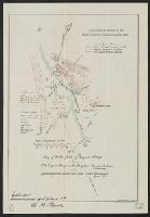
- Found in:
- Beinecke Rare Book and Manuscript Library > Map of battle field of August 10th 1898 : between U.S. regular troops under Brig. Genl. Theodore Schwan, U.S. Volunteers and Spanish forces under Col. Julio Soto Villanueva, Alfonso XIII.
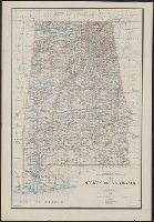
- Creator:
- King, Harry
- Published / Created:
- 1895
- Call Number:
- 793 1895
- Container / Volume:
- BRBL_00520
- Image Count:
- 1
- Resource Type:
- Maps, Atlases & Globes
- Found in:
- Beinecke Rare Book and Manuscript Library > Map of the state of Alabama : compiled from the official records of the General Land Office and other sources / under the direction of Harry King, C.E. Chief of Drafting Division G.L.O.; compiled by Rob[t] H. Morton; revised and drawn by Daniel O'Hare.
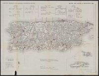
- Creator:
- United States. Adjutant-General's Office. Military Information Division
- Published / Created:
- [1898]
- Call Number:
- 855hc 1898J
- Container / Volume:
- BRBL_00765
- Image Count:
- 1
- Resource Type:
- Maps, Atlases & Globes
- Found in:
- Beinecke Rare Book and Manuscript Library > Military map, island of Puerto Rico, 1898 / drawn by W. Morey Jr. C.E.