Skip to search
Skip to main content
Skip to first result
Search
You Searched For
Format
cartographic
Genre
Maps
Resource Type
Maps, Atlases & Globes
Publication Place
Washington, D.C. :
New Search
Search Results
Creator:
Published / Created:
[1945]
Call Number:
575 T135 1945
Container / Volume:
BRBL_00313
Image Count:
1
Resource Type:
Maps, Atlases & Globes
Alternative Title:
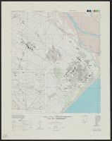
Formosa city plans., Series L991, and Taito, Formosa, Taito-chō, Taito-gun
Description:
"N2244.3-E12106.7/2.8x2.7.", Alternate title: Taitō, Formosa, Taitō-chō, Taitō-gun., Includes inset, glossary, and coverage and boundary diagrams., Relief shown by form lines and spot heights., and Standard map series designation: [Series] L991 / A.M.S.
Publisher:
The Service,
Subject (Geographic):
Tʻai-tung hsien (Taiwan)--Maps
Found in:
Beinecke Rare Book and Manuscript Library > Formosa city plans 1:10,000. Taitō / prepared under the direction of the Chief of Engineers by the Army Map Service (AM), U.S. Army.
Creator:
Published / Created:
[1944]
Call Number:
575 T63 1945
Container / Volume:
BRBL_00313
Image Count:
1
Resource Type:
Maps, Atlases & Globes
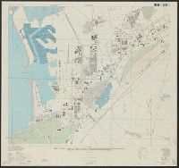
Alternative Title:
A.M.S. ; L991, Formosa city plans., Series (Standard map series designation system) ; L991., Series L991, and Toshien, Formosa, (Taiwan), Takao-shu
Description:
Contour inverval 10 meters., Includes glossary and coverage and boundary diagrams., and Relief shown by form lines and spot heights.
Publisher:
The Service,
Subject (Geographic):
Kao-hsiung shih (Taiwan)--Maps
Found in:
Beinecke Rare Book and Manuscript Library > Formosa city plans 1:10,000. Toshien / prepared under the direction of the Chief of Engineers by the Army Map Service (AM), U.S. Army.
Creator:
Published / Created:
[1944]
Call Number:
575 C43 1944
Container / Volume:
BRBL_00312
Image Count:
1
Resource Type:
Maps, Atlases & Globes
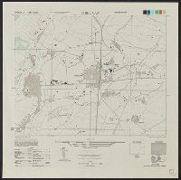
Alternative Title:
Chikunan, Shinchiku-shū, Formosa (Taiwan), Its A.M.S. ; L991, and Series (Standard map series designation system) ; L991.
Description:
"Place names are transcribed according to the modified Hepburn (Romaji) System." and Includes glossary and coverage and boundary diagrams.
Publisher:
Army Map Service,
Subject (Geographic):
Chu-nan chen (Taiwan)--Maps
Found in:
Beinecke Rare Book and Manuscript Library > Formosa city plans 1:8,000. Chikunan / prepared under the direction of the Chief of Engineers by the Army Map Service (AM), U.S. Army.
Published / Created:
1943
Call Number:
38FB 1943a
Container / Volume:
BRBL_00170
Image Count:
2
Resource Type:
Maps, Atlases & Globes
Description:
"5 May 1943"., "Map no. 2043"., Legend indicates French departments., and Photocopy.
Publisher:
R & A, O.S.S.,
Subject (Geographic):
France--Administrative and political divisions--Maps
Found in:
Beinecke Rare Book and Manuscript Library > France : Board of economic warfare.
Creator:
Published / Created:
1966
Call Number:
817cbj 1966
Container / Volume:
BRBL_00564
Image Count:
1
Resource Type:
Maps, Atlases & Globes
Alternative Title:
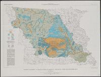
Hydrologic investigations atlas ; HA-217, Hydrologic investigations atlas ; HA-217., and Missouri River Basin
Description:
"Prepared in cooperation with [10 states]" and Includes text.
Publisher:
U.S. Geological Survey,
Subject (Geographic):
Missouri River Watershed--Maps
Subject (Name):
Geological Survey (U.S.)
Subject (Topic):
Groundwater--Missouri River Watershed--Maps
Found in:
Beinecke Rare Book and Manuscript Library > General availability of ground water and depth to water level in the Missouri River Basin / by G.A. La Rocque, Jr.
Creator:
Published / Created:
1942
Call Number:
61 1943B
Container / Volume:
BRBL_00331
Image Count:
1
Resource Type:
Maps, Atlases & Globes
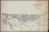
Alternative Title:
Alexandria scale 1:10 000
Publisher:
Army Map Service,
Subject (Geographic):
Alexandria (Egypt)--Maps
Subject (Name):
United States. Army Map Service
Found in:
Beinecke Rare Book and Manuscript Library > General map of Alexandria.
Published / Created:
[1896?]
Call Number:
36hc 1896
Container / Volume:
BRBL_00133
Image Count:
1
Resource Type:
Maps, Atlases & Globes
Publisher:
Norris Peters Co., Photo-lith,
Subject (Geographic):
Saxony (Germany)--Maps
Found in:
Beinecke Rare Book and Manuscript Library > German Maneuvers, 1896.
Creator:
Published / Created:
1944
Call Number:
36gm 1944A
Container / Volume:
BRBL_00130
Image Count:
1
Resource Type:
Maps, Atlases & Globes
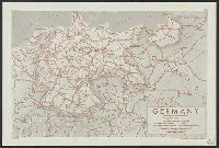
Description:
"Lithographed in the Reproductive Branch, OSS"., "Map No. 2984, 11 April 1944"., and "Provisional Edition."
Publisher:
OSS
Subject (Geographic):
Germany--Maps
Subject (Topic):
Express highways--Germany--Maps
Found in:
Beinecke Rare Book and Manuscript Library > Germany : Super-Highway (Reichsautobahn) / compiled and drawn in the Branch of Research and Analysis, OSS.
Creator:
Published / Created:
c1944.
Call Number:
36 1944C
Container / Volume:
BRBL_00121
Image Count:
1
Resource Type:
Maps, Atlases & Globes
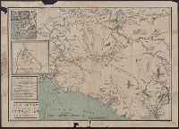
Description:
Relief shown by shading and spot heights.
Publisher:
The Section,
Subject (Geographic):
Germany--History--1933-1945--Maps and Germany--Maps
Found in:
Beinecke Rare Book and Manuscript Library > Germany and its approaches : with international boundaries as of September 1, 1939, the day Germany invaded Poland and, in red, boundaries as of January 1, 1938, before Germany seized Austria and Czechoslovakia / compiled and drawn in the Cartographic Sec
Creator:
Published / Created:
c1897
Call Number:
848 1897E
Container / Volume:
BRBL_00630
Image Count:
1
Resource Type:
Maps, Atlases & Globes
Description:
Includes ill., inset of "Klondike River and affluents," and distance table. and Relief shown by hachures and spot heights. Depths shown in fathoms.
Publisher:
J.B. Tyrrell,
Subject (Geographic):
Copper River Region (Alaska)--Maps and Yukon Territory--Maps
Subject (Name):
Andrew B. Graham Co
Subject (Topic):
Copper River Region (Alaska)--Gold discoveries--Maps, Trails--Alaska--Copper River Region--Maps, Trails--Yukon Territory--Maps, and Yukon Territory--Gold discoveries--Maps
Found in:
Beinecke Rare Book and Manuscript Library > Gold region approaches by Copper River and the Dalton Trail / compiled from latest U.S. surveys, British authorities and other sources by J.B. Tyrrell.
Branch:v1.61.6 ,Deployed:2024-06-12T09:55:19-04:00