Search
You Searched For
Search Results
- Creator:
- Great Britain. Inter-service Topographical Dept
- Published / Created:
- 1943
- Call Number:
- 38 D92 1943
- Container / Volume:
- BRBL_00157
- Image Count:
- 1
- Resource Type:
- Maps, Atlases & Globes
- Found in:
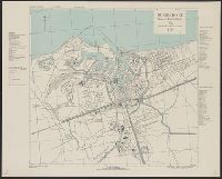
- Beinecke Rare Book and Manuscript Library > Dunkerque [cartographic material] : plan of port & town / compiled and drawn by Inter-Service Topographical Dept. ; produced under the Superintendence of Vice-Admiral John Edgell, hydrographer.
- Creator:
- United States. Army Map Service
- Published / Created:
- 1945
- Call Number:
- 50 1945L
- Container / Volume:
- BRBL_00273
- Image Count:
- 2
- Resource Type:
- Maps, Atlases & Globes
- Found in:
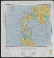
- Beinecke Rare Book and Manuscript Library > Eastern Asia 1:1,000,000 AAF cloth chart. Hakodate. NK54.
- Creator:
- United States. Army Map Service
- Published / Created:
- 1944
- Call Number:
- 50 1945N
- Container / Volume:
- BRBL_00273
- Image Count:
- 2
- Resource Type:
- Maps, Atlases & Globes
- Found in:
- Beinecke Rare Book and Manuscript Library > Eastern Asia 1:1,000,000 AAF cloth chart. Ryojun NJ-51.
- Creator:
- United States. Army Map Service
- Published / Created:
- 1943
- Call Number:
- 556 1944D
- Container / Volume:
- BRBL_00293
- Image Count:
- 2
- Resource Type:
- Maps, Atlases & Globes
- Found in:
- Beinecke Rare Book and Manuscript Library > Eastern Asia 1:1,000,000 [cartographic material] : AAF cloth chart. Hakodate. NK54.
- Published / Created:
- 1944
- Call Number:
- 38gmb 1944
- Container / Volume:
- BRBL_00170
- Image Count:
- 1
- Resource Type:
- Maps, Atlases & Globes
- Found in:
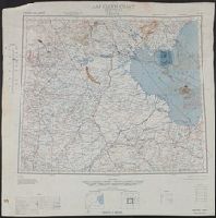
- Beinecke Rare Book and Manuscript Library > Europe road map 1:200,000. 60, Le Mans.
- Published / Created:
- 1921
- Call Number:
- 11hc 1919Z
- Container / Volume:
- BRBL_00010I
- Image Count:
- 1
- Resource Type:
- Maps, Atlases & Globes
- Found in:
- Beinecke Rare Book and Manuscript Library > Extract of Mezieres-Verdun-Metz-Longwy : Meuse-Argonne offensive, map showing daily position of front line Map room G-3, G.H.Q. May 24, 1919.
- Creator:
- National Geographic Society (U.S.). Cartographic Division
- Published / Created:
- 1984
- Call Number:
- 80 1984
- Container / Volume:
- BRBL_00536
- Image Count:
- 2
- Resource Type:
- Maps, Atlases & Globes
- Found in:
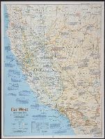
- Beinecke Rare Book and Manuscript Library > Far West / produced by the Cartographic Division, National Geographic Society.
- Creator:
- United States. Army. Corps of Engineers
- Published / Created:
- 1942
- Call Number:
- 67 F31 1942
- Container / Volume:
- BRBL_00348
- Image Count:
- 1
- Resource Type:
- Maps, Atlases & Globes
- Found in:
- Beinecke Rare Book and Manuscript Library > Fedhala, city plan / prepared under the direction of the chief of engineers, U.S. Army.
- Creator:
- Great Britain. Inter-service Topographical Dept
- Published / Created:
- 1943, 1944 printing.
- Call Number:
- 38 F31 1944
- Container / Volume:
- BRBL_00157
- Image Count:
- 1
- Resource Type:
- Maps, Atlases & Globes
- Found in:
- Beinecke Rare Book and Manuscript Library > Fécamp, plan of port and town [cartographic material] / compiled and drawn by Inter-Service Topographical Dept. ; produced under the Superintendence of Vice-Admiral John Edgell, hydrographer.
- Creator:
- United States. Army Map Service
- Published / Created:
- [1945]
- Call Number:
- 575 K63 1945
- Container / Volume:
- BRBL_00312
- Image Count:
- 1
- Resource Type:
- Maps, Atlases & Globes
- Found in:
- Beinecke Rare Book and Manuscript Library > Formosa city plans 1:10,000. Kiirun / prepared under the direction of Chief of Engineers by the Army Map Service (AM), U.S. Army.
- Creator:
- United States. Army Map Service
- Published / Created:
- [1945]
- Call Number:
- 575 T135 1945
- Container / Volume:
- BRBL_00313
- Image Count:
- 1
- Resource Type:
- Maps, Atlases & Globes
- Found in:
- Beinecke Rare Book and Manuscript Library > Formosa city plans 1:10,000. Taitō / prepared under the direction of the Chief of Engineers by the Army Map Service (AM), U.S. Army.
- Creator:
- United States. Army Map Service
- Published / Created:
- [1944]
- Call Number:
- 575 T63 1945
- Container / Volume:
- BRBL_00313
- Image Count:
- 1
- Resource Type:
- Maps, Atlases & Globes
- Found in:
- Beinecke Rare Book and Manuscript Library > Formosa city plans 1:10,000. Toshien / prepared under the direction of the Chief of Engineers by the Army Map Service (AM), U.S. Army.
- Creator:
- United States. Army Map Service
- Published / Created:
- [1944]
- Call Number:
- 575 C43 1944
- Container / Volume:
- BRBL_00312
- Image Count:
- 1
- Resource Type:
- Maps, Atlases & Globes
- Found in:
- Beinecke Rare Book and Manuscript Library > Formosa city plans 1:8,000. Chikunan / prepared under the direction of the Chief of Engineers by the Army Map Service (AM), U.S. Army.
- Published / Created:
- 1943
- Call Number:
- 38FB 1943a
- Container / Volume:
- BRBL_00170
- Image Count:
- 2
- Resource Type:
- Maps, Atlases & Globes
- Found in:
- Beinecke Rare Book and Manuscript Library > France : Board of economic warfare.
- Creator:
- La Rocque, George A., 1908-
- Published / Created:
- 1966
- Call Number:
- 817cbj 1966
- Container / Volume:
- BRBL_00564
- Image Count:
- 1
- Resource Type:
- Maps, Atlases & Globes
- Found in:
- Beinecke Rare Book and Manuscript Library > General availability of ground water and depth to water level in the Missouri River Basin / by G.A. La Rocque, Jr.
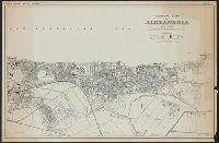
- Creator:
- Egypt. Maṣlaḥat al-Misāḥah
- Published / Created:
- 1942
- Call Number:
- 61 1943B
- Container / Volume:
- BRBL_00331
- Image Count:
- 1
- Resource Type:
- Maps, Atlases & Globes
- Found in:
- Beinecke Rare Book and Manuscript Library > General map of Alexandria.
- Published / Created:
- [1896?]
- Call Number:
- 36hc 1896
- Container / Volume:
- BRBL_00133
- Image Count:
- 1
- Resource Type:
- Maps, Atlases & Globes
- Found in:
- Beinecke Rare Book and Manuscript Library > German Maneuvers, 1896.
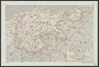
- Creator:
- United States. Office of Strategic Services. Research and Analysis Branch
- Published / Created:
- 1944
- Call Number:
- 36gm 1944A
- Container / Volume:
- BRBL_00130
- Image Count:
- 1
- Resource Type:
- Maps, Atlases & Globes
- Found in:
- Beinecke Rare Book and Manuscript Library > Germany : Super-Highway (Reichsautobahn) / compiled and drawn in the Branch of Research and Analysis, OSS.
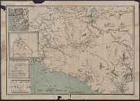
- Creator:
- Darley, James M. (James Morrison)
National Geographic Society (U.S.). Cartographic Section
- Published / Created:
- c1944.
- Call Number:
- 36 1944C
- Container / Volume:
- BRBL_00121
- Image Count:
- 1
- Resource Type:
- Maps, Atlases & Globes
- Found in:
- Beinecke Rare Book and Manuscript Library > Germany and its approaches : with international boundaries as of September 1, 1939, the day Germany invaded Poland and, in red, boundaries as of January 1, 1938, before Germany seized Austria and Czechoslovakia / compiled and drawn in the Cartographic Sec
- Creator:
- Tyrrell, Joseph Burr, 1858-1957
- Published / Created:
- c1897
- Call Number:
- 848 1897E
- Container / Volume:
- BRBL_00630
- Image Count:
- 1
- Resource Type:
- Maps, Atlases & Globes
- Found in:
- Beinecke Rare Book and Manuscript Library > Gold region approaches by Copper River and the Dalton Trail / compiled from latest U.S. surveys, British authorities and other sources by J.B. Tyrrell.